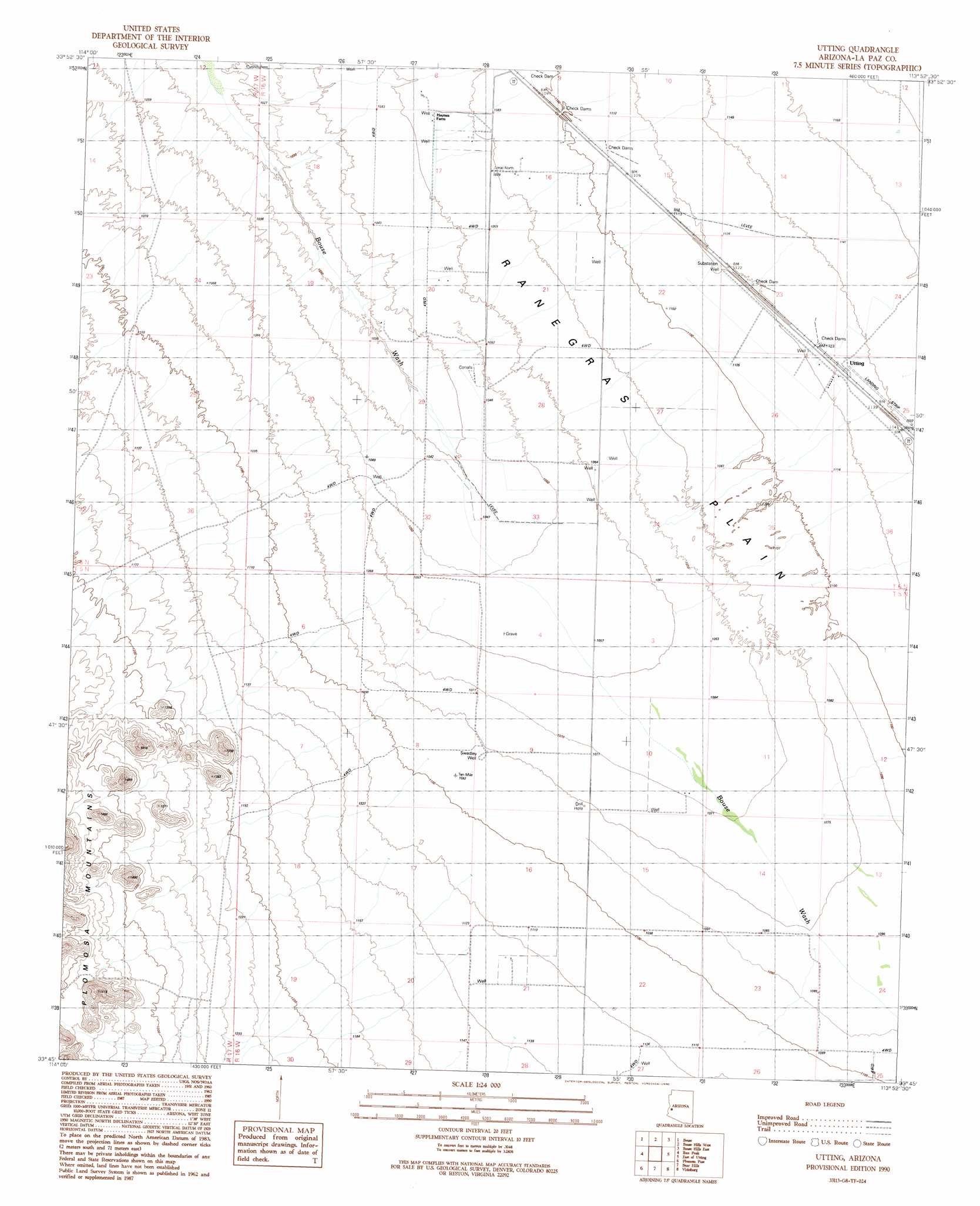
Utting Topo Map Arizona
To zoom in, hover over the map of Utting
USGS Topo Quad 33113g8 - 1:24,000 scale
| Topo Map Name: | Utting |
| USGS Topo Quad ID: | 33113g8 |
| Print Size: | ca. 21 1/4" wide x 27" high |
| Southeast Coordinates: | 33.75° N latitude / 113.875° W longitude |
| Map Center Coordinates: | 33.8125° N latitude / 113.9375° W longitude |
| U.S. State: | AZ |
| Filename: | o33113g8.jpg |
| Download Map JPG Image: | Utting topo map 1:24,000 scale |
| Map Type: | Topographic |
| Topo Series: | 7.5´ |
| Map Scale: | 1:24,000 |
| Source of Map Images: | United States Geological Survey (USGS) |
| Alternate Map Versions: |
Utting AZ 1990, updated 1990 Download PDF Buy paper map Utting AZ 2011 Download PDF Buy paper map Utting AZ 2014 Download PDF Buy paper map |
1:24,000 Topo Quads surrounding Utting
Black Peak |
Bobs Well |
Powerline Well |
Butler Pass |
Butler Well |
Bouse Nw |
Bouse |
Bouse Hills West |
Bouse Hills East |
Harcuvar Peak |
Bouse Sw |
Ibex Peak |
Utting |
East Of Utting |
Harcuvar |
Quartzsite |
Plomosa Pass |
Bear Hills |
Vicksburg |
Hope |
South Of Quartzsite |
Crystal Hill |
New Water Mountains |
New Water Well |
Hope Sw |
> Back to 33113e1 at 1:100,000 scale
> Back to 33112a1 at 1:250,000 scale
> Back to U.S. Topo Maps home
Utting topo map: Gazetteer
Utting: Airports
Utting Siding Airstrip elevation 348m 1141′Utting: Populated Places
Utting elevation 345m 1131′Utting: Wells
Swadley Well elevation 331m 1085′Utting digital topo map on disk
Buy this Utting topo map showing relief, roads, GPS coordinates and other geographical features, as a high-resolution digital map file on DVD: