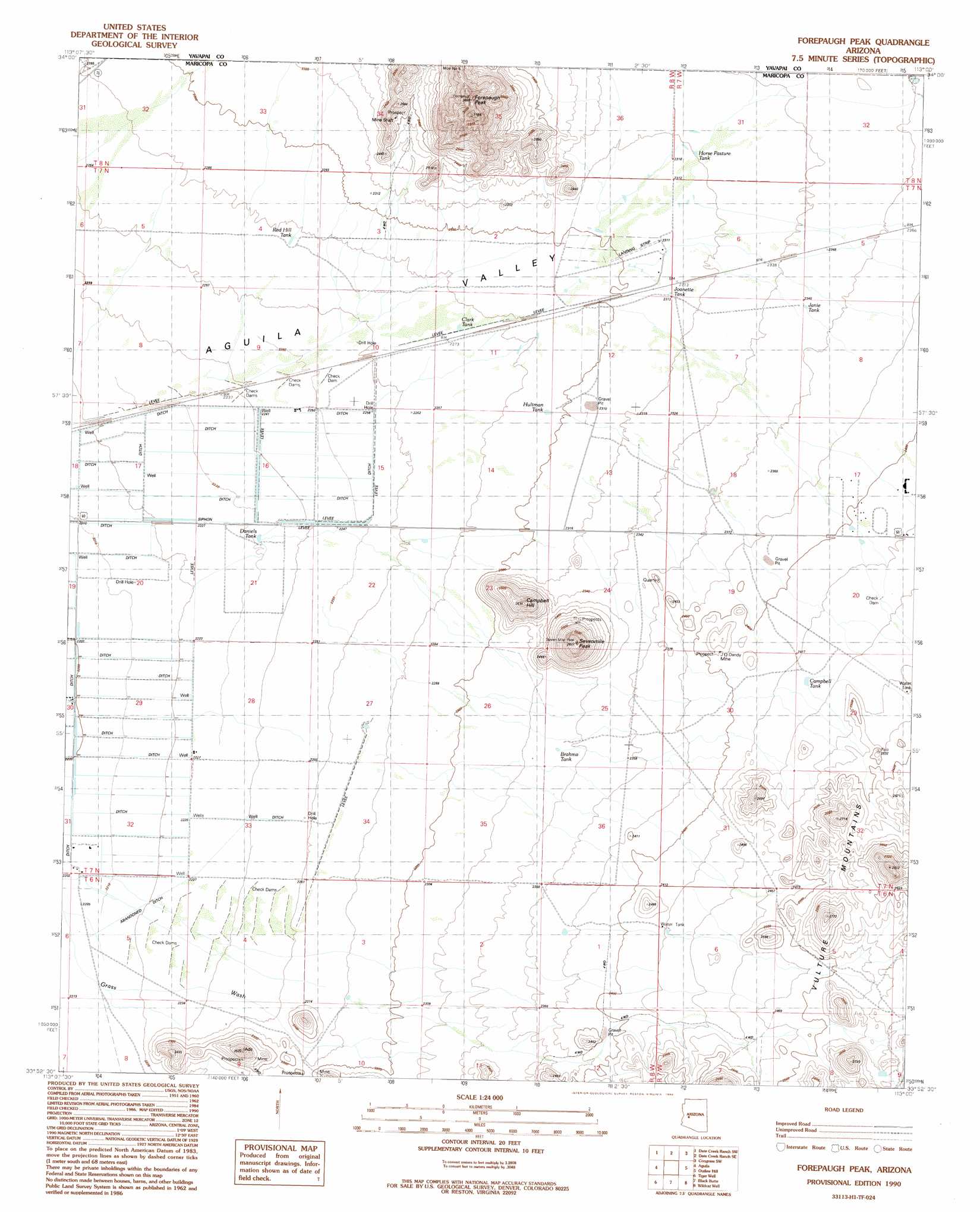
Forepaugh Peak Topo Map Arizona
To zoom in, hover over the map of Forepaugh Peak
USGS Topo Quad 33113h1 - 1:24,000 scale
| Topo Map Name: | Forepaugh Peak |
| USGS Topo Quad ID: | 33113h1 |
| Print Size: | ca. 21 1/4" wide x 27" high |
| Southeast Coordinates: | 33.875° N latitude / 113° W longitude |
| Map Center Coordinates: | 33.9375° N latitude / 113.0625° W longitude |
| U.S. State: | AZ |
| Filename: | o33113h1.jpg |
| Download Map JPG Image: | Forepaugh Peak topo map 1:24,000 scale |
| Map Type: | Topographic |
| Topo Series: | 7.5´ |
| Map Scale: | 1:24,000 |
| Source of Map Images: | United States Geological Survey (USGS) |
| Alternate Map Versions: |
Forepaugh Peak AZ 1990, updated 1990 Download PDF Buy paper map Forepaugh Peak AZ 2011 Download PDF Buy paper map Forepaugh Peak AZ 2014 Download PDF Buy paper map |
1:24,000 Topo Quads surrounding Forepaugh Peak
Smith Peak Ne |
Date Creek Ranch Nw |
Date Creek Ranch |
O'Neill Pass |
Congress |
Smith Peak |
Date Creek Ranch Sw |
Date Creek Ranch Se |
Congress Sw |
Flores |
Gladden |
Aguila |
Forepaugh Peak |
Outlaw Hill |
Vulture Peak |
Harquahala Mountain |
Tiger Well |
Black Butte |
Wildcat Well |
Vulture Mine |
Weldon Hill |
Little Horn Peak |
Hummingbird Spring |
Belmont Mountain |
Star Well |
> Back to 33113e1 at 1:100,000 scale
> Back to 33112a1 at 1:250,000 scale
> Back to U.S. Topo Maps home
Forepaugh Peak topo map: Gazetteer
Forepaugh Peak: Mines
J O Dandy Mine elevation 744m 2440′Forepaugh Peak: Populated Places
Forepaugh elevation 702m 2303′Forepaugh Peak: Reservoirs
Big Pimberton Tanks elevation 720m 2362′Brahma Tank elevation 711m 2332′
Campbell Tank elevation 741m 2431′
Clark Tank elevation 695m 2280′
Daniels Tank elevation 682m 2237′
Forepaugh Tank elevation 720m 2362′
Horse Pasture Tank elevation 708m 2322′
Hultman Tank elevation 699m 2293′
Janie Tank elevation 717m 2352′
Joanette Tank elevation 706m 2316′
Red Hill Tank elevation 695m 2280′
Forepaugh Peak: Summits
Campbell Hill elevation 772m 2532′Forepaugh Peak elevation 933m 3061′
Sevenmile Peak elevation 0m 0′
Forepaugh Peak: Wells
Engle Well elevation 689m 2260′Torrance Well elevation 700m 2296′
Forepaugh Peak digital topo map on disk
Buy this Forepaugh Peak topo map showing relief, roads, GPS coordinates and other geographical features, as a high-resolution digital map file on DVD: