Bouse Hills East Topo Map Arizona
To zoom in, hover over the map of Bouse Hills East
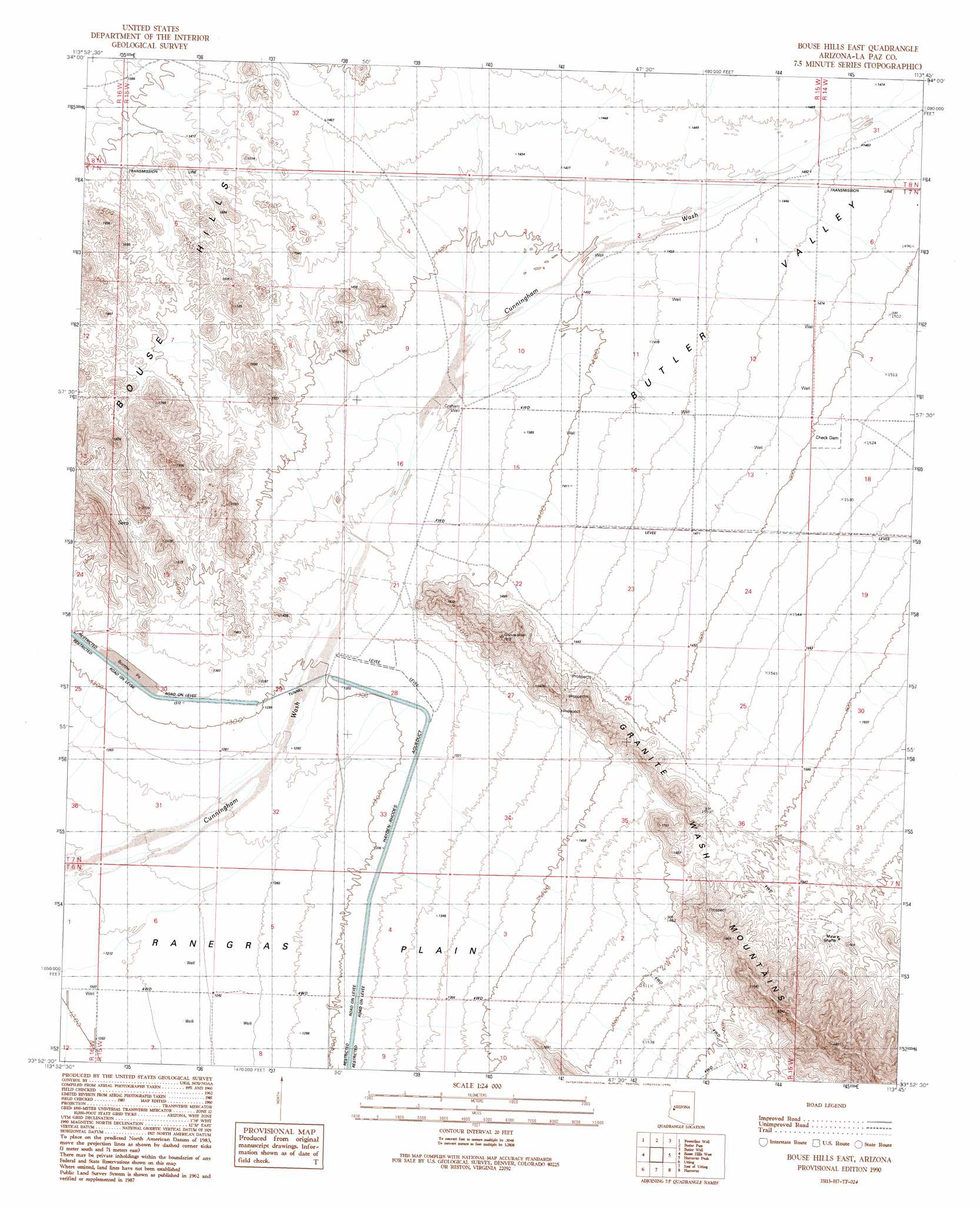
USGS Topo Quad 33113h7 - 1:24,000 scale
| Topo Map Name: | Bouse Hills East |
| USGS Topo Quad ID: | 33113h7 |
| Print Size: | ca. 21 1/4" wide x 27" high |
| Southeast Coordinates: | 33.875° N latitude / 113.75° W longitude |
| Map Center Coordinates: | 33.9375° N latitude / 113.8125° W longitude |
| U.S. State: | AZ |
| Filename: | o33113h7.jpg |
| Download Map JPG Image: | Bouse Hills East topo map 1:24,000 scale |
| Map Type: | Topographic |
| Topo Series: | 7.5´ |
| Map Scale: | 1:24,000 |
| Source of Map Images: | United States Geological Survey (USGS) |
| Alternate Map Versions: |
Bouse Hills East AZ 1990, updated 1990 Download PDF Buy paper map Bouse Hills East AZ 2011 Download PDF Buy paper map Bouse Hills East AZ 2014 Download PDF Buy paper map |
1:24,000 Topo Quads surrounding Bouse Hills East
Osborne Well |
Planet |
Swansea |
Reid Valley |
Alamo Dam |
Bobs Well |
Powerline Well |
Butler Pass |
Butler Well |
Alamo Dam Se |
Bouse |
Bouse Hills West |
Bouse Hills East |
Harcuvar Peak |
Cunningham Pass |
Ibex Peak |
Utting |
East Of Utting |
Harcuvar |
Salome |
Plomosa Pass |
Bear Hills |
Vicksburg |
Hope |
Harrisburg Valley |
> Back to 33113e1 at 1:100,000 scale
> Back to 33112a1 at 1:250,000 scale
> Back to U.S. Topo Maps home
Bouse Hills East topo map: Gazetteer
Bouse Hills East: Dams
Butler Valley Dam elevation 409m 1341′Bouse Hills East: Streams
Big Granite Wash elevation 366m 1200′Bouse Hills East: Valleys
Butler Valley elevation 433m 1420′Bouse Hills East: Wells
Graham Well elevation 417m 1368′Bouse Hills East digital topo map on disk
Buy this Bouse Hills East topo map showing relief, roads, GPS coordinates and other geographical features, as a high-resolution digital map file on DVD: