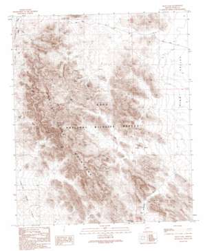
Arch Tank Topo Map Arizona
To zoom in, hover over the map of Arch Tank
USGS Topo Quad 33114b2 - 1:24,000 scale
| Topo Map Name: | Arch Tank |
| USGS Topo Quad ID: | 33114b2 |
| Print Size: | ca. 21 1/4" wide x 27" high |
| Southeast Coordinates: | 33.125° N latitude / 114.125° W longitude |
| Map Center Coordinates: | 33.1875° N latitude / 114.1875° W longitude |
| U.S. State: | AZ |
| Filename: | o33114b2.jpg |
| Download Map JPG Image: | Arch Tank topo map 1:24,000 scale |
| Map Type: | Topographic |
| Topo Series: | 7.5´ |
| Map Scale: | 1:24,000 |
| Source of Map Images: | United States Geological Survey (USGS) |
| Alternate Map Versions: |
Arch Tank AZ 1990, updated 1990 Download PDF Buy paper map Arch Tank AZ 2011 Download PDF Buy paper map Arch Tank AZ 2014 Download PDF Buy paper map |
1:24,000 Topo Quads surrounding Arch Tank
> Back to 33114a1 at 1:100,000 scale
> Back to 33114a1 at 1:250,000 scale
> Back to U.S. Topo Maps home
Arch Tank topo map: Gazetteer
Arch Tank: Arroyos
La Cholla Wash elevation 649m 2129′Arch Tank: Basins
Virgin Basin elevation 529m 1735′Arch Tank: Gaps
McPherson Pass elevation 596m 1955′Arch Tank: Reservoirs
Arch Tank elevation 611m 2004′Bandy Tank elevation 650m 2132′
Black Tank elevation 414m 1358′
Gray Tanks elevation 581m 1906′
Hollow Rock Tank elevation 477m 1564′
Horse Tanks elevation 547m 1794′
Robin Tank elevation 518m 1699′
Arch Tank: Streams
McPherson Wash elevation 504m 1653′Arch Tank digital topo map on disk
Buy this Arch Tank topo map showing relief, roads, GPS coordinates and other geographical features, as a high-resolution digital map file on DVD:


