Dome Rock Mountains Sw Topo Map Arizona
To zoom in, hover over the map of Dome Rock Mountains Sw
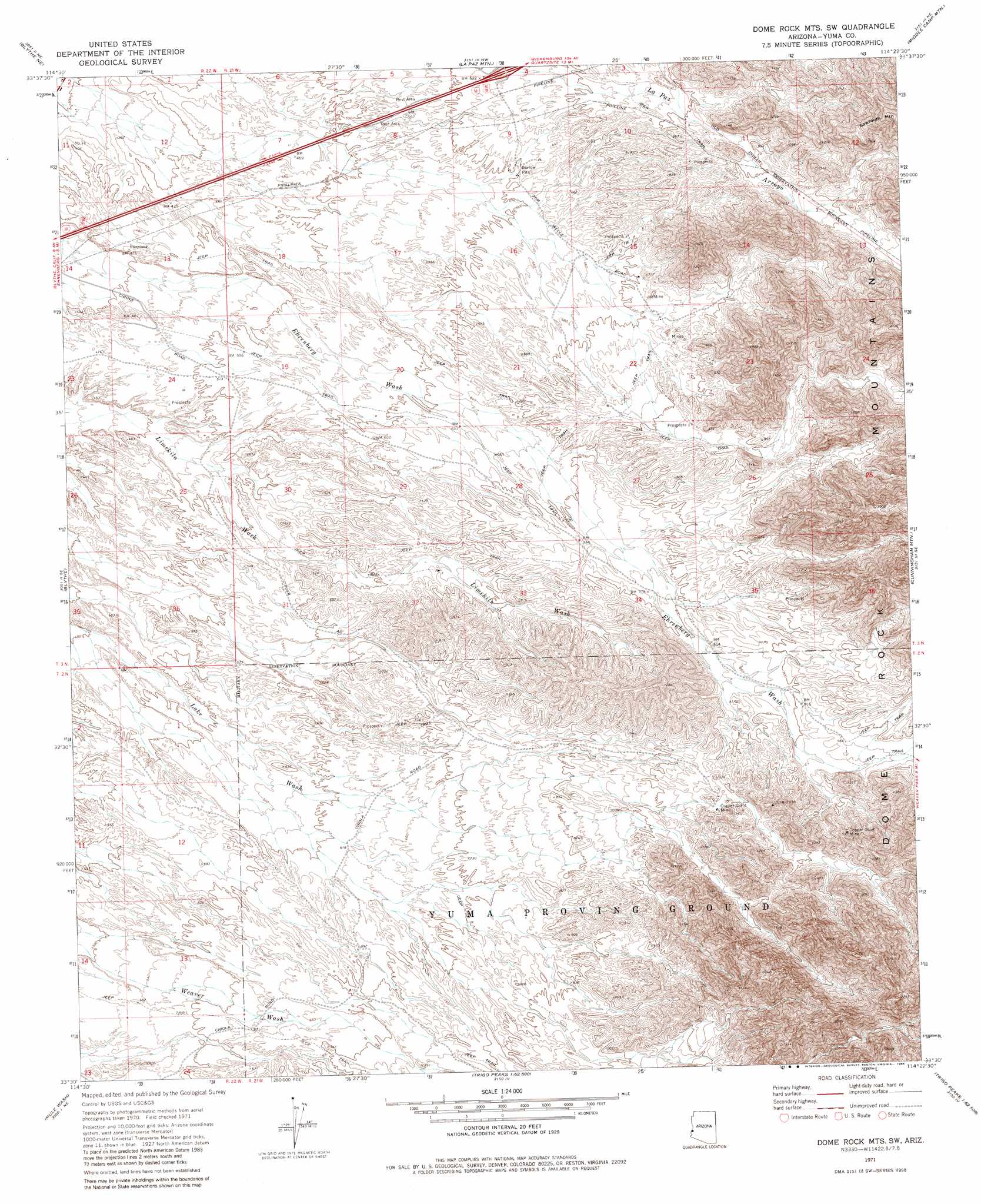
USGS Topo Quad 33114e4 - 1:24,000 scale
| Topo Map Name: | Dome Rock Mountains Sw |
| USGS Topo Quad ID: | 33114e4 |
| Print Size: | ca. 21 1/4" wide x 27" high |
| Southeast Coordinates: | 33.5° N latitude / 114.375° W longitude |
| Map Center Coordinates: | 33.5625° N latitude / 114.4375° W longitude |
| U.S. State: | AZ |
| Filename: | o33114e4.jpg |
| Download Map JPG Image: | Dome Rock Mountains Sw topo map 1:24,000 scale |
| Map Type: | Topographic |
| Topo Series: | 7.5´ |
| Map Scale: | 1:24,000 |
| Source of Map Images: | United States Geological Survey (USGS) |
| Alternate Map Versions: |
Dome Rock Mts SW AZ 1971, updated 1973 Download PDF Buy paper map Dome Rock Mts SW AZ 1971, updated 1984 Download PDF Buy paper map Dome Rock Mountains SW AZ 2011 Download PDF Buy paper map Dome Rock Mountains SW AZ 2014 Download PDF Buy paper map |
1:24,000 Topo Quads surrounding Dome Rock Mountains Sw
Big Maria Mountains Sw |
Big Maria Mountains Se |
Moon Mountain |
Moon Mountain Se |
Bouse Sw |
Mccoy Wash |
Blythe Ne |
La Paz Mountain |
Middle Camp Mountain |
Quartzsite |
Ripley |
Blythe |
Dome Rock Mountains Sw |
Cunningham Mountain |
South Of Quartzsite |
Palo Verde |
Mule Wash |
North Trigo Peaks |
Trigo Pass |
Livingston Hills Nw |
Cibola |
Cibola Se |
Mohave Peak |
Tweed Mine |
Stone Cabin |
> Back to 33114e1 at 1:100,000 scale
> Back to 33114a1 at 1:250,000 scale
> Back to U.S. Topo Maps home
Dome Rock Mountains Sw topo map: Gazetteer
Dome Rock Mountains Sw: Mines
Copper Chief Mine elevation 351m 1151′Copper Giant Mine elevation 299m 980′
Dome Rock Mountains Sw: Valleys
La Paz Arroyo elevation 228m 748′Dome Rock Mountains Sw digital topo map on disk
Buy this Dome Rock Mountains Sw topo map showing relief, roads, GPS coordinates and other geographical features, as a high-resolution digital map file on DVD: