Amos Topo Map California
To zoom in, hover over the map of Amos
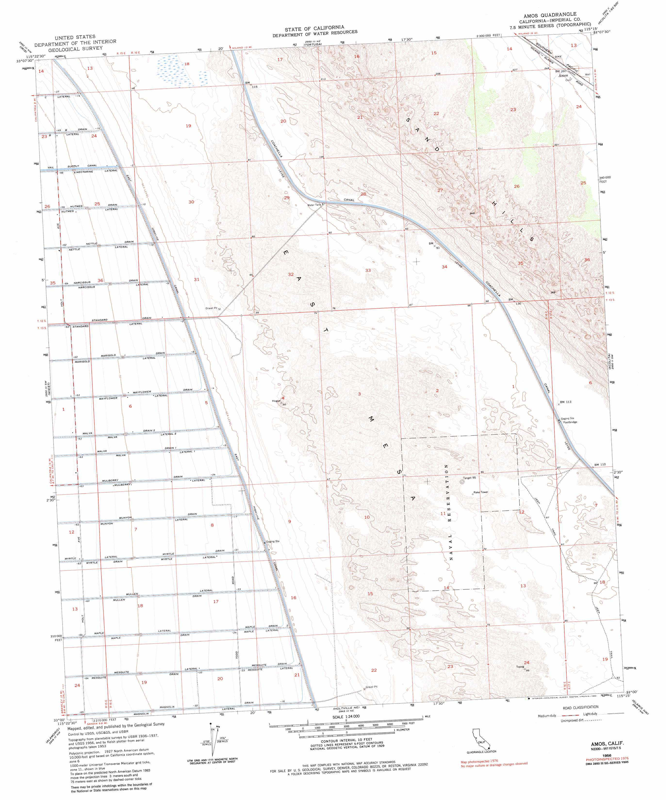
USGS Topo Quad 33115a3 - 1:24,000 scale
| Topo Map Name: | Amos |
| USGS Topo Quad ID: | 33115a3 |
| Print Size: | ca. 21 1/4" wide x 27" high |
| Southeast Coordinates: | 33° N latitude / 115.25° W longitude |
| Map Center Coordinates: | 33.0625° N latitude / 115.3125° W longitude |
| U.S. State: | CA |
| Filename: | o33115a3.jpg |
| Download Map JPG Image: | Amos topo map 1:24,000 scale |
| Map Type: | Topographic |
| Topo Series: | 7.5´ |
| Map Scale: | 1:24,000 |
| Source of Map Images: | United States Geological Survey (USGS) |
| Alternate Map Versions: |
Amos CA 1956, updated 1957 Download PDF Buy paper map Amos CA 1956, updated 1968 Download PDF Buy paper map Amos CA 1956, updated 1968 Download PDF Buy paper map Amos CA 1956, updated 1983 Download PDF Buy paper map Amos CA 2012 Download PDF Buy paper map Amos CA 2015 Download PDF Buy paper map |
1:24,000 Topo Quads surrounding Amos
Wister |
Iris Wash |
Lion Head Mountain |
Pegleg Well |
Little Mule Mountains |
Niland |
Iris |
Tortuga |
Mammoth Wash |
Blue Mountain |
Westmorland East |
Wiest |
Amos |
Acolita |
East Of Acolita |
Brawley |
Alamorio |
Holtville Ne |
Glamis Nw |
Glamis |
El Centro |
Holtville West |
Holtville East |
Glamis Sw |
Glamis Se |
> Back to 33115a1 at 1:100,000 scale
> Back to 33114a1 at 1:250,000 scale
> Back to U.S. Topo Maps home
Amos topo map: Gazetteer
Amos: Canals
Malva Drain One elevation -12m -40′Malva Drain Two elevation -15m -50′
Malva Lateral One elevation -11m -37′
Malva Lateral Two elevation -13m -43′
Amos: Populated Places
Amos elevation 80m 262′Amos: Summits
East Mesa elevation 27m 88′Amos digital topo map on disk
Buy this Amos topo map showing relief, roads, GPS coordinates and other geographical features, as a high-resolution digital map file on DVD: