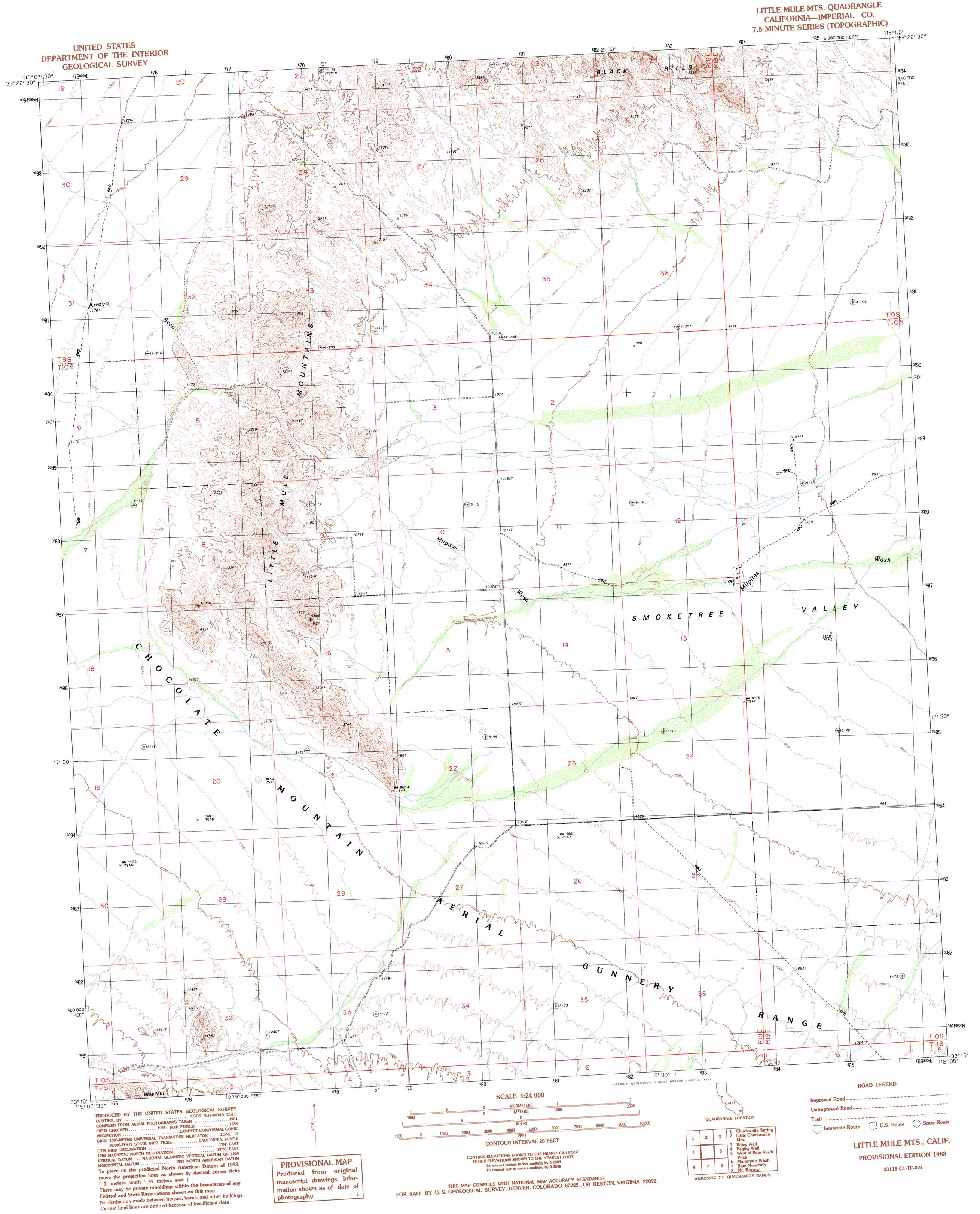
Little Mule Mountains Topo Map California
To zoom in, hover over the map of Little Mule Mountains
USGS Topo Quad 33115c1 - 1:24,000 scale
| Topo Map Name: | Little Mule Mountains |
| USGS Topo Quad ID: | 33115c1 |
| Print Size: | ca. 21 1/4" wide x 27" high |
| Southeast Coordinates: | 33.25° N latitude / 115° W longitude |
| Map Center Coordinates: | 33.3125° N latitude / 115.0625° W longitude |
| U.S. State: | CA |
| Filename: | o33115c1.jpg |
| Download Map JPG Image: | Little Mule Mountains topo map 1:24,000 scale |
| Map Type: | Topographic |
| Topo Series: | 7.5´ |
| Map Scale: | 1:24,000 |
| Source of Map Images: | United States Geological Survey (USGS) |
| Alternate Map Versions: |
Little Mule Mountains CA 1988, updated 1988 Download PDF Buy paper map Little Mule Mts CA 1988, updated 1988 Download PDF Buy paper map Little Mule Mountains CA 2012 Download PDF Buy paper map Little Mule Mountains CA 2015 Download PDF Buy paper map |
1:24,000 Topo Quads surrounding Little Mule Mountains
Pilot Mountain |
Aztec Mines |
East Of Aztec Mines |
Hopkins Well |
Roosevelt Mine |
Augustine Pass |
Chuckwalla Spring |
Little Chuckwalla Mountains |
Wileys Well |
Thumb Peak |
Lion Head Mountain |
Pegleg Well |
Little Mule Mountains |
West Of Palo Verde Peak |
Palo Verde Peak |
Tortuga |
Mammoth Wash |
Blue Mountain |
Mount Barrow |
Buzzards Peak |
Amos |
Acolita |
East Of Acolita |
Gables Wash |
Quartz Peak |
> Back to 33115a1 at 1:100,000 scale
> Back to 33114a1 at 1:250,000 scale
> Back to U.S. Topo Maps home
Little Mule Mountains topo map: Gazetteer
Little Mule Mountains: Ranges
Little Mule Mountains elevation 381m 1250′Little Mule Mountains: Streams
Arroyo Seco elevation 341m 1118′Little Mule Mountains digital topo map on disk
Buy this Little Mule Mountains topo map showing relief, roads, GPS coordinates and other geographical features, as a high-resolution digital map file on DVD: