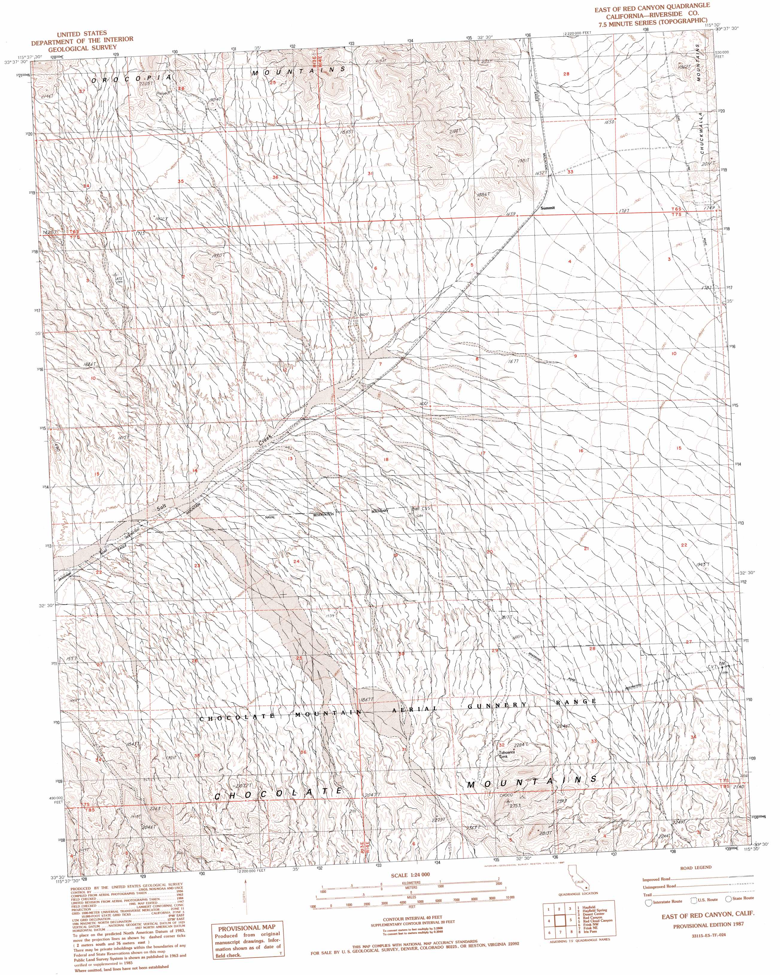
East Of Red Canyon Topo Map California
To zoom in, hover over the map of East Of Red Canyon
USGS Topo Quad 33115e5 - 1:24,000 scale
| Topo Map Name: | East Of Red Canyon |
| USGS Topo Quad ID: | 33115e5 |
| Print Size: | ca. 21 1/4" wide x 27" high |
| Southeast Coordinates: | 33.5° N latitude / 115.5° W longitude |
| Map Center Coordinates: | 33.5625° N latitude / 115.5625° W longitude |
| U.S. State: | CA |
| Filename: | o33115e5.jpg |
| Download Map JPG Image: | East Of Red Canyon topo map 1:24,000 scale |
| Map Type: | Topographic |
| Topo Series: | 7.5´ |
| Map Scale: | 1:24,000 |
| Source of Map Images: | United States Geological Survey (USGS) |
| Alternate Map Versions: |
East of Red Canyon CA 1987, updated 1987 Download PDF Buy paper map East of Red Canyon CA 1987, updated 1987 Download PDF Buy paper map East of Red Canyon CA 2012 Download PDF Buy paper map East of Red Canyon CA 2015 Download PDF Buy paper map |
1:24,000 Topo Quads surrounding East Of Red Canyon
Porcupine Wash |
Conejo Well |
Buzzard Spring |
Victory Pass |
East Of Victory Pass |
Cottonwood Spring |
Hayfield |
Hayfield Spring |
Desert Center |
Corn Spring |
Orocopia Canyon |
Red Canyon |
East Of Red Canyon |
Red Cloud Canyon |
Pilot Mountain |
Durmid |
Frink Nw |
Frink Ne |
Iris Pass |
Augustine Pass |
Durmid Se |
Frink |
Wister |
Iris Wash |
Lion Head Mountain |
> Back to 33115e1 at 1:100,000 scale
> Back to 33114a1 at 1:250,000 scale
> Back to U.S. Topo Maps home
East Of Red Canyon topo map: Gazetteer
East Of Red Canyon: Reservoirs
Tabaseca Tank elevation 612m 2007′East Of Red Canyon digital topo map on disk
Buy this East Of Red Canyon topo map showing relief, roads, GPS coordinates and other geographical features, as a high-resolution digital map file on DVD: