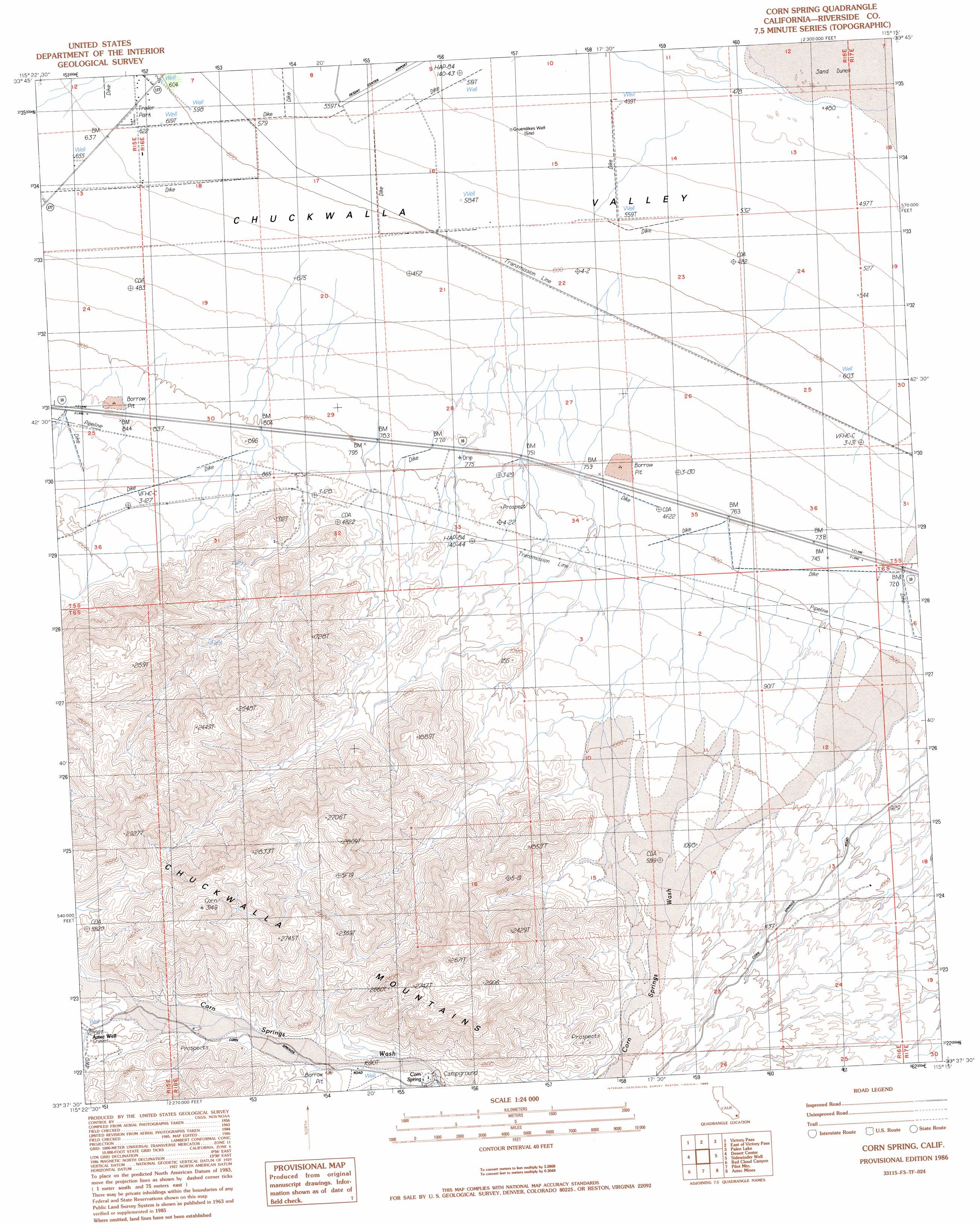
Corn Spring Topo Map California
To zoom in, hover over the map of Corn Spring
USGS Topo Quad 33115f3 - 1:24,000 scale
| Topo Map Name: | Corn Spring |
| USGS Topo Quad ID: | 33115f3 |
| Print Size: | ca. 21 1/4" wide x 27" high |
| Southeast Coordinates: | 33.625° N latitude / 115.25° W longitude |
| Map Center Coordinates: | 33.6875° N latitude / 115.3125° W longitude |
| U.S. State: | CA |
| Filename: | o33115f3.jpg |
| Download Map JPG Image: | Corn Spring topo map 1:24,000 scale |
| Map Type: | Topographic |
| Topo Series: | 7.5´ |
| Map Scale: | 1:24,000 |
| Source of Map Images: | United States Geological Survey (USGS) |
| Alternate Map Versions: |
Corn Spring CA 1986, updated 1986 Download PDF Buy paper map Corn Spring CA 2012 Download PDF Buy paper map Corn Spring CA 2015 Download PDF Buy paper map |
1:24,000 Topo Quads surrounding Corn Spring
Placer Canyon |
Pinto Wells |
Coxcomb Mountains |
West Of Palen Pass |
Palen Pass |
Buzzard Spring |
Victory Pass |
East Of Victory Pass |
Palen Lake |
Palen Mountains |
Hayfield Spring |
Desert Center |
Corn Spring |
Sidewinder Well |
Ford Dry Lake |
East Of Red Canyon |
Red Cloud Canyon |
Pilot Mountain |
Aztec Mines |
East Of Aztec Mines |
Frink Ne |
Iris Pass |
Augustine Pass |
Chuckwalla Spring |
Little Chuckwalla Mountains |
> Back to 33115e1 at 1:100,000 scale
> Back to 33114a1 at 1:250,000 scale
> Back to U.S. Topo Maps home
Corn Spring topo map: Gazetteer
Corn Spring: Airports
Desert Center Airport elevation 163m 534′Corn Spring: Springs
Corn Spring elevation 490m 1607′Corn Spring: Wells
Aztec Well elevation 612m 2007′Gruendikes Well (historical) elevation 159m 521′
Corn Spring digital topo map on disk
Buy this Corn Spring topo map showing relief, roads, GPS coordinates and other geographical features, as a high-resolution digital map file on DVD: