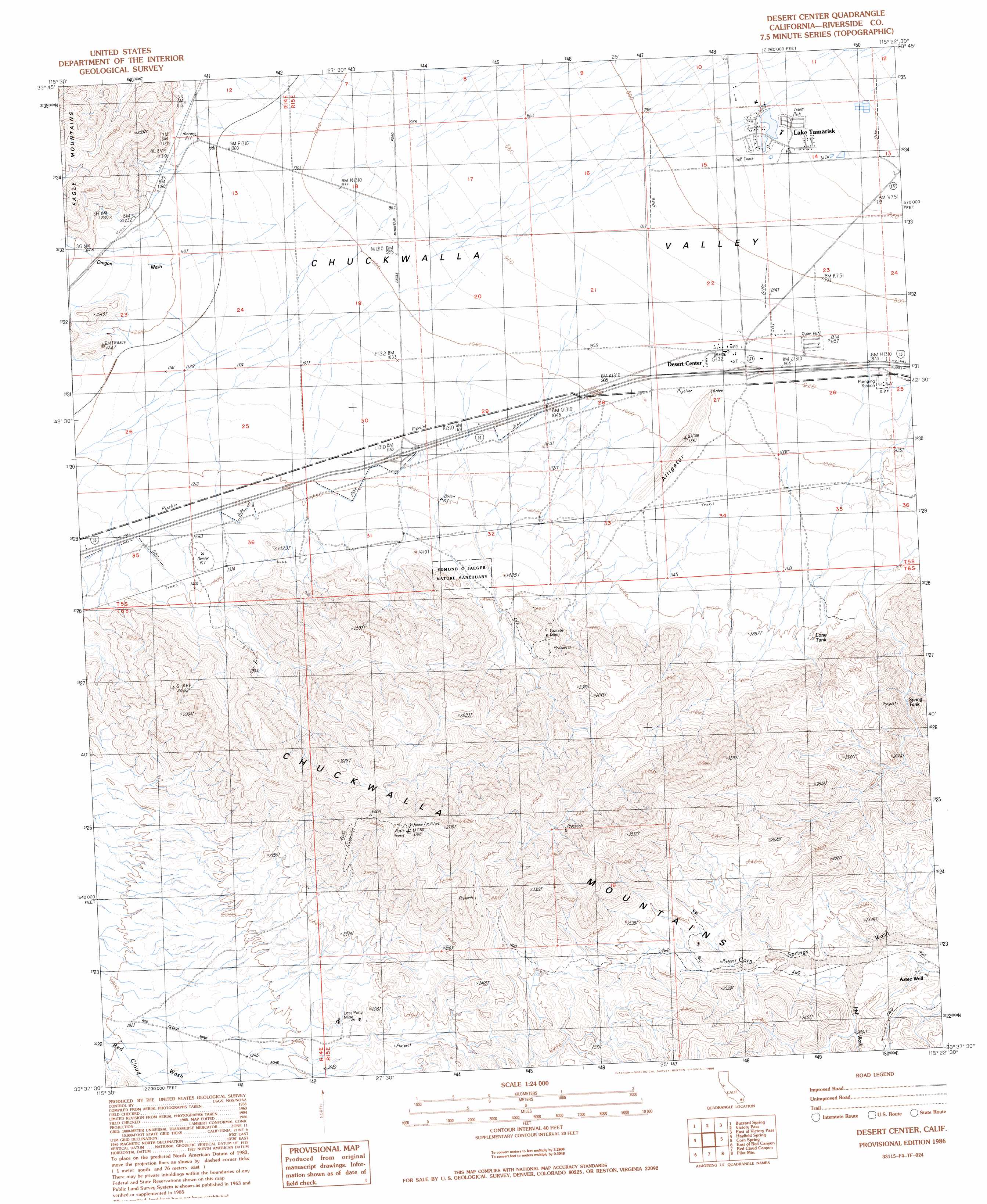
Desert Center Topo Map California
To zoom in, hover over the map of Desert Center
USGS Topo Quad 33115f4 - 1:24,000 scale
| Topo Map Name: | Desert Center |
| USGS Topo Quad ID: | 33115f4 |
| Print Size: | ca. 21 1/4" wide x 27" high |
| Southeast Coordinates: | 33.625° N latitude / 115.375° W longitude |
| Map Center Coordinates: | 33.6875° N latitude / 115.4375° W longitude |
| U.S. State: | CA |
| Filename: | o33115f4.jpg |
| Download Map JPG Image: | Desert Center topo map 1:24,000 scale |
| Map Type: | Topographic |
| Topo Series: | 7.5´ |
| Map Scale: | 1:24,000 |
| Source of Map Images: | United States Geological Survey (USGS) |
| Alternate Map Versions: |
Desert Center CA 1986, updated 1986 Download PDF Buy paper map Desert Center CA 2012 Download PDF Buy paper map Desert Center CA 2015 Download PDF Buy paper map |
1:24,000 Topo Quads surrounding Desert Center
San Bernardino Wash |
Placer Canyon |
Pinto Wells |
Coxcomb Mountains |
West Of Palen Pass |
Conejo Well |
Buzzard Spring |
Victory Pass |
East Of Victory Pass |
Palen Lake |
Hayfield |
Hayfield Spring |
Desert Center |
Corn Spring |
Sidewinder Well |
Red Canyon |
East Of Red Canyon |
Red Cloud Canyon |
Pilot Mountain |
Aztec Mines |
Frink Nw |
Frink Ne |
Iris Pass |
Augustine Pass |
Chuckwalla Spring |
> Back to 33115e1 at 1:100,000 scale
> Back to 33114a1 at 1:250,000 scale
> Back to U.S. Topo Maps home
Desert Center topo map: Gazetteer
Desert Center: Mines
Granite Mine elevation 505m 1656′Lost Pony Mine elevation 634m 2080′
Desert Center: Parks
Edmund C Jaeger Nature Sanctuary elevation 403m 1322′Desert Center: Populated Places
Desert Center elevation 276m 905′Lake Tamarisk elevation 220m 721′
Desert Center: Post Offices
Desert Center Post Office elevation 274m 898′Desert Center: Reservoirs
Long Tank elevation 367m 1204′Spring Tank elevation 447m 1466′
Desert Center: Streams
Dragon Wash elevation 309m 1013′Irish Wash elevation 642m 2106′
Desert Center: Summits
Alligator elevation 377m 1236′Desert Center: Wells
Granite Well elevation 425m 1394′Desert Center digital topo map on disk
Buy this Desert Center topo map showing relief, roads, GPS coordinates and other geographical features, as a high-resolution digital map file on DVD: