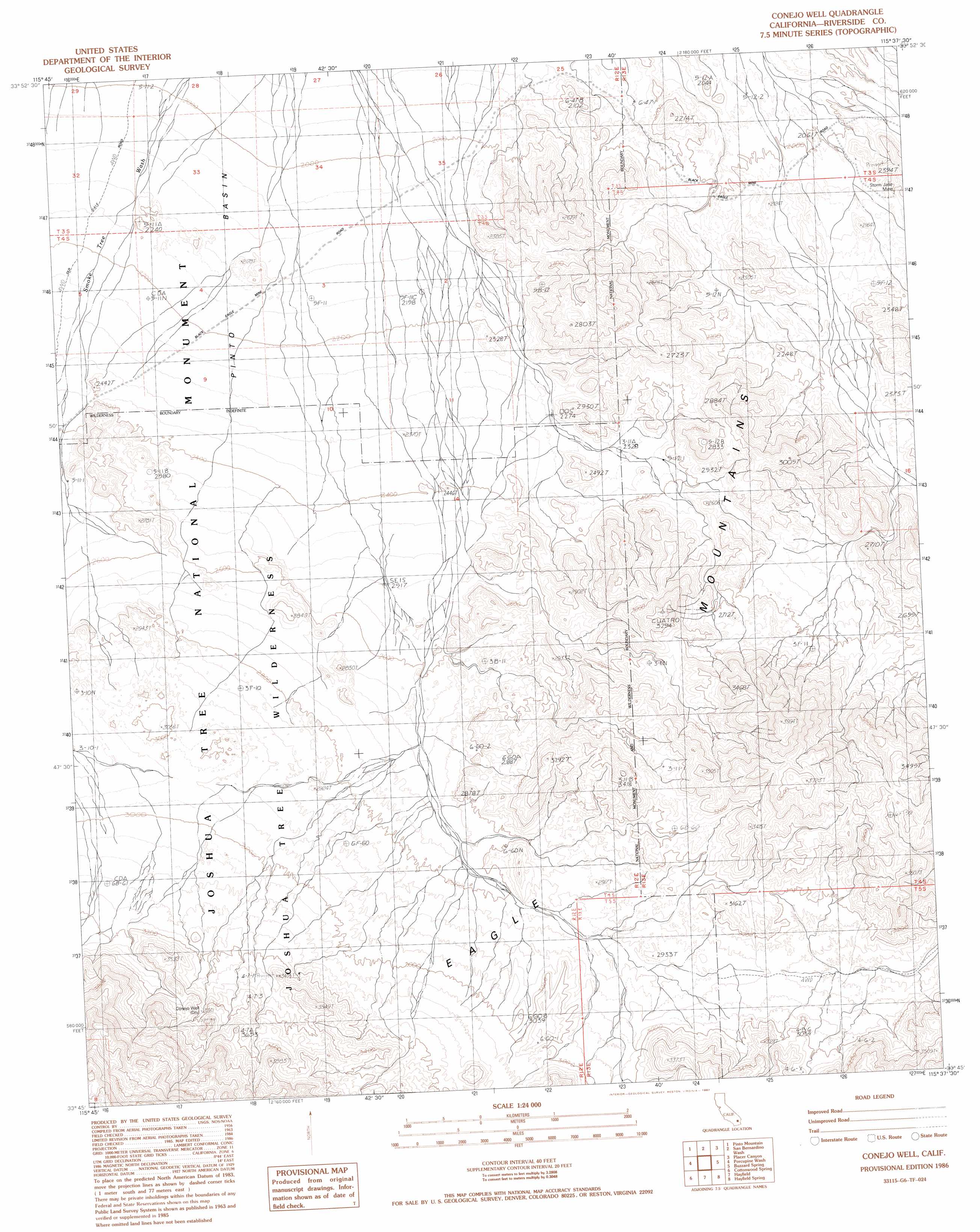
Conejo Well Topo Map California
To zoom in, hover over the map of Conejo Well
USGS Topo Quad 33115g6 - 1:24,000 scale
| Topo Map Name: | Conejo Well |
| USGS Topo Quad ID: | 33115g6 |
| Print Size: | ca. 21 1/4" wide x 27" high |
| Southeast Coordinates: | 33.75° N latitude / 115.625° W longitude |
| Map Center Coordinates: | 33.8125° N latitude / 115.6875° W longitude |
| U.S. State: | CA |
| Filename: | o33115g6.jpg |
| Download Map JPG Image: | Conejo Well topo map 1:24,000 scale |
| Map Type: | Topographic |
| Topo Series: | 7.5´ |
| Map Scale: | 1:24,000 |
| Source of Map Images: | United States Geological Survey (USGS) |
| Alternate Map Versions: |
Conejo Well CA 1986, updated 1987 Download PDF Buy paper map Conejo Well CA 1986, updated 1987 Download PDF Buy paper map Conejo Well CA 2012 Download PDF Buy paper map Conejo Well CA 2015 Download PDF Buy paper map |
1:24,000 Topo Quads surrounding Conejo Well
Twentynine Palms Mountain |
Humbug Mountain |
New Dale |
Clarks Pass |
Cadiz Valley Sw |
Fried Liver Wash |
Pinto Mountain |
San Bernardino Wash |
Placer Canyon |
Pinto Wells |
Washington Wash |
Porcupine Wash |
Conejo Well |
Buzzard Spring |
Victory Pass |
Cottonwood Basin |
Cottonwood Spring |
Hayfield |
Hayfield Spring |
Desert Center |
Mortmar |
Orocopia Canyon |
Red Canyon |
East Of Red Canyon |
Red Cloud Canyon |
> Back to 33115e1 at 1:100,000 scale
> Back to 33114a1 at 1:250,000 scale
> Back to U.S. Topo Maps home
Conejo Well digital topo map on disk
Buy this Conejo Well topo map showing relief, roads, GPS coordinates and other geographical features, as a high-resolution digital map file on DVD: