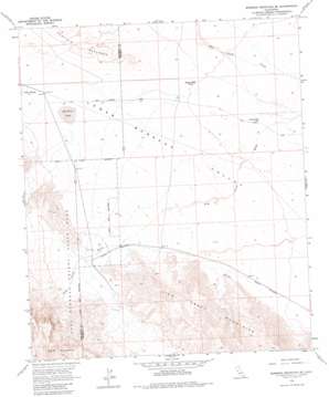
Borrego Mountain Se Topo Map California
To zoom in, hover over the map of Borrego Mountain Se
USGS Topo Quad 33116a1 - 1:24,000 scale
| Topo Map Name: | Borrego Mountain Se |
| USGS Topo Quad ID: | 33116a1 |
| Print Size: | ca. 21 1/4" wide x 27" high |
| Southeast Coordinates: | 33° N latitude / 116° W longitude |
| Map Center Coordinates: | 33.0625° N latitude / 116.0625° W longitude |
| U.S. State: | CA |
| Filename: | o33116a1.jpg |
| Download Map JPG Image: | Borrego Mountain Se topo map 1:24,000 scale |
| Map Type: | Topographic |
| Topo Series: | 7.5´ |
| Map Scale: | 1:24,000 |
| Source of Map Images: | United States Geological Survey (USGS) |
| Alternate Map Versions: |
Borrego Mountain SE CA 1958, updated 1959 Download PDF Buy paper map Borrego Mountain SE CA 1958, updated 1965 Download PDF Buy paper map Borrego Mountain SE CA 1958, updated 1965 Download PDF Buy paper map Borrego Mountain SE CA 1958, updated 1982 Download PDF Buy paper map Borrego Mountain SE CA 1958, updated 1982 Download PDF Buy paper map Borrego Mountain SE CA 2012 Download PDF Buy paper map Borrego Mountain SE CA 2015 Download PDF Buy paper map |
1:24,000 Topo Quads surrounding Borrego Mountain Se
> Back to 33116a1 at 1:100,000 scale
> Back to 33116a1 at 1:250,000 scale
> Back to U.S. Topo Maps home
Borrego Mountain Se topo map: Gazetteer
Borrego Mountain Se: Areas
Ocotillo Badlands elevation 57m 187′Borrego Mountain Se: Arroyos
Alma Wash elevation 19m 62′Borrego Mountain Se: Flats
Halfhill Lake elevation 18m 59′Borrego Mountain Se: Summits
Split Mountain elevation 414m 1358′Borrego Mountain Se: Valleys
Lower Borrego Valley elevation 13m 42′Borrego Mountain Se: Wells
Baileys Well elevation 0m 0′County Well elevation -6m -20′
Borrego Mountain Se digital topo map on disk
Buy this Borrego Mountain Se topo map showing relief, roads, GPS coordinates and other geographical features, as a high-resolution digital map file on DVD:


