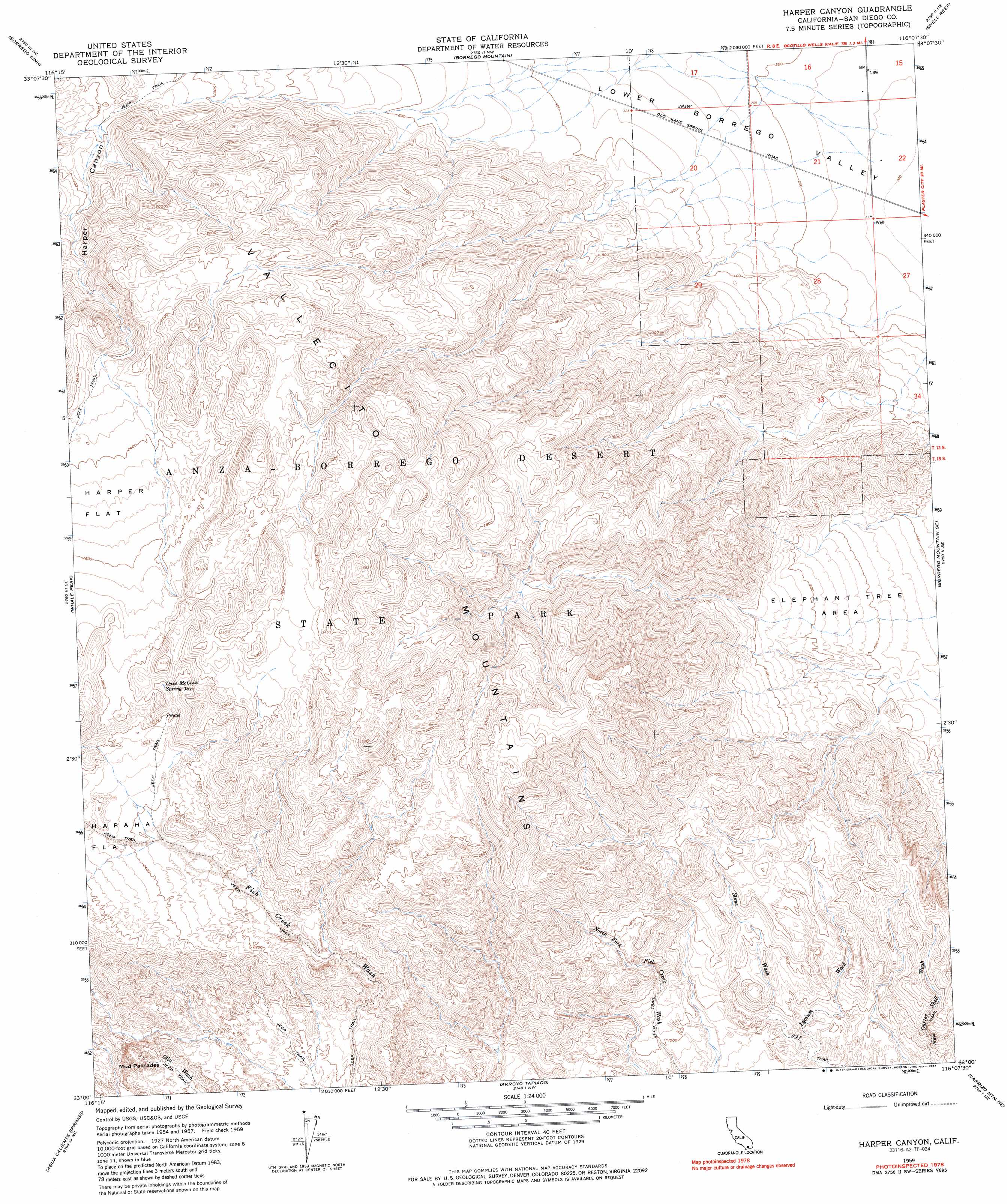
Harper Canyon Topo Map California
To zoom in, hover over the map of Harper Canyon
USGS Topo Quad 33116a2 - 1:24,000 scale
| Topo Map Name: | Harper Canyon |
| USGS Topo Quad ID: | 33116a2 |
| Print Size: | ca. 21 1/4" wide x 27" high |
| Southeast Coordinates: | 33° N latitude / 116.125° W longitude |
| Map Center Coordinates: | 33.0625° N latitude / 116.1875° W longitude |
| U.S. State: | CA |
| Filename: | o33116a2.jpg |
| Download Map JPG Image: | Harper Canyon topo map 1:24,000 scale |
| Map Type: | Topographic |
| Topo Series: | 7.5´ |
| Map Scale: | 1:24,000 |
| Source of Map Images: | United States Geological Survey (USGS) |
| Alternate Map Versions: |
Harper Canyon CA 1959, updated 1961 Download PDF Buy paper map Harper Canyon CA 1959, updated 1966 Download PDF Buy paper map Harper Canyon CA 1959, updated 1981 Download PDF Buy paper map Harper Canyon CA 1959, updated 1981 Download PDF Buy paper map Harper Canyon CA 1959, updated 1987 Download PDF Buy paper map Harper Canyon CA 1959, updated 1987 Download PDF Buy paper map Harper Canyon CA 2012 Download PDF Buy paper map Harper Canyon CA 2015 Download PDF Buy paper map |
1:24,000 Topo Quads surrounding Harper Canyon
Borrego Palm Canyon |
Clark Lake |
Fonts Point |
Seventeen Palms |
Truckhaven |
Tubb Canyon |
Borrego Sink |
Borrego Mountain |
Shell Reef |
Kane Spring Nw |
Earthquake Valley |
Whale Peak |
Harper Canyon |
Borrego Mountain Se |
Harpers Well |
Monument Peak |
Agua Caliente Springs |
Arroyo Tapiado |
Carrizo Mountain Ne |
Plaster City Nw |
Mount Laguna |
Sombrero Peak |
Sweeney Pass |
Carrizo Mountain |
Painted Gorge |
> Back to 33116a1 at 1:100,000 scale
> Back to 33116a1 at 1:250,000 scale
> Back to U.S. Topo Maps home
Harper Canyon topo map: Gazetteer
Harper Canyon: Areas
Elephant Tree Area elevation 221m 725′Harper Canyon: Cliffs
Mud Palisades elevation 556m 1824′Harper Canyon: Springs
Dave McCain Spring elevation 834m 2736′Harper Canyon: Streams
Stone Wash elevation 208m 682′Vallecito Creek elevation 847m 2778′
Harper Canyon: Trails
Elephant Trees Nature Trail elevation 217m 711′Harper Canyon: Valleys
Harper Canyon elevation 323m 1059′Harper Canyon digital topo map on disk
Buy this Harper Canyon topo map showing relief, roads, GPS coordinates and other geographical features, as a high-resolution digital map file on DVD: