Clark Lake Ne Topo Map California
To zoom in, hover over the map of Clark Lake Ne
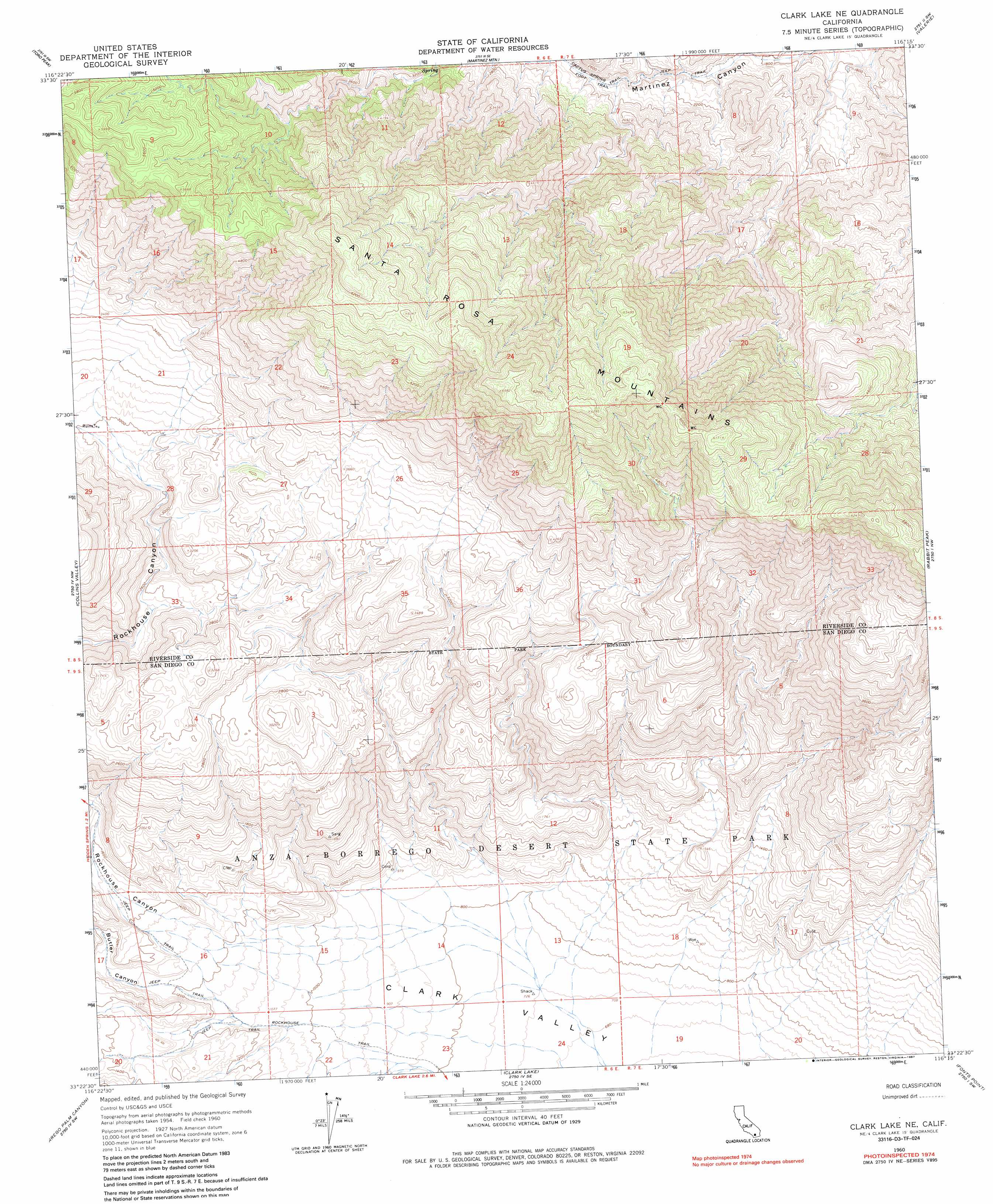
USGS Topo Quad 33116d3 - 1:24,000 scale
| Topo Map Name: | Clark Lake Ne |
| USGS Topo Quad ID: | 33116d3 |
| Print Size: | ca. 21 1/4" wide x 27" high |
| Southeast Coordinates: | 33.375° N latitude / 116.25° W longitude |
| Map Center Coordinates: | 33.4375° N latitude / 116.3125° W longitude |
| U.S. State: | CA |
| Filename: | o33116d3.jpg |
| Download Map JPG Image: | Clark Lake Ne topo map 1:24,000 scale |
| Map Type: | Topographic |
| Topo Series: | 7.5´ |
| Map Scale: | 1:24,000 |
| Source of Map Images: | United States Geological Survey (USGS) |
| Alternate Map Versions: |
Clark Lake NE CA 1960, updated 1961 Download PDF Buy paper map Clark Lake NE CA 1960, updated 1967 Download PDF Buy paper map Clark Lake NE CA 1960, updated 1967 Download PDF Buy paper map Clark Lake NE CA 1960, updated 1987 Download PDF Buy paper map Clark Lake NE CA 2012 Download PDF Buy paper map Clark Lake NE CA 2015 Download PDF Buy paper map |
1:24,000 Topo Quads surrounding Clark Lake Ne
Palm View Peak |
Rancho Mirage |
La Quinta |
Indio |
Thermal Canyon |
Butterfly Peak |
Toro Peak |
Martinez Mountain |
Valerie |
Mecca |
Bucksnort Mountain |
Collins Valley |
Clark Lake Ne |
Rabbit Peak |
Oasis |
Hot Springs Mountain |
Borrego Palm Canyon |
Clark Lake |
Fonts Point |
Seventeen Palms |
Ranchita |
Tubb Canyon |
Borrego Sink |
Borrego Mountain |
Shell Reef |
> Back to 33116a1 at 1:100,000 scale
> Back to 33116a1 at 1:250,000 scale
> Back to U.S. Topo Maps home
Clark Lake Ne topo map: Gazetteer
Clark Lake Ne: Trails
Rockhouse Trail elevation 299m 980′Clark Lake Ne: Valleys
Butler Canyon elevation 350m 1148′Rockhouse Canyon elevation 379m 1243′
Clark Lake Ne digital topo map on disk
Buy this Clark Lake Ne topo map showing relief, roads, GPS coordinates and other geographical features, as a high-resolution digital map file on DVD: