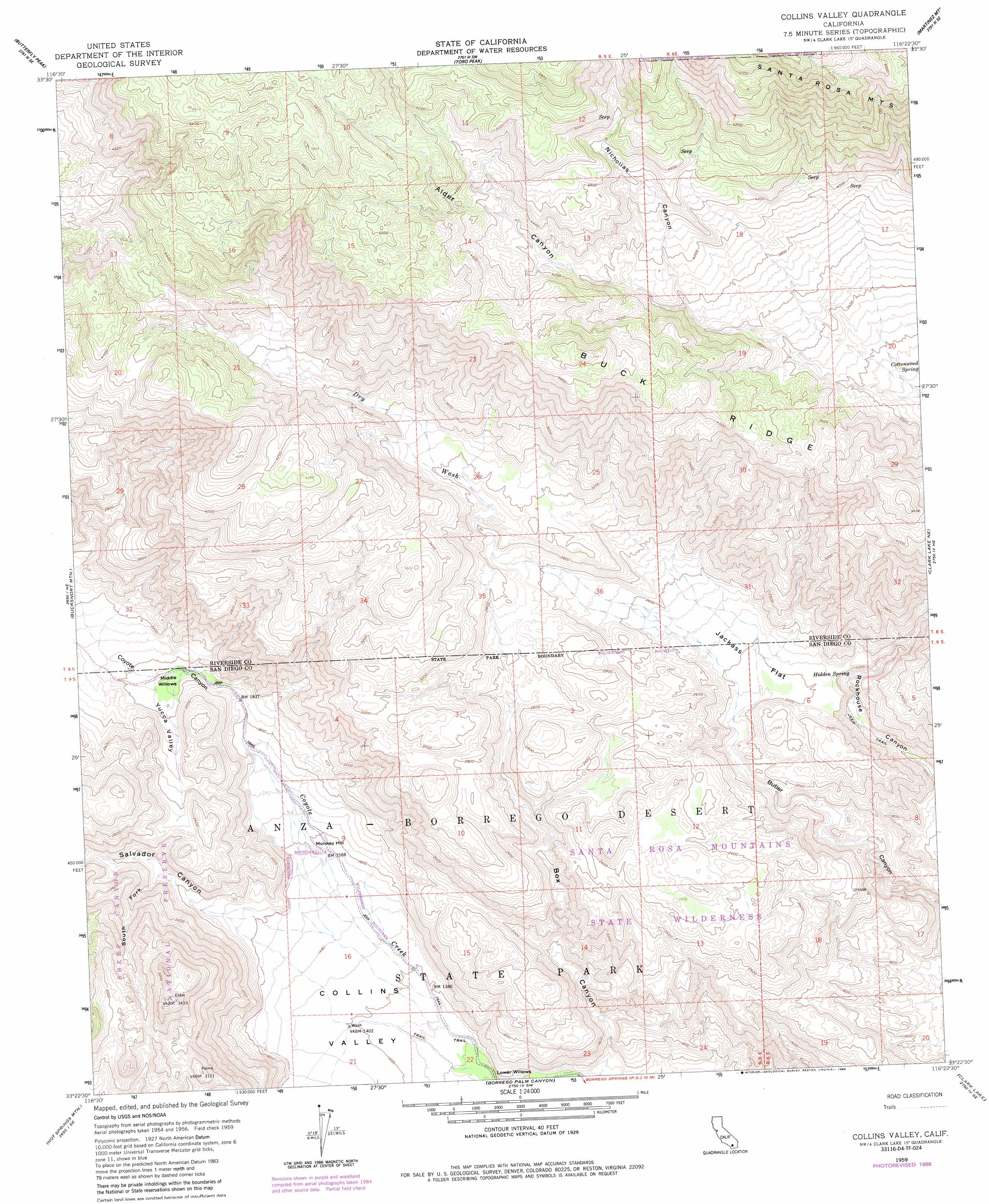
Collins Valley Topo Map California
To zoom in, hover over the map of Collins Valley
USGS Topo Quad 33116d4 - 1:24,000 scale
| Topo Map Name: | Collins Valley |
| USGS Topo Quad ID: | 33116d4 |
| Print Size: | ca. 21 1/4" wide x 27" high |
| Southeast Coordinates: | 33.375° N latitude / 116.375° W longitude |
| Map Center Coordinates: | 33.4375° N latitude / 116.4375° W longitude |
| U.S. State: | CA |
| Filename: | o33116d4.jpg |
| Download Map JPG Image: | Collins Valley topo map 1:24,000 scale |
| Map Type: | Topographic |
| Topo Series: | 7.5´ |
| Map Scale: | 1:24,000 |
| Source of Map Images: | United States Geological Survey (USGS) |
| Alternate Map Versions: |
Collins Valley CA 1959, updated 1960 Download PDF Buy paper map Collins Valley CA 1959, updated 1969 Download PDF Buy paper map Collins Valley CA 1959, updated 1969 Download PDF Buy paper map Collins Valley CA 1959, updated 1981 Download PDF Buy paper map Collins Valley CA 1959, updated 1988 Download PDF Buy paper map Collins Valley CA 1996, updated 1999 Download PDF Buy paper map Collins Valley CA 2012 Download PDF Buy paper map Collins Valley CA 2015 Download PDF Buy paper map |
| FStopo: | US Forest Service topo Collins Valley is available: Download FStopo PDF Download FStopo TIF |
1:24,000 Topo Quads surrounding Collins Valley
Idyllwild |
Palm View Peak |
Rancho Mirage |
La Quinta |
Indio |
Anza |
Butterfly Peak |
Toro Peak |
Martinez Mountain |
Valerie |
Beauty Mountain |
Bucksnort Mountain |
Collins Valley |
Clark Lake Ne |
Rabbit Peak |
Warner Springs |
Hot Springs Mountain |
Borrego Palm Canyon |
Clark Lake |
Fonts Point |
Warners Ranch |
Ranchita |
Tubb Canyon |
Borrego Sink |
Borrego Mountain |
> Back to 33116a1 at 1:100,000 scale
> Back to 33116a1 at 1:250,000 scale
> Back to U.S. Topo Maps home
Collins Valley topo map: Gazetteer
Collins Valley: Flats
Jackass Flat elevation 666m 2185′Lower Willows elevation 391m 1282′
Middle Willows elevation 589m 1932′
Collins Valley: Ridges
Buck Ridge elevation 1309m 4294′Collins Valley: Springs
Cottonwood Spring elevation 949m 3113′Hidden Spring elevation 626m 2053′
Collins Valley: Streams
Dry Wash elevation 718m 2355′Collins Valley: Summits
Monkey Hill elevation 503m 1650′Collins Valley: Trails
Anza Trail elevation 549m 1801′Collins Valley: Valleys
Alder Canyon elevation 1003m 3290′Box Canyon elevation 384m 1259′
Collins Valley elevation 426m 1397′
Nicholias Canyon elevation 1133m 3717′
Salvador Canyon elevation 475m 1558′
South Fork Salvador Canyon elevation 551m 1807′
Yucca Valley elevation 605m 1984′
Collins Valley digital topo map on disk
Buy this Collins Valley topo map showing relief, roads, GPS coordinates and other geographical features, as a high-resolution digital map file on DVD: