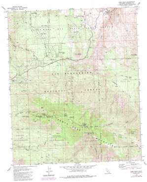
Toro Peak Topo Map California
To zoom in, hover over the map of Toro Peak
USGS Topo Quad 33116e4 - 1:24,000 scale
| Topo Map Name: | Toro Peak |
| USGS Topo Quad ID: | 33116e4 |
| Print Size: | ca. 21 1/4" wide x 27" high |
| Southeast Coordinates: | 33.5° N latitude / 116.375° W longitude |
| Map Center Coordinates: | 33.5625° N latitude / 116.4375° W longitude |
| U.S. State: | CA |
| Filename: | o33116e4.jpg |
| Download Map JPG Image: | Toro Peak topo map 1:24,000 scale |
| Map Type: | Topographic |
| Topo Series: | 7.5´ |
| Map Scale: | 1:24,000 |
| Source of Map Images: | United States Geological Survey (USGS) |
| Alternate Map Versions: |
Toro Peak CA 1981, updated 1982 Download PDF Buy paper map Toro Peak CA 1981, updated 1984 Download PDF Buy paper map Toro Peak CA 1981, updated 1988 Download PDF Buy paper map Toro Peak CA 1996, updated 1999 Download PDF Buy paper map Toro Peak CA 1996, updated 1999 Download PDF Buy paper map Toro Peak CA 1996, updated 1999 Download PDF Buy paper map Toro Peak CA 2012 Download PDF Buy paper map Toro Peak CA 2015 Download PDF Buy paper map |
| FStopo: | US Forest Service topo Toro Peak is available: Download FStopo PDF Download FStopo TIF |
1:24,000 Topo Quads surrounding Toro Peak
> Back to 33116e1 at 1:100,000 scale
> Back to 33116a1 at 1:250,000 scale
> Back to U.S. Topo Maps home
Toro Peak topo map: Gazetteer
Toro Peak: Flats
Little Pinyon Flat elevation 1301m 4268′Pinyon Flat elevation 1269m 4163′
Toro Peak: Mines
Asbestos Mine elevation 1194m 3917′Dolomite Mine elevation 1217m 3992′
Garnet Queen Mine elevation 1839m 6033′
Toro Peak: Parks
Hidden Palms State Ecological Reserve elevation 856m 2808′Toro Peak: Populated Places
Alpine Village elevation 1229m 4032′Pinyon Crest elevation 1243m 4078′
Pinyon Pines elevation 1243m 4078′
Ribbonwood elevation 1340m 4396′
Taylor elevation 1093m 3585′
Toro Peak: Springs
Asbestos Spring elevation 1324m 4343′Cactus Spring elevation 1287m 4222′
Cedar Spring elevation 2332m 7650′
Dos Palmas Spring elevation 1099m 3605′
Mountain Home Spring elevation 1967m 6453′
Santa Rosa Spring elevation 2247m 7372′
Stump Spring elevation 2308m 7572′
Toro Spring elevation 1633m 5357′
Virgin Spring elevation 2316m 7598′
Toro Peak: Streams
Horsethief Creek elevation 997m 3270′Toro Peak: Summits
Santa Rosa Mountain elevation 2449m 8034′Sheep Mountain elevation 1562m 5124′
Spring Crest elevation 1367m 4484′
Toro Peak elevation 2650m 8694′
Toro Peak: Valleys
Hidden Palm Canyon elevation 695m 2280′Toro Peak digital topo map on disk
Buy this Toro Peak topo map showing relief, roads, GPS coordinates and other geographical features, as a high-resolution digital map file on DVD:


