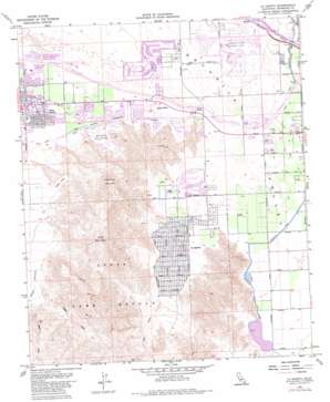
La Quinta Topo Map California
To zoom in, hover over the map of La Quinta
USGS Topo Quad 33116f3 - 1:24,000 scale
| Topo Map Name: | La Quinta |
| USGS Topo Quad ID: | 33116f3 |
| Print Size: | ca. 21 1/4" wide x 27" high |
| Southeast Coordinates: | 33.625° N latitude / 116.25° W longitude |
| Map Center Coordinates: | 33.6875° N latitude / 116.3125° W longitude |
| U.S. State: | CA |
| Filename: | o33116f3.jpg |
| Download Map JPG Image: | La Quinta topo map 1:24,000 scale |
| Map Type: | Topographic |
| Topo Series: | 7.5´ |
| Map Scale: | 1:24,000 |
| Source of Map Images: | United States Geological Survey (USGS) |
| Alternate Map Versions: |
La Quinta CA 1959, updated 1960 Download PDF Buy paper map La Quinta CA 1959, updated 1968 Download PDF Buy paper map La Quinta CA 1959, updated 1973 Download PDF Buy paper map La Quinta CA 1959, updated 1980 Download PDF Buy paper map La Quinta CA 2012 Download PDF Buy paper map La Quinta CA 2015 Download PDF Buy paper map |
| FStopo: | US Forest Service topo La Quinta is available: Download FStopo PDF Download FStopo TIF |
1:24,000 Topo Quads surrounding La Quinta
> Back to 33116e1 at 1:100,000 scale
> Back to 33116a1 at 1:250,000 scale
> Back to U.S. Topo Maps home
La Quinta topo map: Gazetteer
La Quinta: Airports
Bermuda Dunes Airport elevation 19m 62′La Quinta: Canals
Deep Canyon Stormwater Channel elevation 49m 160′La Quinta: Dams
West Side Detention Dike Number 2 Dam elevation 2m 6′West Side Detention Dike Number 3 Dam elevation 93m 305′
West Side Detention Dike Number 4 Dam elevation 2m 6′
La Quinta: Parks
Fritz Burns Park elevation 13m 42′La Quinta Community Park elevation 15m 49′
Lake Cahuilla Park elevation 8m 26′
Living Desert Reserve elevation 129m 423′
Palm Desert Community Park elevation 50m 164′
La Quinta: Populated Places
Bermuda Dunes elevation 29m 95′Bermuda Palms Mobile Park elevation 11m 36′
Indian Wells elevation 27m 88′
Indian Wells Mobile Home Park elevation 16m 52′
La Quinta elevation 41m 134′
Palm Desert elevation 67m 219′
Palm Desert Country elevation 54m 177′
La Quinta: Post Offices
Indian Wells Post Office elevation 43m 141′La Quinta Post Office elevation 14m 45′
La Quinta Post Office (historical) elevation 41m 134′
Palm Desert Post Office elevation 74m 242′
La Quinta: Reservoirs
Lake Cahuilla elevation 2m 6′La Quinta: Streams
Bear Creek elevation 104m 341′Coyote Creek elevation 266m 872′
Dead Indian Creek elevation 118m 387′
Sheep Creek elevation 277m 908′
La Quinta: Summits
Eisenhower Mountain elevation 586m 1922′Indio Mountain elevation 657m 2155′
Point Happy elevation 35m 114′
La Quinta: Valleys
Deep Canyon elevation 165m 541′Hidden Valley elevation 155m 508′
La Quinta digital topo map on disk
Buy this La Quinta topo map showing relief, roads, GPS coordinates and other geographical features, as a high-resolution digital map file on DVD:


