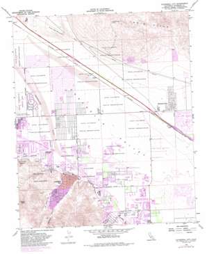
Cathedral City Topo Map California
To zoom in, hover over the map of Cathedral City
USGS Topo Quad 33116g4 - 1:24,000 scale
| Topo Map Name: | Cathedral City |
| USGS Topo Quad ID: | 33116g4 |
| Print Size: | ca. 21 1/4" wide x 27" high |
| Southeast Coordinates: | 33.75° N latitude / 116.375° W longitude |
| Map Center Coordinates: | 33.8125° N latitude / 116.4375° W longitude |
| U.S. State: | CA |
| Filename: | o33116g4.jpg |
| Download Map JPG Image: | Cathedral City topo map 1:24,000 scale |
| Map Type: | Topographic |
| Topo Series: | 7.5´ |
| Map Scale: | 1:24,000 |
| Source of Map Images: | United States Geological Survey (USGS) |
| Alternate Map Versions: |
Cathedral City CA 1958, updated 1960 Download PDF Buy paper map Cathedral City CA 1958, updated 1960 Download PDF Buy paper map Cathedral City CA 1958, updated 1964 Download PDF Buy paper map Cathedral City CA 1958, updated 1973 Download PDF Buy paper map Cathedral City CA 1958, updated 1982 Download PDF Buy paper map Cathedral City CA 1958, updated 1982 Download PDF Buy paper map Cathedral City CA 1958, updated 1988 Download PDF Buy paper map Cathedral City CA 1958, updated 1988 Download PDF Buy paper map Cathedral City CA 1975, updated 1977 Download PDF Buy paper map Cathedral City CA 2012 Download PDF Buy paper map Cathedral City CA 2015 Download PDF Buy paper map |
| FStopo: | US Forest Service topo Cathedral City is available: Download FStopo PDF Download FStopo TIF |
1:24,000 Topo Quads surrounding Cathedral City
> Back to 33116e1 at 1:100,000 scale
> Back to 33116a1 at 1:250,000 scale
> Back to U.S. Topo Maps home
Cathedral City topo map: Gazetteer
Cathedral City: Airports
Eisenhower Medical Center Heliport elevation 71m 232′Cathedral City: Parks
Agua Caliente Park elevation 119m 390′Bloch Cancer Survivors Park elevation 86m 282′
Century Park elevation 104m 341′
Oasis Water Park elevation 110m 360′
Panorama Park elevation 121m 396′
Second Street Park elevation 89m 291′
Wolfson Park elevation 79m 259′
Cathedral City: Populated Places
Caliente Sands elevation 94m 308′Cathedral City elevation 100m 328′
Desert Hills Trailer Park elevation 108m 354′
Dorado Mobile Home Park elevation 97m 318′
Edom elevation 67m 219′
Mahoney Trailer Park elevation 102m 334′
Rimlon elevation 104m 341′
Royal Palms elevation 96m 314′
Suntown elevation 93m 305′
Thousand Palms elevation 75m 246′
Cathedral City: Post Offices
Cathedral City Post Office elevation 97m 318′Cathedral City Post Office (historical) elevation 100m 328′
Thousand Palms Post Office elevation 69m 226′
Cathedral City: Streams
Morongo Wash elevation 163m 534′Palm Canyon Wash elevation 98m 321′
Tahquitz Creek elevation 107m 351′
Cathedral City: Summits
Edom Hill elevation 477m 1564′Flat Top Mountain elevation 253m 830′
Murray Hill elevation 671m 2201′
Cathedral City: Valleys
Bradley Canyon elevation 92m 301′Cathedral Canyon elevation 102m 334′
Cathedral City digital topo map on disk
Buy this Cathedral City topo map showing relief, roads, GPS coordinates and other geographical features, as a high-resolution digital map file on DVD:


