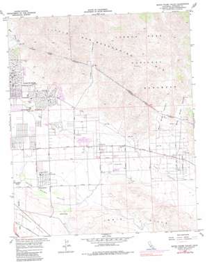
Seven Palms Valley Topo Map California
To zoom in, hover over the map of Seven Palms Valley
USGS Topo Quad 33116h4 - 1:24,000 scale
| Topo Map Name: | Seven Palms Valley |
| USGS Topo Quad ID: | 33116h4 |
| Print Size: | ca. 21 1/4" wide x 27" high |
| Southeast Coordinates: | 33.875° N latitude / 116.375° W longitude |
| Map Center Coordinates: | 33.9375° N latitude / 116.4375° W longitude |
| U.S. State: | CA |
| Filename: | o33116h4.jpg |
| Download Map JPG Image: | Seven Palms Valley topo map 1:24,000 scale |
| Map Type: | Topographic |
| Topo Series: | 7.5´ |
| Map Scale: | 1:24,000 |
| Source of Map Images: | United States Geological Survey (USGS) |
| Alternate Map Versions: |
Seven Palms Valley CA 1958, updated 1959 Download PDF Buy paper map Seven Palms Valley CA 1958, updated 1965 Download PDF Buy paper map Seven Palms Valley CA 1958, updated 1973 Download PDF Buy paper map Seven Palms Valley CA 1958, updated 1985 Download PDF Buy paper map Seven Palms Valley CA 1958, updated 1985 Download PDF Buy paper map Seven Palms Valley CA 2012 Download PDF Buy paper map Seven Palms Valley CA 2015 Download PDF Buy paper map |
1:24,000 Topo Quads surrounding Seven Palms Valley
> Back to 33116e1 at 1:100,000 scale
> Back to 33116a1 at 1:250,000 scale
> Back to U.S. Topo Maps home
Seven Palms Valley topo map: Gazetteer
Seven Palms Valley: Basins
Seven Palms Valley elevation 227m 744′Seven Palms Valley: Flats
Willow Hole elevation 205m 672′Seven Palms Valley: Parks
Eastside Neighborhood Park elevation 387m 1269′Mission Springs Park elevation 278m 912′
Seven Palms Valley: Populated Places
Desert Edge elevation 299m 980′Seven Palms Valley: Summits
Miracle Hill elevation 345m 1131′Seven Palms Valley: Tunnels
Coachella Tunnels elevation 615m 2017′Seven Palms Valley: Valleys
East Wide Canyon elevation 418m 1371′Long Canyon elevation 386m 1266′
West Wide Canyon elevation 405m 1328′
Seven Palms Valley digital topo map on disk
Buy this Seven Palms Valley topo map showing relief, roads, GPS coordinates and other geographical features, as a high-resolution digital map file on DVD:


