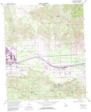
Cabazon Topo Map California
To zoom in, hover over the map of Cabazon
USGS Topo Quad 33116h7 - 1:24,000 scale
| Topo Map Name: | Cabazon |
| USGS Topo Quad ID: | 33116h7 |
| Print Size: | ca. 21 1/4" wide x 27" high |
| Southeast Coordinates: | 33.875° N latitude / 116.75° W longitude |
| Map Center Coordinates: | 33.9375° N latitude / 116.8125° W longitude |
| U.S. State: | CA |
| Filename: | o33116h7.jpg |
| Download Map JPG Image: | Cabazon topo map 1:24,000 scale |
| Map Type: | Topographic |
| Topo Series: | 7.5´ |
| Map Scale: | 1:24,000 |
| Source of Map Images: | United States Geological Survey (USGS) |
| Alternate Map Versions: |
Cabazon CA 1956, updated 1957 Download PDF Buy paper map Cabazon CA 1956, updated 1963 Download PDF Buy paper map Cabazon CA 1956, updated 1973 Download PDF Buy paper map Cabazon CA 1956, updated 1987 Download PDF Buy paper map Cabazon CA 1956, updated 1988 Download PDF Buy paper map Cabazon CA 1996, updated 1999 Download PDF Buy paper map Cabazon CA 2012 Download PDF Buy paper map Cabazon CA 2015 Download PDF Buy paper map |
| FStopo: | US Forest Service topo Cabazon is available: Download FStopo PDF Download FStopo TIF |
1:24,000 Topo Quads surrounding Cabazon
> Back to 33116e1 at 1:100,000 scale
> Back to 33116a1 at 1:250,000 scale
> Back to U.S. Topo Maps home
Cabazon topo map: Gazetteer
Cabazon: Airports
Banning Municipal Airport elevation 665m 2181′Cabazon: Crossings
Interchange 101 elevation 699m 2293′Cabazon: Falls
East Portal Adit elevation 488m 1601′Cabazon: Flats
Burro Flats elevation 1182m 3877′Cabazon: Gaps
San Gorgonio Pass elevation 485m 1591′Cabazon: Mines
Cabazon Shaft elevation 545m 1788′Cabazon: Parks
Cabazon Park elevation 522m 1712′Pass Valley Park elevation 723m 2372′
Cabazon: Populated Places
Cabazon elevation 559m 1833′Owl elevation 613m 2011′
Cabazon: Post Offices
Cabazon Post Office elevation 552m 1811′Cabazon: Streams
Brown Creek elevation 857m 2811′Hathaway Creek elevation 692m 2270′
Potrero Creek elevation 634m 2080′
Smith Creek elevation 565m 1853′
Twin Pines Creek elevation 524m 1719′
Cabazon: Summits
Barker Peak elevation 1321m 4333′Cabazon Peak elevation 1382m 4534′
Cabazon: Valleys
Banning Canyon elevation 782m 2565′Corral Canyon elevation 920m 3018′
Deep Canyon elevation 677m 2221′
East Branch Millard Canyon elevation 1085m 3559′
Lion Canyon elevation 565m 1853′
Millard Canyon elevation 724m 2375′
West Branch Millard Canyon elevation 903m 2962′
Wood Canyon elevation 1095m 3592′
Cabazon digital topo map on disk
Buy this Cabazon topo map showing relief, roads, GPS coordinates and other geographical features, as a high-resolution digital map file on DVD:


