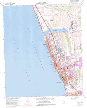
Encinitas Topo Map California
To zoom in, hover over the map of Encinitas
USGS Topo Quad 33117a3 - 1:24,000 scale
| Topo Map Name: | Encinitas |
| USGS Topo Quad ID: | 33117a3 |
| Print Size: | ca. 21 1/4" wide x 27" high |
| Southeast Coordinates: | 33° N latitude / 117.25° W longitude |
| Map Center Coordinates: | 33.0625° N latitude / 117.3125° W longitude |
| U.S. State: | CA |
| Filename: | o33117a3.jpg |
| Download Map JPG Image: | Encinitas topo map 1:24,000 scale |
| Map Type: | Topographic |
| Topo Series: | 7.5´ |
| Map Scale: | 1:24,000 |
| Source of Map Images: | United States Geological Survey (USGS) |
| Alternate Map Versions: |
Encinitas CA 1948, updated 1955 Download PDF Buy paper map Encinitas CA 1948, updated 1963 Download PDF Buy paper map Encinitas CA 1949, updated 1949 Download PDF Buy paper map Encinitas CA 1949, updated 1949 Download PDF Buy paper map Encinitas CA 1968, updated 1969 Download PDF Buy paper map Encinitas CA 1968, updated 1969 Download PDF Buy paper map Encinitas CA 1968, updated 1978 Download PDF Buy paper map Encinitas CA 1968, updated 1978 Download PDF Buy paper map Encinitas CA 1968, updated 1978 Download PDF Buy paper map Encinitas CA 1997, updated 2001 Download PDF Buy paper map Encinitas CA 2012 Download PDF Buy paper map Encinitas CA 2015 Download PDF Buy paper map |
1:24,000 Topo Quads surrounding Encinitas
San Onofre Bluff |
Las Pulgas Canyon |
Morro Hill |
Bonsall |
Pala |
Oceanside |
San Luis Rey |
San Marcos |
Valley Center |
|
Encinitas |
Rancho Santa Fe |
Escondido |
||
Del Mar |
Poway |
|||
La Jolla |
La Mesa |
> Back to 33117a1 at 1:100,000 scale
> Back to 33116a1 at 1:250,000 scale
> Back to U.S. Topo Maps home
Encinitas topo map: Gazetteer
Encinitas: Bays
Batiquitos Lagoon elevation 4m 13′Encinitas: Crossings
Interchange 39 elevation 5m 16′Interchange 40 elevation 48m 157′
Interchange 41A elevation 55m 180′
Interchange 41B elevation 31m 101′
Interchange 43 elevation 49m 160′
Interchange 44 elevation 10m 32′
Interchange 45 elevation 29m 95′
Interchange 47 elevation 19m 62′
Encinitas: Parks
Ada Harris Park elevation 68m 223′Cardiff State Beach elevation 5m 16′
Ecke Park elevation 47m 154′
Encinitas Beach County Park elevation 5m 16′
Encinitas Viewpoint Park elevation 44m 144′
Glen Park elevation 13m 42′
Leucadia Park elevation 18m 59′
Moonlight State Beach elevation 11m 36′
Oakcrest County Park elevation 116m 380′
Ponto State Beach elevation 5m 16′
Quail Park Botanical Garden elevation 79m 259′
San Eligo Lagoon County Park and Ecological Reserve elevation 2m 6′
San Elijo State Beach elevation 15m 49′
Sea Cliff County Park elevation 9m 29′
Seaside Gardens County Park elevation 4m 13′
South Carlsbad State Beach elevation 22m 72′
Swamis Seaside Park elevation 26m 85′
Encinitas: Populated Places
Cardiff-by-the-Sea elevation 24m 78′Encinitas elevation 25m 82′
Green Valley Mobile Estates elevation 61m 200′
La Costa elevation 17m 55′
Lanaki Lane Mobile Home Park elevation 20m 65′
Leucadia elevation 19m 62′
Park Encinitas Trailer Park elevation 61m 200′
Riviera Mobile Home Park elevation 22m 72′
Sea Aire Mobile Home Park elevation 23m 75′
Encinitas: Post Offices
Cardiff By the Sea Post Office elevation 24m 78′Encinitas Post Office elevation 23m 75′
Leucadia Post Office elevation 18m 59′
Encinitas: Streams
Encinitas Creek elevation 5m 16′San Marcos Creek elevation 5m 16′
Encinitas: Swamps
San Elijo Lagoon elevation 2m 6′Encinitas: Valleys
Canyon de las Encinas elevation 6m 19′Green Valley elevation 8m 26′
Lux Canyon elevation 4m 13′
Encinitas digital topo map on disk
Buy this Encinitas topo map showing relief, roads, GPS coordinates and other geographical features, as a high-resolution digital map file on DVD:


