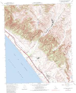
Las Pulgas Canyon Topo Map California
To zoom in, hover over the map of Las Pulgas Canyon
USGS Topo Quad 33117c4 - 1:24,000 scale
| Topo Map Name: | Las Pulgas Canyon |
| USGS Topo Quad ID: | 33117c4 |
| Print Size: | ca. 21 1/4" wide x 27" high |
| Southeast Coordinates: | 33.25° N latitude / 117.375° W longitude |
| Map Center Coordinates: | 33.3125° N latitude / 117.4375° W longitude |
| U.S. State: | CA |
| Filename: | o33117c4.jpg |
| Download Map JPG Image: | Las Pulgas Canyon topo map 1:24,000 scale |
| Map Type: | Topographic |
| Topo Series: | 7.5´ |
| Map Scale: | 1:24,000 |
| Source of Map Images: | United States Geological Survey (USGS) |
| Alternate Map Versions: |
Las Pulgas Canyon CA 1948, updated 1959 Download PDF Buy paper map Las Pulgas Canyon CA 1948, updated 1966 Download PDF Buy paper map Las Pulgas Canyon CA 1949 Download PDF Buy paper map Las Pulgas Canyon CA 1968, updated 1970 Download PDF Buy paper map Las Pulgas Canyon CA 1968, updated 1982 Download PDF Buy paper map Las Pulgas Canyon CA 1968, updated 1982 Download PDF Buy paper map Las Pulgas Canyon CA 2012 Download PDF Buy paper map Las Pulgas Canyon CA 2015 Download PDF Buy paper map |
1:24,000 Topo Quads surrounding Las Pulgas Canyon
> Back to 33117a1 at 1:100,000 scale
> Back to 33116a1 at 1:250,000 scale
> Back to U.S. Topo Maps home
Las Pulgas Canyon topo map: Gazetteer
Las Pulgas Canyon: Crossings
Interchange 62 elevation 19m 62′Las Pulgas Canyon: Dams
Pulgas Lake Dam elevation 119m 390′Las Pulgas Canyon: Populated Places
Don (historical) elevation 41m 134′Las Flores elevation 26m 85′
Stuart elevation 19m 62′
Las Pulgas Canyon: Reservoirs
Pulgas Lake elevation 119m 390′Las Pulgas Canyon: Streams
Las Flores Creek elevation 0m 0′Las Pulgas Canyon: Summits
Horno Hill elevation 446m 1463′San Onofre Mountain elevation 525m 1722′
Las Pulgas Canyon: Swamps
Las Flores Marsh elevation 3m 9′Las Pulgas Canyon: Valleys
Aliso Canyon elevation 0m 0′Cockleburr Canyon elevation 0m 0′
French Canyon elevation 0m 0′
Horno Canyon elevation 0m 0′
Las Pulgas Canyon elevation 24m 78′
Piedra de Lumbre Canyon elevation 44m 144′
Las Pulgas Canyon digital topo map on disk
Buy this Las Pulgas Canyon topo map showing relief, roads, GPS coordinates and other geographical features, as a high-resolution digital map file on DVD:


