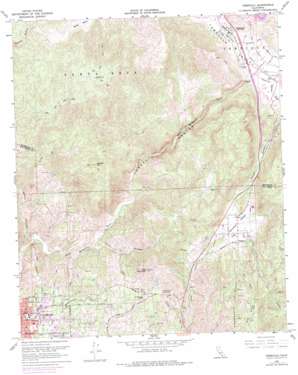
Temecula Topo Map California
To zoom in, hover over the map of Temecula
USGS Topo Quad 33117d2 - 1:24,000 scale
| Topo Map Name: | Temecula |
| USGS Topo Quad ID: | 33117d2 |
| Print Size: | ca. 21 1/4" wide x 27" high |
| Southeast Coordinates: | 33.375° N latitude / 117.125° W longitude |
| Map Center Coordinates: | 33.4375° N latitude / 117.1875° W longitude |
| U.S. State: | CA |
| Filename: | o33117d2.jpg |
| Download Map JPG Image: | Temecula topo map 1:24,000 scale |
| Map Type: | Topographic |
| Topo Series: | 7.5´ |
| Map Scale: | 1:24,000 |
| Source of Map Images: | United States Geological Survey (USGS) |
| Alternate Map Versions: |
Temecula CA 1948, updated 1955 Download PDF Buy paper map Temecula CA 1948, updated 1963 Download PDF Buy paper map Temecula CA 1950, updated 1950 Download PDF Buy paper map Temecula CA 1968, updated 1970 Download PDF Buy paper map Temecula CA 1968, updated 1975 Download PDF Buy paper map Temecula CA 2012 Download PDF Buy paper map Temecula CA 2015 Download PDF Buy paper map |
1:24,000 Topo Quads surrounding Temecula
> Back to 33117a1 at 1:100,000 scale
> Back to 33116a1 at 1:250,000 scale
> Back to U.S. Topo Maps home
Temecula topo map: Gazetteer
Temecula: Basins
Walker Basin elevation 402m 1318′Temecula: Crossings
Interchange 51 elevation 243m 797′Interchange 54 elevation 343m 1125′
Interchange 58 elevation 311m 1020′
Temecula: Dams
Red Mountain Reservoir 37-000 Dam elevation 336m 1102′Temecula: Parks
Fallbrook Park elevation 219m 718′Pala Road Park elevation 305m 1000′
Rainbow Park elevation 320m 1049′
Sam Hicks Monument Park elevation 312m 1023′
Santa Margarita Ecological Reserve elevation 369m 1210′
Temecula: Populated Places
Lake Village elevation 352m 1154′Los Ranchitos elevation 319m 1046′
Rainbow elevation 318m 1043′
Ridgecrest Estates elevation 266m 872′
Temecula elevation 310m 1017′
Windsor Crest elevation 342m 1122′
Temecula: Post Offices
Temecula Post Office elevation 307m 1007′Temecula: Reservoirs
Martin Reservoir elevation 304m 997′Red Mountain Reservoir elevation 336m 1102′
Temecula: Streams
Murrieta Creek elevation 299m 980′Pechanga Creek elevation 304m 997′
Rainbow Creek elevation 123m 403′
Temecula Creek elevation 290m 951′
Temecula: Summits
Gavilan Mountain elevation 557m 1827′Red Mountain elevation 487m 1597′
Temecula: Valleys
Rainbow Valley elevation 317m 1040′Sandia Canyon elevation 100m 328′
Temecula Canyon elevation 101m 331′
Temecula Valley elevation 302m 990′
Temecula digital topo map on disk
Buy this Temecula topo map showing relief, roads, GPS coordinates and other geographical features, as a high-resolution digital map file on DVD:


