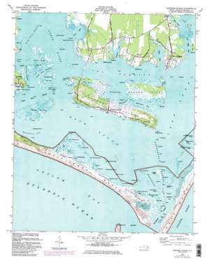
Harkers Island Topo Map North Carolina
To zoom in, hover over the map of Harkers Island
USGS Topo Quad 34076f5 - 1:24,000 scale
| Topo Map Name: | Harkers Island |
| USGS Topo Quad ID: | 34076f5 |
| Print Size: | ca. 21 1/4" wide x 27" high |
| Southeast Coordinates: | 34.625° N latitude / 76.5° W longitude |
| Map Center Coordinates: | 34.6875° N latitude / 76.5625° W longitude |
| U.S. State: | NC |
| Filename: | o34076f5.jpg |
| Download Map JPG Image: | Harkers Island topo map 1:24,000 scale |
| Map Type: | Topographic |
| Topo Series: | 7.5´ |
| Map Scale: | 1:24,000 |
| Source of Map Images: | United States Geological Survey (USGS) |
| Alternate Map Versions: |
Harkers Island NC 1949, updated 1984 Download PDF Buy paper map Harkers Island NC 1949, updated 1984 Download PDF Buy paper map Harkers Island NC 1951 Download PDF Buy paper map Harkers Island NC 1951, updated 1973 Download PDF Buy paper map Harkers Island NC 1997, updated 2001 Download PDF Buy paper map Harkers Island NC 2010 Download PDF Buy paper map Harkers Island NC 2013 Download PDF Buy paper map Harkers Island NC 2016 Download PDF Buy paper map |
1:24,000 Topo Quads surrounding Harkers Island
Cherry Point |
Merrimon |
South River |
Long Bay |
Atlantic |
Newport |
Core Creek |
Williston |
Davis |
Styron Bay |
Mansfield |
Beaufort |
Harkers Island |
Horsepen Point |
|
Cape Lookout |
||||
> Back to 34076e1 at 1:100,000 scale
> Back to 34076a1 at 1:250,000 scale
> Back to U.S. Topo Maps home
Harkers Island topo map: Gazetteer
Harkers Island: Areas
Crystal Coast elevation 0m 0′Harkers Island: Bars
Black Hammock Point elevation 0m 0′Shackleford Banks elevation 2m 6′
Shep Shoal elevation 0m 0′
Harkers Island: Bays
Back Sound elevation 0m 0′Bald Hill Bay elevation 0m 0′
Blinds Hammock Bay elevation 0m 0′
Brooks Creek elevation 0m 0′
Davis Bay elevation 0m 0′
Eastmouth Bay elevation 0m 0′
Goose Bay elevation 0m 0′
Henry Jones Creek elevation 0m 0′
Johnsons Bay elevation 0m 0′
Lighthouse Bay elevation 0m 0′
Westmouth Bay elevation 0m 0′
Whale Creek elevation 0m 0′
Whitehurst Creek elevation 0m 0′
Harkers Island: Capes
Bottle Run Point elevation 0m 0′Crab Point elevation 1m 3′
Gaskill Point elevation 1m 3′
Gloucester Point elevation 1m 3′
Harkers Point elevation 1m 3′
Horse Point elevation 0m 0′
Lenoxville Point elevation 1m 3′
Rush Point elevation 1m 3′
Sandy Point elevation 0m 0′
Shell Point elevation 0m 0′
Steep Point elevation 0m 0′
Wading Point elevation 2m 6′
White Point elevation 0m 0′
Harkers Island: Channels
Barden Inlet elevation 0m 0′Barden Inlet elevation 0m 0′
Great Marsh Creek elevation 0m 0′
Lighthouse Channel elevation 0m 0′
North River Channel elevation 0m 0′
North River Thorofare elevation 0m 0′
Shackleford Slue elevation 0m 0′
Sheep Island Slue elevation 0m 0′
Steep Point Channel elevation 2m 6′
Steep Point Channel elevation 0m 0′
The Ditch elevation 0m 0′
The Straits elevation 0m 0′
Harkers Island: Guts
Cabs Creek elevation 0m 0′Harkers Island: Islands
Baregrass Island elevation 0m 0′Bells Island elevation 1m 3′
Blinds Hammock elevation 0m 0′
Browns Island elevation 1m 3′
Bunch of Hair elevation 0m 0′
Cedar Hammock elevation 0m 0′
Cockle Marsh Island elevation 0m 0′
Cow Island elevation 0m 0′
Great Marsh Island elevation 1m 3′
Gull Island elevation 0m 0′
Gunning Hammock Island elevation 1m 3′
Hard Working Lumps elevation 0m 0′
Harkers Island elevation 2m 6′
Horse Island elevation 0m 0′
Jacks Island elevation 0m 0′
Little Deep Marsh Island elevation 1m 3′
Lovis Shore elevation 1m 3′
Morgan Island elevation 1m 3′
Oak Hammock elevation 0m 0′
Porters Island elevation 0m 0′
Sam Winsors Lump elevation 1m 3′
Sam Winter Lump elevation 1m 3′
Sheep Island elevation 0m 0′
Shooting Hammock elevation 0m 0′
Simons Island elevation 0m 0′
Whitehurst Island elevation 0m 0′
Harkers Island: Lakes
Willow Pond elevation 2m 6′Harkers Island: Parks
Cape Lookout National Seashore elevation 0m 0′Harkers Island: Populated Places
Gloucester elevation 2m 6′Harkers Island elevation 3m 9′
Marshallberg elevation 1m 3′
Straits elevation 2m 6′
Straits Haven elevation 1m 3′
The Black Cat elevation 4m 13′
Tusk elevation 1m 3′
Harkers Island: Streams
Janes Creek elevation 0m 0′Newby Creek elevation 0m 0′
North River elevation 0m 0′
Sleepy Creek elevation 0m 0′
Tusk Creek elevation 0m 0′
Harkers Island: Summits
Bald Hill elevation 1m 3′Diamond City Hills elevation 1m 3′
High Hill elevation 1m 3′
Harkers Island: Swamps
Big Shoal Marsh elevation 0m 0′Conch Shoal Marsh elevation 0m 0′
Horse Marsh elevation 2m 6′
Middle Marshes elevation 2m 6′
North River Marsh elevation 1m 3′
Sheephead Marsh elevation 0m 0′
White Shoal Marsh elevation 0m 0′
Harkers Island digital topo map on disk
Buy this Harkers Island topo map showing relief, roads, GPS coordinates and other geographical features, as a high-resolution digital map file on DVD:
Atlantic Coast (NY, NJ, PA, DE, MD, VA, NC)
Buy digital topo maps: Atlantic Coast (NY, NJ, PA, DE, MD, VA, NC)


