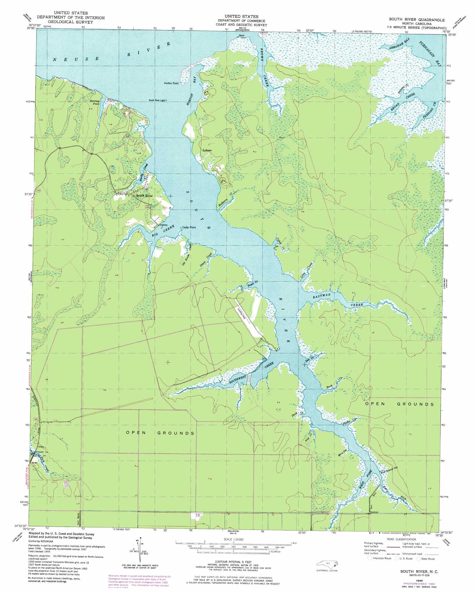
South River Topo Map North Carolina
To zoom in, hover over the map of South River
USGS Topo Quad 34076h5 - 1:24,000 scale
| Topo Map Name: | South River |
| USGS Topo Quad ID: | 34076h5 |
| Print Size: | ca. 21 1/4" wide x 27" high |
| Southeast Coordinates: | 34.875° N latitude / 76.5° W longitude |
| Map Center Coordinates: | 34.9375° N latitude / 76.5625° W longitude |
| U.S. State: | NC |
| Filename: | o34076h5.jpg |
| Download Map JPG Image: | South River topo map 1:24,000 scale |
| Map Type: | Topographic |
| Topo Series: | 7.5´ |
| Map Scale: | 1:24,000 |
| Source of Map Images: | United States Geological Survey (USGS) |
| Alternate Map Versions: |
South River NC 1949, updated 1984 Download PDF Buy paper map South River NC 1950 Download PDF Buy paper map South River NC 2010 Download PDF Buy paper map South River NC 2013 Download PDF Buy paper map South River NC 2016 Download PDF Buy paper map |
1:24,000 Topo Quads surrounding South River
Bayboro |
Vandemere |
Jones Bay |
Little Fishing Point |
|
Arapahoe |
Oriental |
Broad Creek |
Point Of Marsh |
North Bay |
Cherry Point |
Merrimon |
South River |
Long Bay |
Atlantic |
Newport |
Core Creek |
Williston |
Davis |
Styron Bay |
Mansfield |
Beaufort |
Harkers Island |
Horsepen Point |
> Back to 34076e1 at 1:100,000 scale
> Back to 34076a1 at 1:250,000 scale
> Back to U.S. Topo Maps home
South River topo map: Gazetteer
South River: Bays
Abraham Bay elevation 0m 0′Horton Bay elevation 1m 3′
Pitman Creek elevation 0m 0′
South River: Capes
Cedar Point elevation 1m 3′Horton Point elevation 1m 3′
South River: Guts
Miry Gut elevation 0m 0′Neal Creek elevation 1m 3′
Rich Island Gut elevation 0m 0′
South River: Populated Places
Lukens elevation 2m 6′South River elevation 2m 6′
Sportsmans Village elevation 1m 3′
South River: Reservoirs
Herring Pond elevation 0m 0′South River: Streams
Big Creek elevation 1m 3′Broad Creek elevation 1m 3′
Brown Creek elevation 1m 3′
Buck Creek elevation 1m 3′
Coffee Creek elevation 1m 3′
Dixon Creek elevation 0m 0′
Doe Creek elevation 0m 0′
Duck Creek elevation 0m 0′
East Fork South River elevation 1m 3′
Eastman Creek elevation 1m 3′
Elisha Creek elevation 1m 3′
Hardy Creek elevation 1m 3′
Little Creek elevation 1m 3′
Mulberry Creek elevation 1m 3′
Old House Creek elevation 1m 3′
Parsons Creek elevation 1m 3′
Royal Creek elevation 1m 3′
South River elevation 1m 3′
Southwest Creek elevation 1m 3′
West Fork South River elevation 1m 3′
South River digital topo map on disk
Buy this South River topo map showing relief, roads, GPS coordinates and other geographical features, as a high-resolution digital map file on DVD:
Atlantic Coast (NY, NJ, PA, DE, MD, VA, NC)
Buy digital topo maps: Atlantic Coast (NY, NJ, PA, DE, MD, VA, NC)
 map DVD")