Scotts Hill Topo Map North Carolina
To zoom in, hover over the map of Scotts Hill
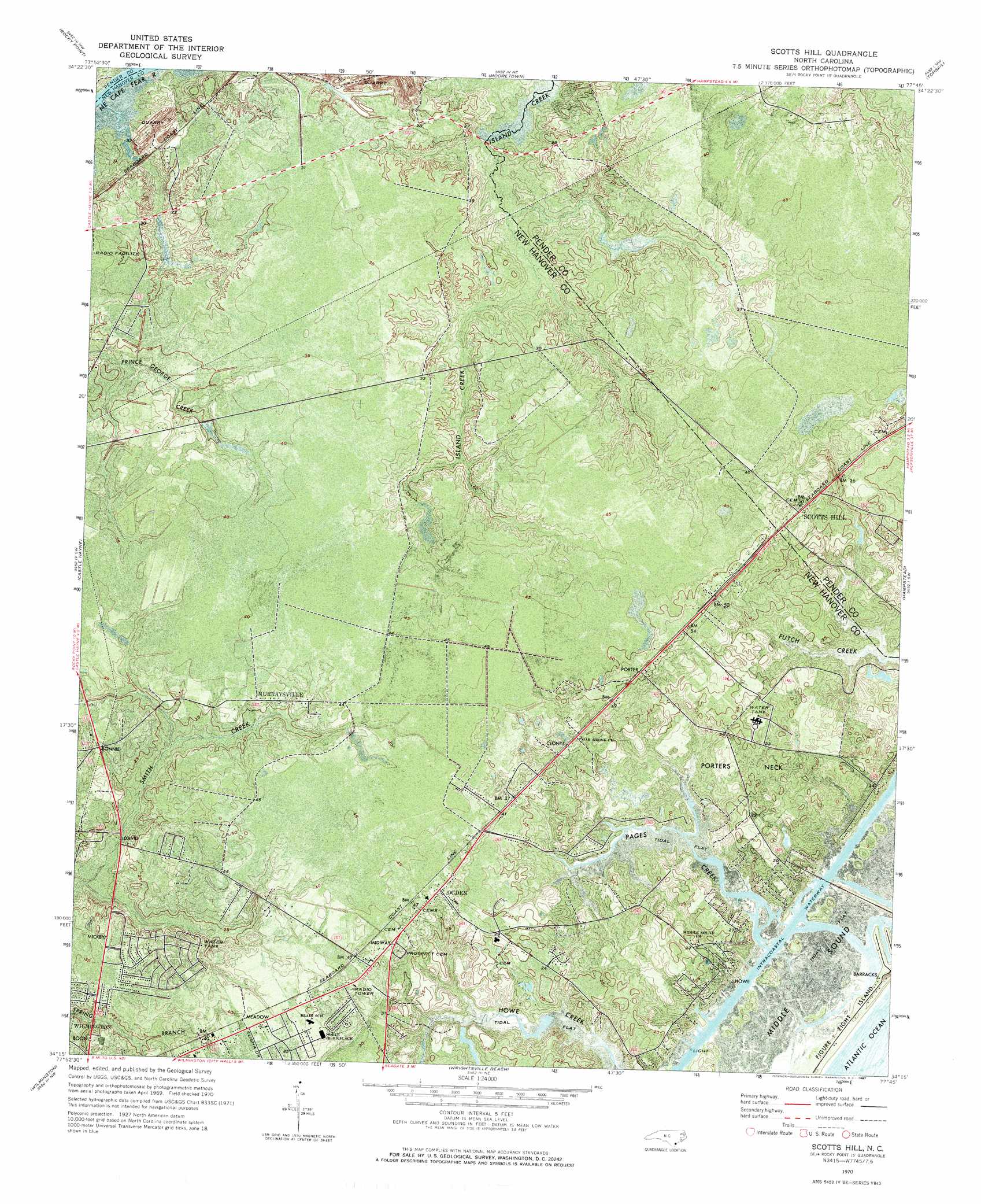
USGS Topo Quad 34077c7 - 1:24,000 scale
| Topo Map Name: | Scotts Hill |
| USGS Topo Quad ID: | 34077c7 |
| Print Size: | ca. 21 1/4" wide x 27" high |
| Southeast Coordinates: | 34.25° N latitude / 77.75° W longitude |
| Map Center Coordinates: | 34.3125° N latitude / 77.8125° W longitude |
| U.S. State: | NC |
| Filename: | p34077c7.jpg |
| Download Map JPG Image: | Scotts Hill topo map 1:24,000 scale |
| Map Type: | Orthophoto |
| Topo Series: | 7.5´ |
| Map Scale: | 1:24,000 |
| Source of Map Images: | United States Geological Survey (USGS) |
| Alternate Map Versions: |
Scotts Hill NC 1970, updated 1973 Download PDF Buy paper map Scotts Hill NC 1970, updated 1987 Download PDF Buy paper map Scotts Hill NC 1970, updated 1987 Download PDF Buy paper map Scotts Hill NC 1980, updated 1985 Download PDF Buy paper map Scotts Hill NC 1997, updated 2000 Download PDF Buy paper map Scotts Hill NC 2010 Download PDF Buy paper map Scotts Hill NC 2013 Download PDF Buy paper map Scotts Hill NC 2016 Download PDF Buy paper map |
1:24,000 Topo Quads surrounding Scotts Hill
Costin |
Burgaw |
Stag Park |
Maple Hill Sw |
Folkstone |
Currie |
Rocky Point |
Mooretown |
Topsail |
Holly Ridge |
Leland |
Castle Hayne |
Scotts Hill |
Hampstead |
|
Winnabow |
Wilmington |
Wrightsville Beach |
||
Funston |
Carolina Beach |
> Back to 34077a1 at 1:100,000 scale
> Back to 34076a1 at 1:250,000 scale
> Back to U.S. Topo Maps home
Scotts Hill topo map: Gazetteer
Scotts Hill: Bays
Middle Sound elevation 1m 3′Scotts Hill: Capes
Falcon Point elevation 1m 3′Howe Point elevation 1m 3′
Porters Neck elevation 6m 19′
Scotts Hill: Populated Places
Bayshore elevation 3m 9′Brandywine elevation 7m 22′
Country Side Mobile Home Park elevation 7m 22′
D and H Estates Mobile Home Park elevation 14m 45′
Falcon Point elevation 4m 13′
Hidden Lakes Mobile Home Park elevation 5m 16′
Highland Pines Mobile Home Park elevation 11m 36′
James Mobile Home Park elevation 8m 26′
K and M Mobile Home Park elevation 11m 36′
Kings Grant elevation 9m 29′
Kirkland elevation 15m 49′
Market Heights Mobile Home Park elevation 14m 45′
Murraysville elevation 11m 36′
Ocean View elevation 7m 22′
Ogden elevation 14m 45′
Pineview Mobile Home Park elevation 6m 19′
Port-O-Pines Estates elevation 11m 36′
Queens Point elevation 6m 19′
Scotts Hill elevation 12m 39′
Shell Bank elevation 6m 19′
Smith Creek elevation 10m 32′
Stone Mobile Home Park elevation 7m 22′
Stoneybrook elevation 8m 26′
Treasure Cove elevation 7m 22′
Triple H Mobile Home Park elevation 14m 45′
Westwood Heights elevation 7m 22′
Wheel Estates Mobile Home Park elevation 12m 39′
Scotts Hill: Streams
Howe Creek elevation 0m 0′Pages Creek elevation 0m 0′
Scotts Hill digital topo map on disk
Buy this Scotts Hill topo map showing relief, roads, GPS coordinates and other geographical features, as a high-resolution digital map file on DVD:
Atlantic Coast (NY, NJ, PA, DE, MD, VA, NC)
Buy digital topo maps: Atlantic Coast (NY, NJ, PA, DE, MD, VA, NC)
 map DVD")