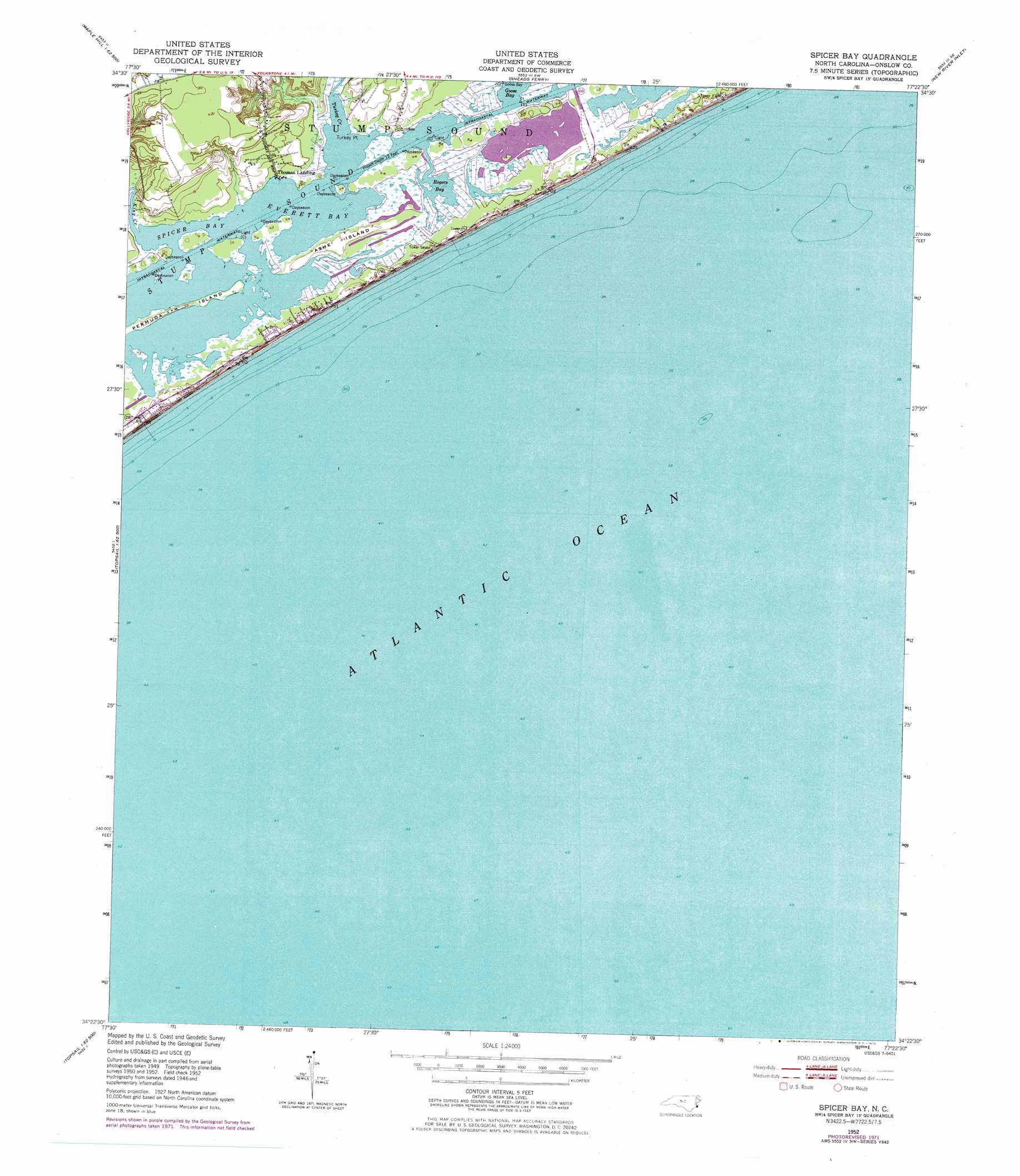
Spicer Bay Topo Map North Carolina
To zoom in, hover over the map of Spicer Bay
USGS Topo Quad 34077d4 - 1:24,000 scale
| Topo Map Name: | Spicer Bay |
| USGS Topo Quad ID: | 34077d4 |
| Print Size: | ca. 21 1/4" wide x 27" high |
| Southeast Coordinates: | 34.375° N latitude / 77.375° W longitude |
| Map Center Coordinates: | 34.4375° N latitude / 77.4375° W longitude |
| U.S. State: | NC |
| Filename: | o34077d4.jpg |
| Download Map JPG Image: | Spicer Bay topo map 1:24,000 scale |
| Map Type: | Topographic |
| Topo Series: | 7.5´ |
| Map Scale: | 1:24,000 |
| Source of Map Images: | United States Geological Survey (USGS) |
| Alternate Map Versions: |
Spicer Bay NC 1952, updated 1955 Download PDF Buy paper map Spicer Bay NC 1952, updated 1973 Download PDF Buy paper map Spicer Bay NC 1952, updated 1973 Download PDF Buy paper map Spicer Bay NC 1980, updated 1985 Download PDF Buy paper map Spicer Bay NC 1980, updated 1985 Download PDF Buy paper map Spicer Bay NC 1997, updated 2000 Download PDF Buy paper map Spicer Bay NC 2010 Download PDF Buy paper map Spicer Bay NC 2013 Download PDF Buy paper map Spicer Bay NC 2016 Download PDF Buy paper map |
1:24,000 Topo Quads surrounding Spicer Bay
Maple Hill |
Haws Run |
Jacksonville South |
Camp Lejeune |
Hubert |
Maple Hill Sw |
Folkstone |
Sneads Ferry |
New River Inlet |
Browns Inlet |
Topsail |
Holly Ridge |
Spicer Bay |
||
Hampstead |
||||
> Back to 34077a1 at 1:100,000 scale
> Back to 34076a1 at 1:250,000 scale
> Back to U.S. Topo Maps home
Spicer Bay topo map: Gazetteer
Spicer Bay: Bays
Everett Bay elevation 0m 0′Goose Bay elevation 0m 0′
Rogers Bay elevation 0m 0′
Spicer Bay elevation 0m 0′
Stump Sound elevation 0m 0′
Spicer Bay: Beaches
Sea Haven Beach elevation 0m 0′Spicer Bay: Capes
Turkey Point elevation 0m 0′Spicer Bay: Guts
Stump Inlet (historical) elevation 0m 0′Spicer Bay: Islands
Ashe Island elevation 2m 6′Permuda Island elevation 1m 3′
Topsail Island elevation 1m 3′
Spicer Bay: Populated Places
North Topsail Beach elevation 0m 0′Ocean City Beach elevation 2m 6′
Thomas Landing elevation 1m 3′
Spicer Bay: Streams
Kings Creek elevation -1m -4′Turkey Creek elevation 0m 0′
Spicer Bay digital topo map on disk
Buy this Spicer Bay topo map showing relief, roads, GPS coordinates and other geographical features, as a high-resolution digital map file on DVD:
Atlantic Coast (NY, NJ, PA, DE, MD, VA, NC)
Buy digital topo maps: Atlantic Coast (NY, NJ, PA, DE, MD, VA, NC)
 map DVD")