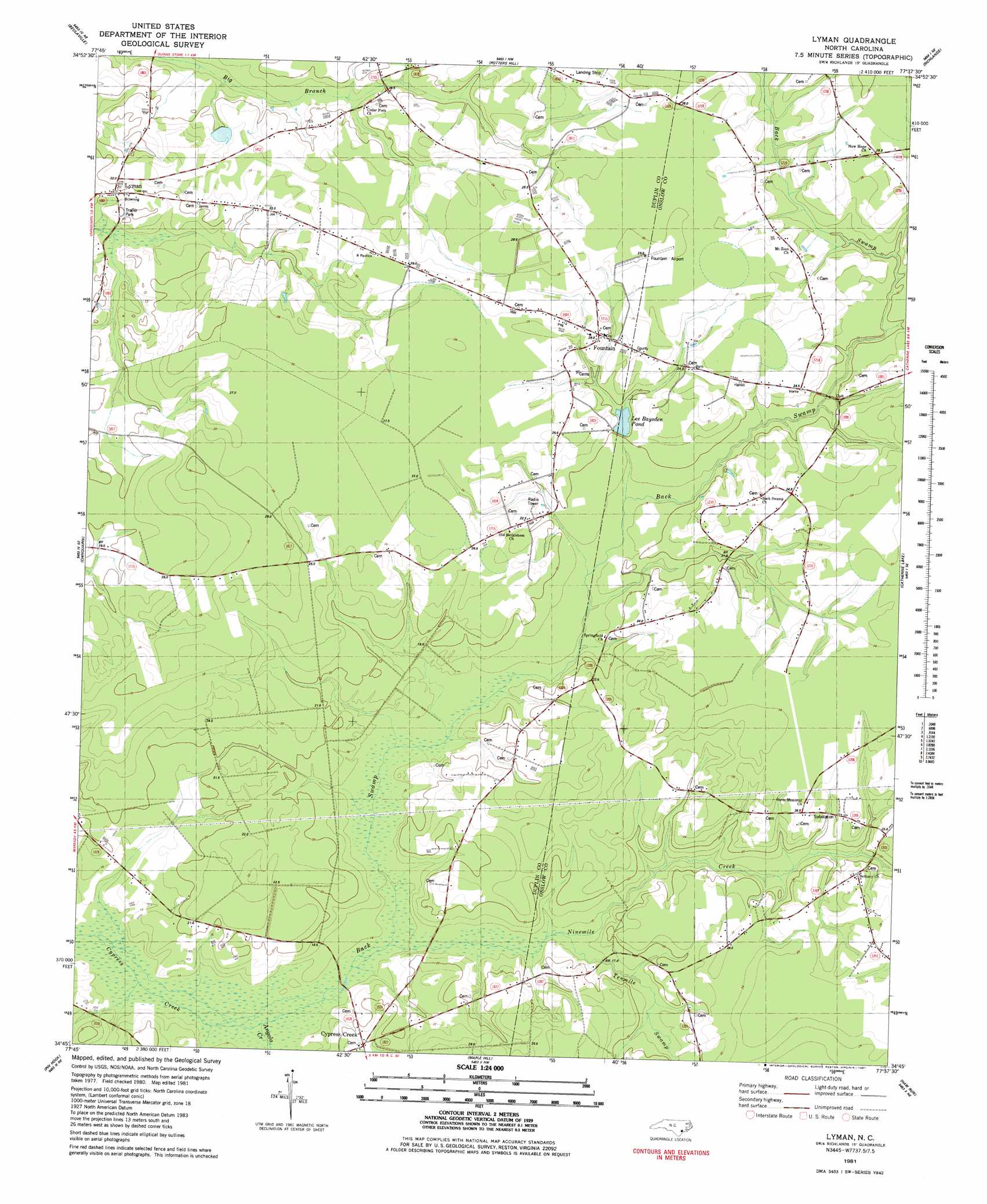
Lyman Topo Map North Carolina
To zoom in, hover over the map of Lyman
USGS Topo Quad 34077g6 - 1:24,000 scale
| Topo Map Name: | Lyman |
| USGS Topo Quad ID: | 34077g6 |
| Print Size: | ca. 21 1/4" wide x 27" high |
| Southeast Coordinates: | 34.75° N latitude / 77.625° W longitude |
| Map Center Coordinates: | 34.8125° N latitude / 77.6875° W longitude |
| U.S. State: | NC |
| Filename: | o34077g6.jpg |
| Download Map JPG Image: | Lyman topo map 1:24,000 scale |
| Map Type: | Topographic |
| Topo Series: | 7.5´ |
| Map Scale: | 1:24,000 |
| Source of Map Images: | United States Geological Survey (USGS) |
| Alternate Map Versions: |
Lyman NC 1981, updated 1981 Download PDF Buy paper map Lyman NC 2010 Download PDF Buy paper map Lyman NC 2013 Download PDF Buy paper map Lyman NC 2016 Download PDF Buy paper map |
1:24,000 Topo Quads surrounding Lyman
Summerlins Crossroads |
Albertson |
Pink Hill |
Comfort |
Phillips Crossroads |
Kenansville |
Beulaville |
Potters Hill |
Richlands |
Jacksonville Nw |
Charity |
Chinquapin |
Lyman |
Catherine Lake |
Jacksonville North |
Wallace East |
Pin Hook |
Maple Hill |
Haws Run |
Jacksonville South |
Burgaw |
Stag Park |
Maple Hill Sw |
Folkstone |
Sneads Ferry |
> Back to 34077e1 at 1:100,000 scale
> Back to 34076a1 at 1:250,000 scale
> Back to U.S. Topo Maps home
Lyman topo map: Gazetteer
Lyman: Airports
Fountain Airport elevation 28m 91′Lyman: Populated Places
Cypress Creek elevation 22m 72′Fountain elevation 24m 78′
Gurganus elevation 21m 68′
Lyman elevation 18m 59′
Sand Mobile Home Park elevation 27m 88′
Lyman: Reservoirs
Lee Baysden Pond elevation 18m 59′Lyman: Streams
Angola Creek elevation 13m 42′Back Swamp elevation 13m 42′
Ninemile Creek elevation 14m 45′
Tenmile Creek elevation 16m 52′
Lyman digital topo map on disk
Buy this Lyman topo map showing relief, roads, GPS coordinates and other geographical features, as a high-resolution digital map file on DVD:
Atlantic Coast (NY, NJ, PA, DE, MD, VA, NC)
Buy digital topo maps: Atlantic Coast (NY, NJ, PA, DE, MD, VA, NC)
 map DVD")