Juniper Creek Topo Map North Carolina
To zoom in, hover over the map of Juniper Creek
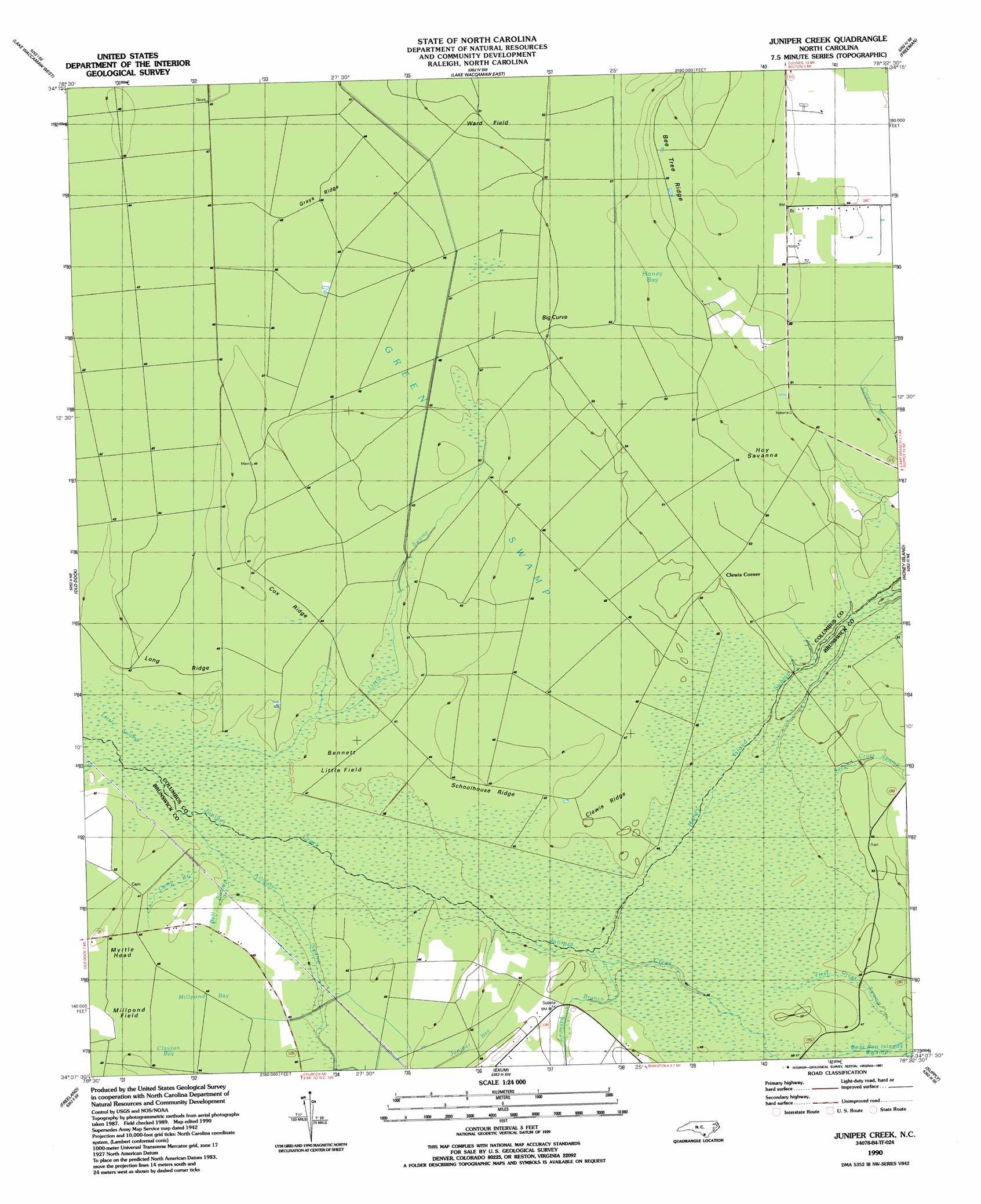
USGS Topo Quad 34078b4 - 1:24,000 scale
| Topo Map Name: | Juniper Creek |
| USGS Topo Quad ID: | 34078b4 |
| Print Size: | ca. 21 1/4" wide x 27" high |
| Southeast Coordinates: | 34.125° N latitude / 78.375° W longitude |
| Map Center Coordinates: | 34.1875° N latitude / 78.4375° W longitude |
| U.S. State: | NC |
| Filename: | o34078b4.jpg |
| Download Map JPG Image: | Juniper Creek topo map 1:24,000 scale |
| Map Type: | Topographic |
| Topo Series: | 7.5´ |
| Map Scale: | 1:24,000 |
| Source of Map Images: | United States Geological Survey (USGS) |
| Alternate Map Versions: |
Juniper Creek NC 1942, updated 1962 Download PDF Buy paper map Juniper Creek NC 1990, updated 1991 Download PDF Buy paper map Juniper Creek NC 2010 Download PDF Buy paper map Juniper Creek NC 2013 Download PDF Buy paper map Juniper Creek NC 2016 Download PDF Buy paper map |
1:24,000 Topo Quads surrounding Juniper Creek
Clarkton |
Emerson |
Council |
Kelly |
Point Caswell |
Whiteville |
Lake Waccamaw West |
Lake Waccamaw East |
Freeman |
Acme |
Nakina |
Old Dock |
Juniper Creek |
Honey Island |
Lewis Swamp |
Pireway |
Freeland |
Exum |
Supply |
Bolivia |
Longs |
Calabash |
Shallotte |
Holden Beach |
Lockwoods Folly |
> Back to 34078a1 at 1:100,000 scale
> Back to 34078a1 at 1:250,000 scale
> Back to U.S. Topo Maps home
Juniper Creek topo map: Gazetteer
Juniper Creek: Flats
Bennett Little Field elevation 12m 39′Millpond Field elevation 12m 39′
The Opening elevation 14m 45′
Ward Field elevation 15m 49′
Juniper Creek: Plains
Hoy Savanna elevation 16m 52′Juniper Creek: Populated Places
Big Curve elevation 14m 45′Clewis Corner elevation 15m 49′
Myrtle Head elevation 12m 39′
Juniper Creek: Ridges
Bee Tree Ridge elevation 20m 65′Clewis Ridge elevation 15m 49′
Cox Ridge elevation 13m 42′
Grays Ridge elevation 14m 45′
Long Ridge elevation 13m 42′
Schoolhouse Ridge elevation 13m 42′
Juniper Creek: Streams
Alligator Swamp elevation 11m 36′Bell Swamp elevation 11m 36′
Camp Branch elevation 11m 36′
First Cross Swamp elevation 12m 39′
Leonard Branch elevation 12m 39′
Little Swamp elevation 11m 36′
Second Cross Swamp elevation 13m 42′
Juniper Creek: Summits
Myrtle Head elevation 13m 42′Juniper Creek: Swamps
Green Swamp elevation 13m 42′Honey Bay elevation 15m 49′
Honey Island Swamp elevation 14m 45′
Juniper Bay elevation 13m 42′
Millpond Bay elevation 13m 42′
Juniper Creek digital topo map on disk
Buy this Juniper Creek topo map showing relief, roads, GPS coordinates and other geographical features, as a high-resolution digital map file on DVD:
South Carolina, Western North Carolina & Northeastern Georgia
Buy digital topo maps: South Carolina, Western North Carolina & Northeastern Georgia