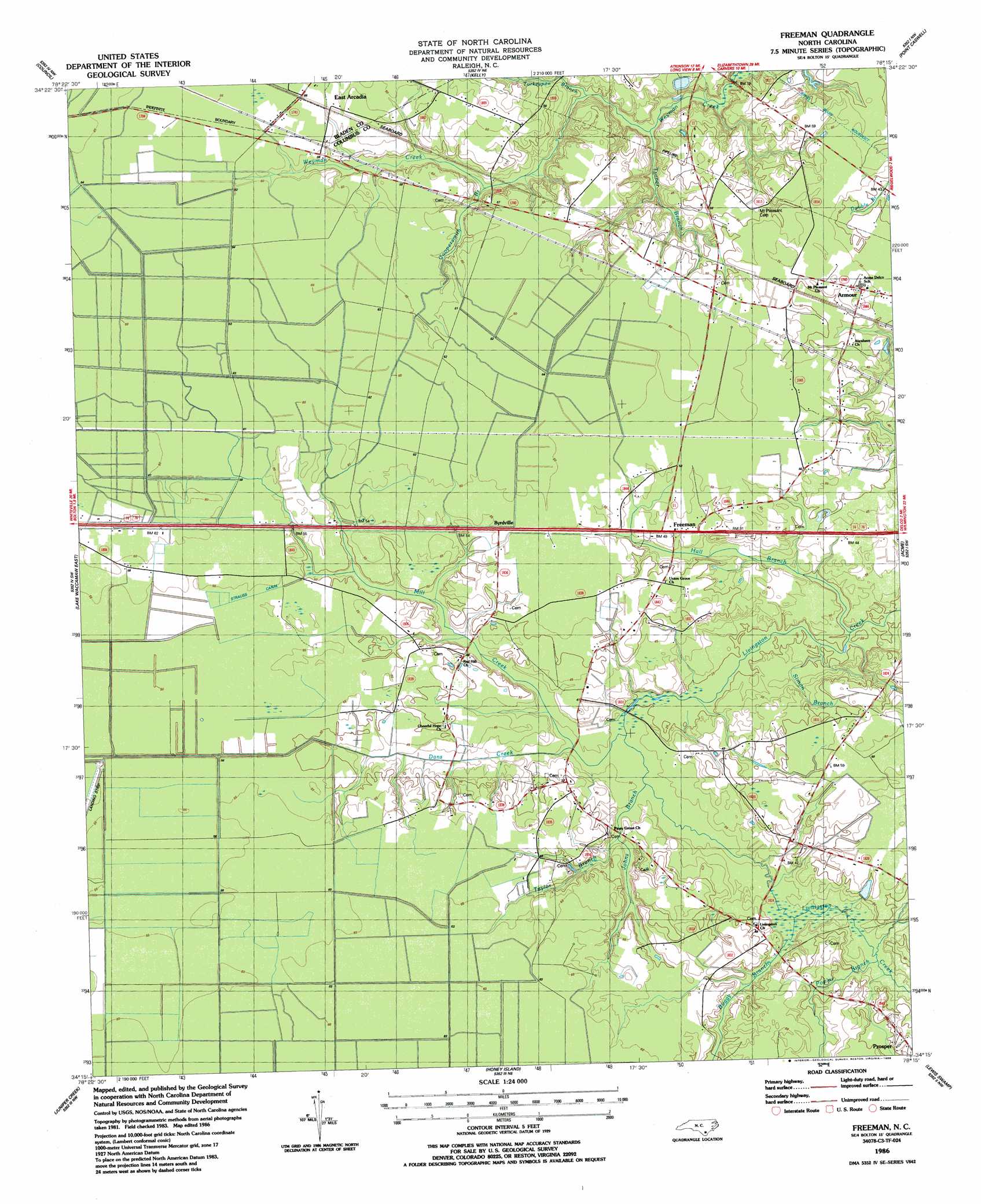
Freeman Topo Map North Carolina
To zoom in, hover over the map of Freeman
USGS Topo Quad 34078c3 - 1:24,000 scale
| Topo Map Name: | Freeman |
| USGS Topo Quad ID: | 34078c3 |
| Print Size: | ca. 21 1/4" wide x 27" high |
| Southeast Coordinates: | 34.25° N latitude / 78.25° W longitude |
| Map Center Coordinates: | 34.3125° N latitude / 78.3125° W longitude |
| U.S. State: | NC |
| Filename: | o34078c3.jpg |
| Download Map JPG Image: | Freeman topo map 1:24,000 scale |
| Map Type: | Topographic |
| Topo Series: | 7.5´ |
| Map Scale: | 1:24,000 |
| Source of Map Images: | United States Geological Survey (USGS) |
| Alternate Map Versions: |
Freeman NC 1986, updated 1986 Download PDF Buy paper map Freeman NC 2011 Download PDF Buy paper map Freeman NC 2013 Download PDF Buy paper map Freeman NC 2016 Download PDF Buy paper map |
1:24,000 Topo Quads surrounding Freeman
Elizabethtown South |
Singletary Lake |
Rowan |
Atkinson |
Costin |
Emerson |
Council |
Kelly |
Point Caswell |
Currie |
Lake Waccamaw West |
Lake Waccamaw East |
Freeman |
Acme |
Leland |
Old Dock |
Juniper Creek |
Honey Island |
Lewis Swamp |
Winnabow |
Freeland |
Exum |
Supply |
Bolivia |
Funston |
> Back to 34078a1 at 1:100,000 scale
> Back to 34078a1 at 1:250,000 scale
> Back to U.S. Topo Maps home
Freeman topo map: Gazetteer
Freeman: Canals
Lateral Canal E elevation 18m 59′Lateral Canal F elevation 19m 62′
Lateral Canal G elevation 18m 59′
Strauss Canal elevation 16m 52′
Freeman: Lakes
Broadwater Lake elevation 6m 19′Freeman: Populated Places
Armour elevation 18m 59′Byrdville elevation 16m 52′
Freeman elevation 16m 52′
Prosper elevation 18m 59′
Freeman: Streams
Boggy Branch elevation 10m 32′Coopersmith Branch elevation 10m 32′
Dans Creek elevation 8m 26′
Hall Branch elevation 7m 22′
Johns Branch elevation 8m 26′
McClennen Branch elevation 15m 49′
Mill Creek elevation 7m 22′
Poplar Branch elevation 11m 36′
Scott Branch elevation 11m 36′
Simon Branch elevation 8m 26′
Taylor Branch elevation 10m 32′
Terrapin Branch elevation 12m 39′
Turkeypen Branch elevation 7m 22′
Turner Branch elevation 5m 16′
Freeman: Swamps
Big Bay elevation 18m 59′Bitch Bay elevation 18m 59′
Black Bay elevation 18m 59′
Buzzard Bay elevation 18m 59′
Strauss Swamp elevation 15m 49′
Freeman digital topo map on disk
Buy this Freeman topo map showing relief, roads, GPS coordinates and other geographical features, as a high-resolution digital map file on DVD:
South Carolina, Western North Carolina & Northeastern Georgia
Buy digital topo maps: South Carolina, Western North Carolina & Northeastern Georgia