Clarkton Topo Map North Carolina
To zoom in, hover over the map of Clarkton
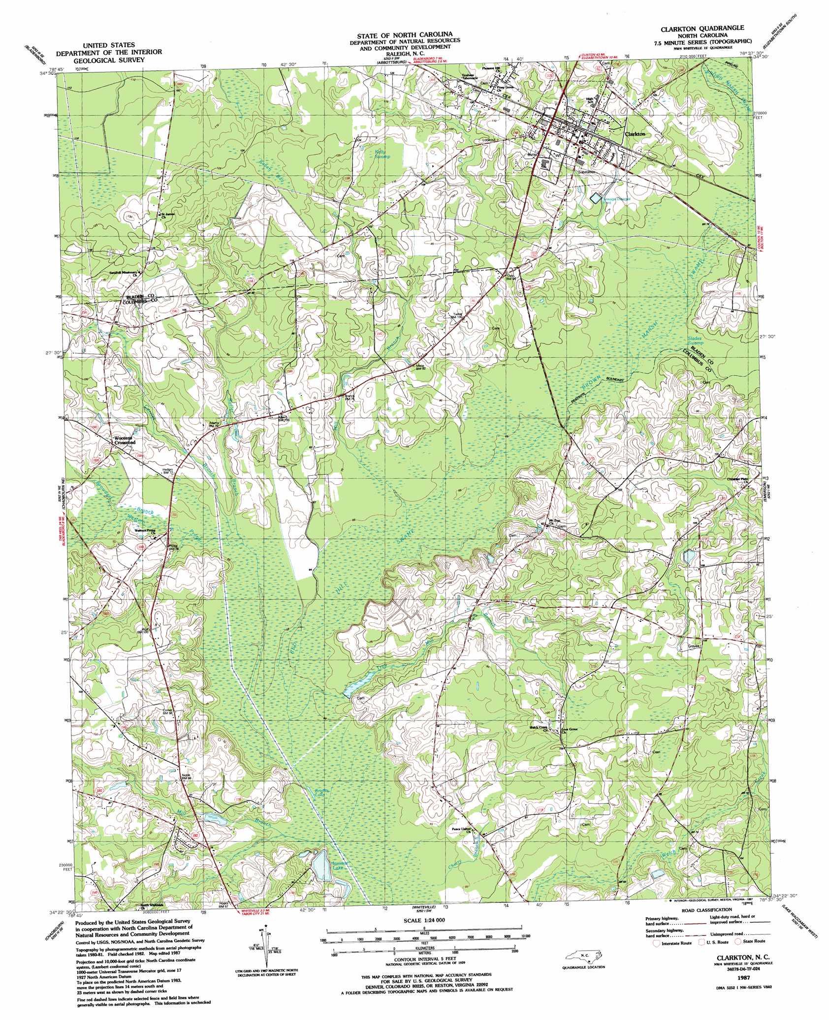
USGS Topo Quad 34078d6 - 1:24,000 scale
| Topo Map Name: | Clarkton |
| USGS Topo Quad ID: | 34078d6 |
| Print Size: | ca. 21 1/4" wide x 27" high |
| Southeast Coordinates: | 34.375° N latitude / 78.625° W longitude |
| Map Center Coordinates: | 34.4375° N latitude / 78.6875° W longitude |
| U.S. State: | NC |
| Filename: | o34078d6.jpg |
| Download Map JPG Image: | Clarkton topo map 1:24,000 scale |
| Map Type: | Topographic |
| Topo Series: | 7.5´ |
| Map Scale: | 1:24,000 |
| Source of Map Images: | United States Geological Survey (USGS) |
| Alternate Map Versions: |
Clarkton NC 1987, updated 1987 Download PDF Buy paper map Clarkton NC 2002, updated 2002 Download PDF Buy paper map Clarkton NC 2010 Download PDF Buy paper map Clarkton NC 2013 Download PDF Buy paper map Clarkton NC 2016 Download PDF Buy paper map |
1:24,000 Topo Quads surrounding Clarkton
Northeast Lumberton |
Tar Heel |
Dublin |
Elizabethtown North |
White Lake |
Southeast Lumberton |
Bladenboro |
Abbottsburg |
Elizabethtown South |
Singletary Lake |
Evergreen |
Chadbourn Ne |
Clarkton |
Emerson |
Council |
Cerro Gordo |
Chadbourn |
Whiteville |
Lake Waccamaw West |
Lake Waccamaw East |
Tabor City West |
Tabor City East |
Nakina |
Old Dock |
Juniper Creek |
> Back to 34078a1 at 1:100,000 scale
> Back to 34078a1 at 1:250,000 scale
> Back to U.S. Topo Maps home
Clarkton topo map: Gazetteer
Clarkton: Lakes
Brights Lake elevation 18m 59′Clarkton: Populated Places
Clarkton elevation 29m 95′Wootens Crossroads elevation 28m 91′
Clarkton: Reservoirs
Inmans Lake elevation 23m 75′Clarkton: Streams
Browders Branch elevation 20m 65′Brown Marsh Swamp elevation 21m 68′
Butler Branch elevation 19m 62′
Cherry Branch elevation 17m 55′
Curries Branch elevation 19m 62′
Elkton Swamp elevation 21m 68′
Mill Branch elevation 17m 55′
Mill Branch elevation 19m 62′
Slades Swamp elevation 20m 65′
Troy Mill Branch elevation 17m 55′
Western Prong elevation 19m 62′
Clarkton: Swamps
Brown Marsh Swamp elevation 21m 68′Kelly Swamp elevation 31m 101′
Raven Bay elevation 36m 118′
Red Hill Swamp elevation 19m 62′
Clarkton digital topo map on disk
Buy this Clarkton topo map showing relief, roads, GPS coordinates and other geographical features, as a high-resolution digital map file on DVD:
South Carolina, Western North Carolina & Northeastern Georgia
Buy digital topo maps: South Carolina, Western North Carolina & Northeastern Georgia