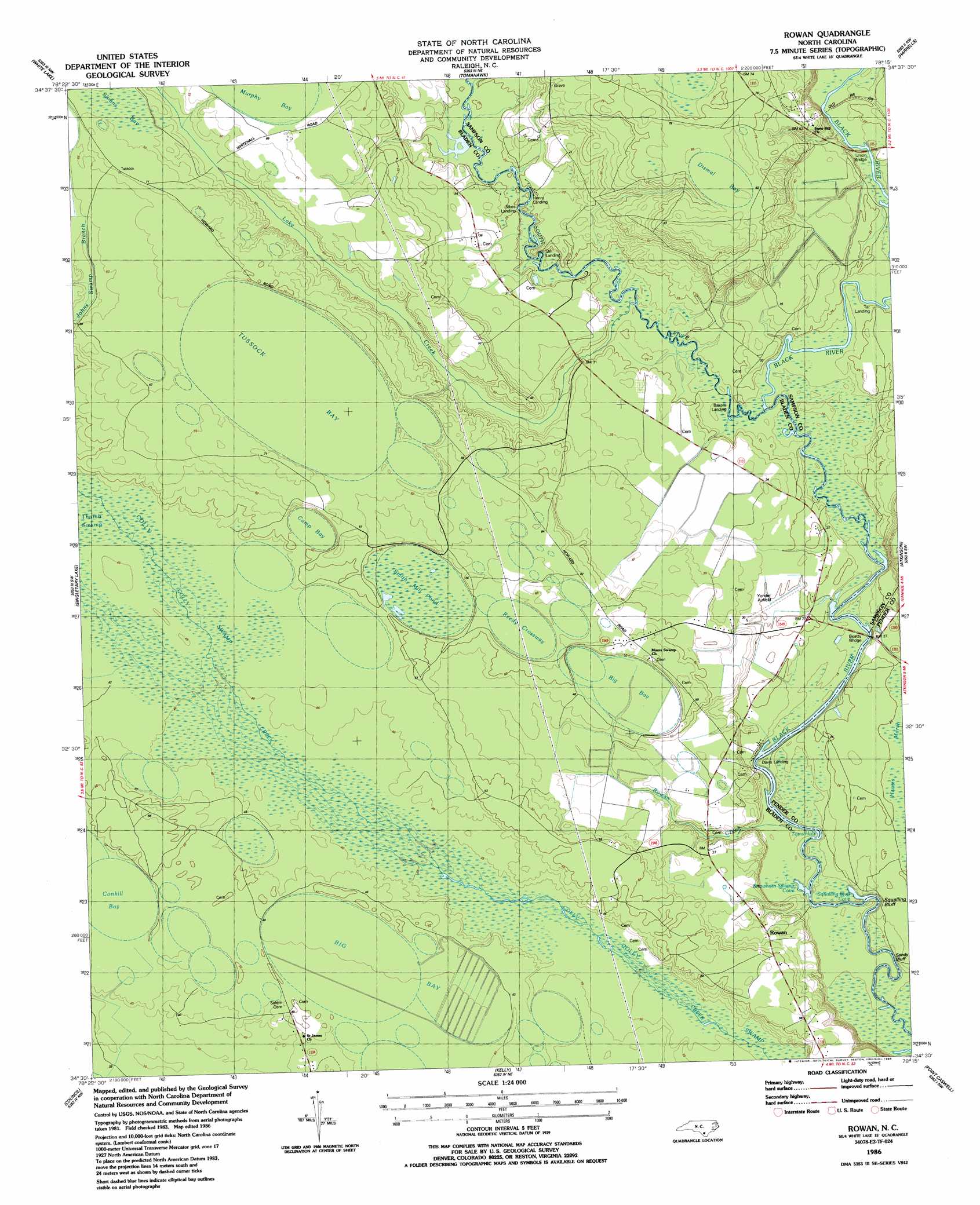
Rowan Topo Map North Carolina
To zoom in, hover over the map of Rowan
USGS Topo Quad 34078e3 - 1:24,000 scale
| Topo Map Name: | Rowan |
| USGS Topo Quad ID: | 34078e3 |
| Print Size: | ca. 21 1/4" wide x 27" high |
| Southeast Coordinates: | 34.5° N latitude / 78.25° W longitude |
| Map Center Coordinates: | 34.5625° N latitude / 78.3125° W longitude |
| U.S. State: | NC |
| Filename: | o34078e3.jpg |
| Download Map JPG Image: | Rowan topo map 1:24,000 scale |
| Map Type: | Topographic |
| Topo Series: | 7.5´ |
| Map Scale: | 1:24,000 |
| Source of Map Images: | United States Geological Survey (USGS) |
| Alternate Map Versions: |
Rowan NC 1986, updated 1986 Download PDF Buy paper map Rowan NC 2010 Download PDF Buy paper map Rowan NC 2013 Download PDF Buy paper map Rowan NC 2016 Download PDF Buy paper map |
1:24,000 Topo Quads surrounding Rowan
Ammon |
Garland |
Ingold |
Delway |
Rose Hill |
Elizabethtown North |
White Lake |
Tomahawk |
Harrells |
Wallace West |
Elizabethtown South |
Singletary Lake |
Rowan |
Atkinson |
Costin |
Emerson |
Council |
Kelly |
Point Caswell |
Currie |
Lake Waccamaw West |
Lake Waccamaw East |
Freeman |
Acme |
Leland |
> Back to 34078e1 at 1:100,000 scale
> Back to 34078a1 at 1:250,000 scale
> Back to U.S. Topo Maps home
Rowan topo map: Gazetteer
Rowan: Airports
Yonder Airfield elevation 6m 19′Rowan: Basins
Big Bay elevation 15m 49′Big Bay elevation 13m 42′
Camp Bay elevation 16m 52′
Conkill Bay elevation 15m 49′
Dismal Bay elevation 25m 82′
Reedy Crossway elevation 17m 55′
Smith Mill Pond elevation 15m 49′
Tussock Bay elevation 20m 65′
Rowan: Bays
Squalling Bluff Cove elevation 3m 9′Strawhorn Swamp Cove elevation 3m 9′
Rowan: Bridges
Beatty Bridge elevation 5m 16′Dunlap Bridge elevation 6m 19′
Union Bridge elevation 6m 19′
Rowan: Cliffs
Sandy Bluff elevation 7m 22′Squalling Bluff elevation 3m 9′
Rowan: Lakes
Toms Hole elevation 3m 9′Rowan: Populated Places
Rowan elevation 16m 52′Rowan: Streams
Lake Creek elevation 5m 16′Rowan Creek elevation 4m 13′
South River elevation 4m 13′
Rowan: Swamps
Devils Nest elevation 17m 55′Lyon Swamp elevation 10m 32′
Moore Swamp elevation 18m 59′
Rowan Swamp elevation 12m 39′
Rowan digital topo map on disk
Buy this Rowan topo map showing relief, roads, GPS coordinates and other geographical features, as a high-resolution digital map file on DVD:
South Carolina, Western North Carolina & Northeastern Georgia
Buy digital topo maps: South Carolina, Western North Carolina & Northeastern Georgia