Northeast Lumberton Topo Map North Carolina
To zoom in, hover over the map of Northeast Lumberton
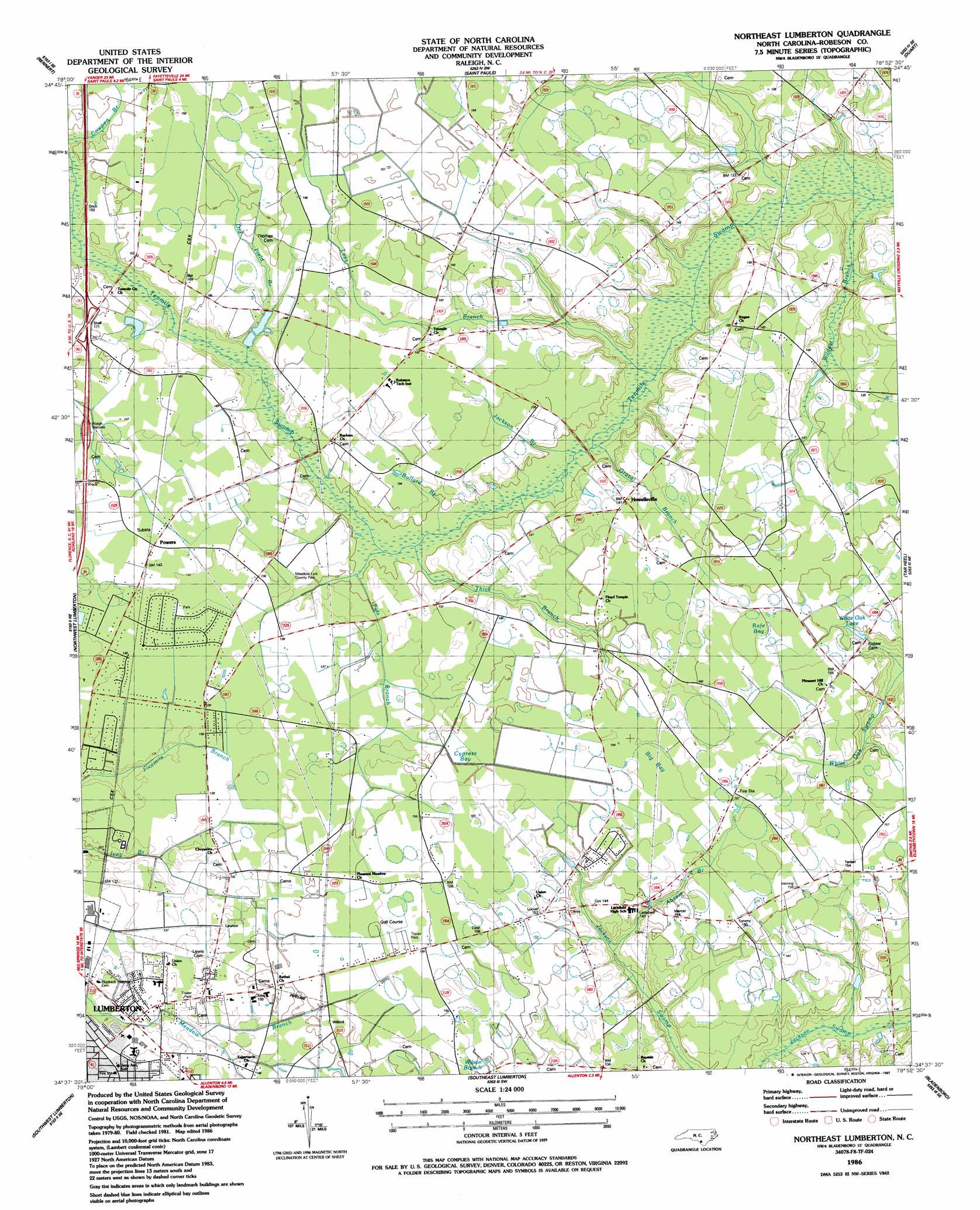
USGS Topo Quad 34078f8 - 1:24,000 scale
| Topo Map Name: | Northeast Lumberton |
| USGS Topo Quad ID: | 34078f8 |
| Print Size: | ca. 21 1/4" wide x 27" high |
| Southeast Coordinates: | 34.625° N latitude / 78.875° W longitude |
| Map Center Coordinates: | 34.6875° N latitude / 78.9375° W longitude |
| U.S. State: | NC |
| Filename: | o34078f8.jpg |
| Download Map JPG Image: | Northeast Lumberton topo map 1:24,000 scale |
| Map Type: | Topographic |
| Topo Series: | 7.5´ |
| Map Scale: | 1:24,000 |
| Source of Map Images: | United States Geological Survey (USGS) |
| Alternate Map Versions: |
Northeast Lumberton NC 1986, updated 1987 Download PDF Buy paper map Northeast Lumberton NC 2010 Download PDF Buy paper map Northeast Lumberton NC 2013 Download PDF Buy paper map Northeast Lumberton NC 2016 Download PDF Buy paper map |
1:24,000 Topo Quads surrounding Northeast Lumberton
Raeford |
Parkton |
Hope Mills |
Cedar Creek |
Autryville |
Red Springs |
Rennert |
Saint Pauls |
Duart |
Jerome |
Pembroke |
Northwest Lumberton |
Northeast Lumberton |
Tar Heel |
Dublin |
Mcdonald |
Southwest Lumberton |
Southeast Lumberton |
Bladenboro |
Abbottsburg |
Gaddysville |
Fairmont |
Evergreen |
Chadbourn Ne |
Clarkton |
> Back to 34078e1 at 1:100,000 scale
> Back to 34078a1 at 1:250,000 scale
> Back to U.S. Topo Maps home
Northeast Lumberton topo map: Gazetteer
Northeast Lumberton: Parks
Meadow Lark County Park elevation 41m 134′Northeast Lumberton: Populated Places
Barker Ten Mile elevation 42m 137′Eaglewood Mobile Home Park elevation 47m 154′
Howellsville elevation 43m 141′
Lone Oak Mobile Home Park elevation 44m 144′
Powers elevation 44m 144′
Rosewood Mobile Home Park elevation 45m 147′
Northeast Lumberton: Reservoirs
White Oak Lake elevation 43m 141′Northeast Lumberton: Streams
Abram Branch elevation 39m 127′Bullard Branch elevation 38m 124′
Cowpen Branch elevation 44m 144′
Gravel Branch elevation 37m 121′
Jackson Branch elevation 37m 121′
Lees Branch elevation 37m 121′
Old Field Branch elevation 41m 134′
Pats Branch elevation 38m 124′
Thick Branch elevation 38m 124′
Wildcat Branch elevation 35m 114′
Northeast Lumberton: Swamps
Big Bay elevation 47m 154′Cypress Bay elevation 47m 154′
Rafe Bay elevation 49m 160′
Northeast Lumberton digital topo map on disk
Buy this Northeast Lumberton topo map showing relief, roads, GPS coordinates and other geographical features, as a high-resolution digital map file on DVD:
South Carolina, Western North Carolina & Northeastern Georgia
Buy digital topo maps: South Carolina, Western North Carolina & Northeastern Georgia