Turkey Topo Map North Carolina
To zoom in, hover over the map of Turkey
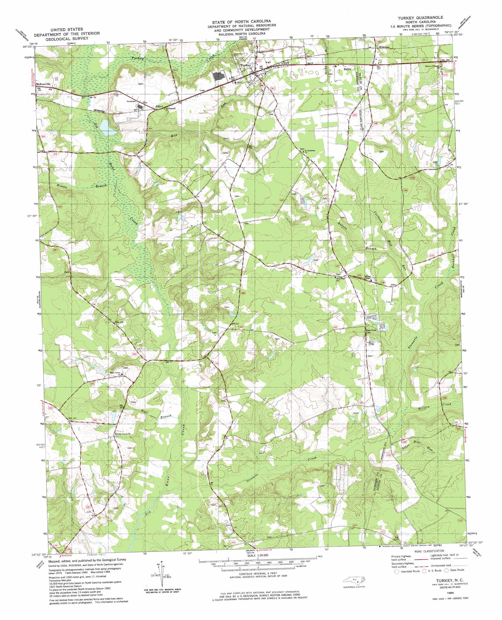
USGS Topo Quad 34078h2 - 1:24,000 scale
| Topo Map Name: | Turkey |
| USGS Topo Quad ID: | 34078h2 |
| Print Size: | ca. 21 1/4" wide x 27" high |
| Southeast Coordinates: | 34.875° N latitude / 78.125° W longitude |
| Map Center Coordinates: | 34.9375° N latitude / 78.1875° W longitude |
| U.S. State: | NC |
| Filename: | o34078h2.jpg |
| Download Map JPG Image: | Turkey topo map 1:24,000 scale |
| Map Type: | Topographic |
| Topo Series: | 7.5´ |
| Map Scale: | 1:24,000 |
| Source of Map Images: | United States Geological Survey (USGS) |
| Alternate Map Versions: |
Turkey NC 1984, updated 1984 Download PDF Buy paper map Turkey NC 2010 Download PDF Buy paper map Turkey NC 2013 Download PDF Buy paper map Turkey NC 2016 Download PDF Buy paper map |
1:24,000 Topo Quads surrounding Turkey
Timothy |
Newton Grove South |
Dobbersville |
Mount Olive |
Williams |
Bearskin |
Clinton North |
Faison |
Warsaw North |
Summerlins Crossroads |
Bonnetsville |
Clinton South |
Turkey |
Warsaw South |
Kenansville |
Garland |
Ingold |
Delway |
Rose Hill |
Charity |
White Lake |
Tomahawk |
Harrells |
Wallace West |
Wallace East |
> Back to 34078e1 at 1:100,000 scale
> Back to 34078a1 at 1:250,000 scale
> Back to U.S. Topo Maps home
Turkey topo map: Gazetteer
Turkey: Airports
Yam Yankees Airport elevation 40m 131′Turkey: Bridges
Kirbys Bridge elevation 25m 82′Reeds Ford Bridge elevation 20m 65′
Turkey: Populated Places
Baltic elevation 45m 147′Elliott elevation 41m 134′
Turkey elevation 44m 144′
Turkey: Streams
Bakers Branch elevation 29m 95′Buckhall Creek elevation 27m 88′
Bull Branch elevation 20m 65′
Carltons Mill Run elevation 26m 85′
Mill Run elevation 25m 82′
Millers Creek elevation 24m 78′
Rowan Branch elevation 23m 75′
Sikes Mill Run elevation 24m 78′
Stewarts Creek elevation 19m 62′
Turkey Creek elevation 26m 85′
Turkey digital topo map on disk
Buy this Turkey topo map showing relief, roads, GPS coordinates and other geographical features, as a high-resolution digital map file on DVD:
South Carolina, Western North Carolina & Northeastern Georgia
Buy digital topo maps: South Carolina, Western North Carolina & Northeastern Georgia