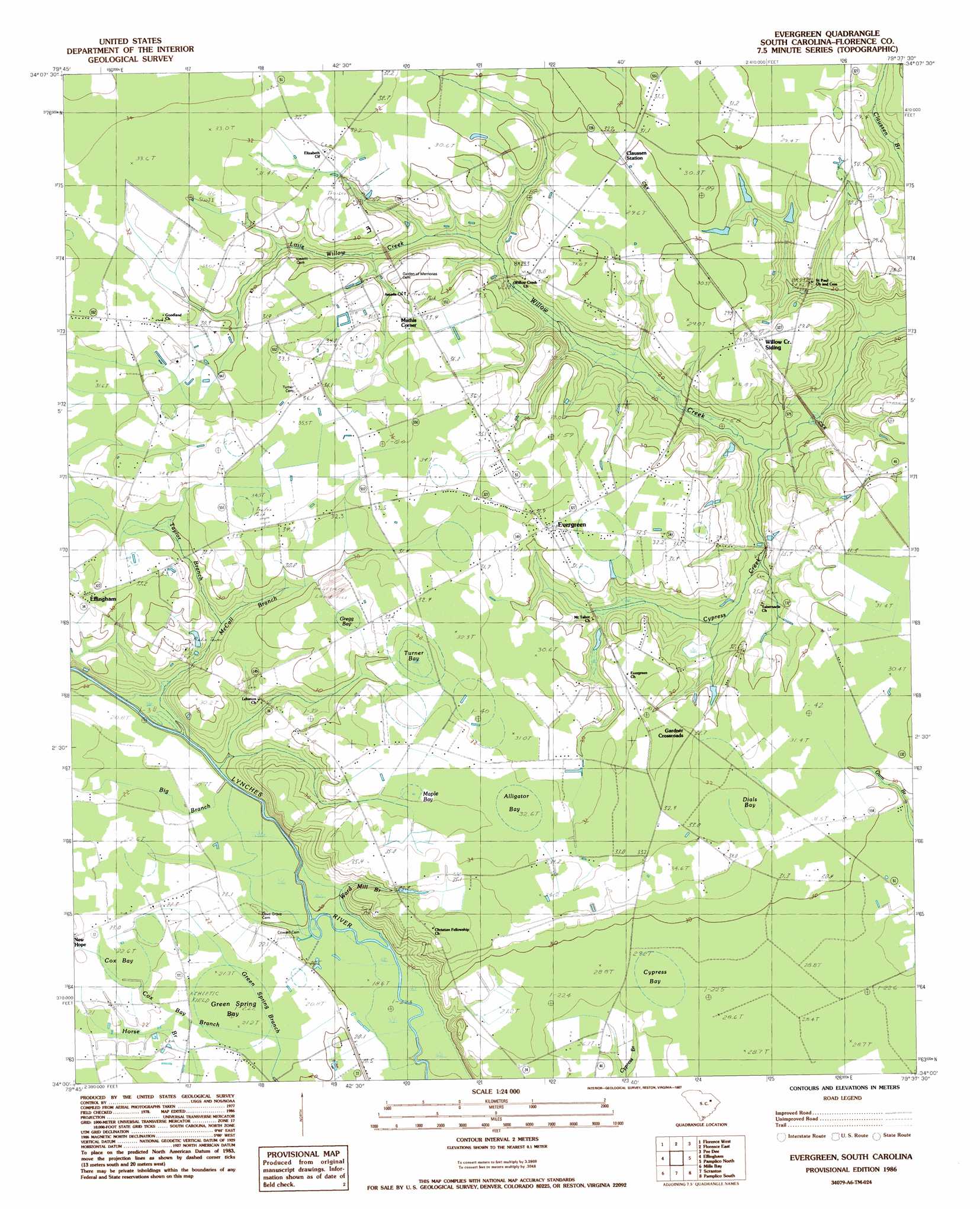
Evergreen Topo Map South Carolina
To zoom in, hover over the map of Evergreen
USGS Topo Quad 34079a6 - 1:24,000 scale
| Topo Map Name: | Evergreen |
| USGS Topo Quad ID: | 34079a6 |
| Print Size: | ca. 21 1/4" wide x 27" high |
| Southeast Coordinates: | 34° N latitude / 79.625° W longitude |
| Map Center Coordinates: | 34.0625° N latitude / 79.6875° W longitude |
| U.S. State: | SC |
| Filename: | o34079a6.jpg |
| Download Map JPG Image: | Evergreen topo map 1:24,000 scale |
| Map Type: | Topographic |
| Topo Series: | 7.5´ |
| Map Scale: | 1:24,000 |
| Source of Map Images: | United States Geological Survey (USGS) |
| Alternate Map Versions: |
Evergreen SC 1986, updated 1987 Download PDF Buy paper map Evergreen SC 2011 Download PDF Buy paper map Evergreen SC 2014 Download PDF Buy paper map |
1:24,000 Topo Quads surrounding Evergreen
Darlington West |
Darlington East |
Witherspoon Island |
Oak Grove |
Latta |
Timmonsville |
Florence West |
Florence East |
Pee Dee |
Marion |
Sardis |
Effingham |
Evergreen |
Pamplico North |
Friendship |
Olanta |
Mill Bay |
Scranton |
Pamplico South |
Gresham |
Hebron Crossroads |
Lake City West |
Lake City East |
Prospect Crossroads |
Johnsonville |
> Back to 34079a1 at 1:100,000 scale
> Back to 34078a1 at 1:250,000 scale
> Back to U.S. Topo Maps home
Evergreen topo map: Gazetteer
Evergreen: Basins
Cox Bay elevation 22m 72′Evergreen: Populated Places
Evergreen elevation 31m 101′Gardner Crossroads elevation 32m 104′
Mathis Corner elevation 33m 108′
Willow Creek Siding elevation 29m 95′
Evergreen: Streams
Bay Branch elevation 20m 65′Big Branch elevation 20m 65′
Cox Bay Branch elevation 20m 65′
Cypress Creek elevation 16m 52′
Little Willow Creek elevation 21m 68′
McCall Branch elevation 21m 68′
Taylor Branch elevation 24m 78′
Ward Mill Branch elevation 19m 62′
Evergreen: Swamps
Alligator Bay elevation 32m 104′Cypress Bay elevation 28m 91′
Dials Bay elevation 32m 104′
Green Spring Bay elevation 21m 68′
Gregg Bay elevation 33m 108′
Maple Bay elevation 32m 104′
Turner Bay elevation 32m 104′
Wills Bay elevation 28m 91′
Evergreen digital topo map on disk
Buy this Evergreen topo map showing relief, roads, GPS coordinates and other geographical features, as a high-resolution digital map file on DVD:
South Carolina, Western North Carolina & Northeastern Georgia
Buy digital topo maps: South Carolina, Western North Carolina & Northeastern Georgia