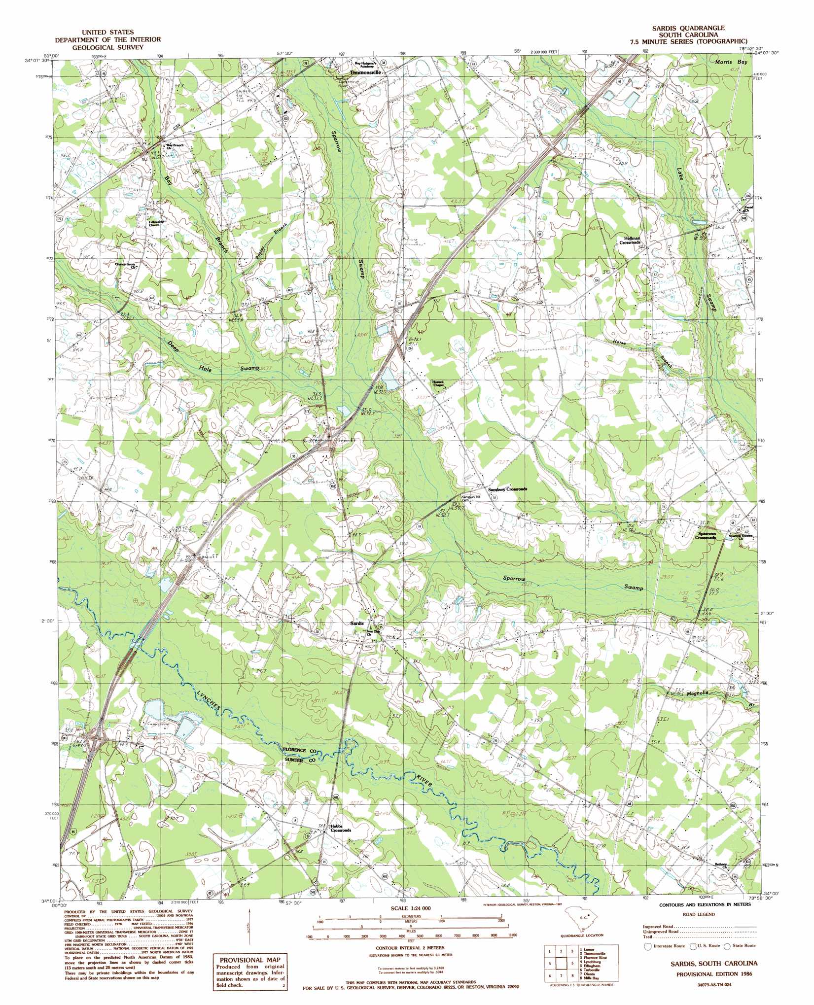
Sardis Topo Map South Carolina
To zoom in, hover over the map of Sardis
USGS Topo Quad 34079a8 - 1:24,000 scale
| Topo Map Name: | Sardis |
| USGS Topo Quad ID: | 34079a8 |
| Print Size: | ca. 21 1/4" wide x 27" high |
| Southeast Coordinates: | 34° N latitude / 79.875° W longitude |
| Map Center Coordinates: | 34.0625° N latitude / 79.9375° W longitude |
| U.S. State: | SC |
| Filename: | o34079a8.jpg |
| Download Map JPG Image: | Sardis topo map 1:24,000 scale |
| Map Type: | Topographic |
| Topo Series: | 7.5´ |
| Map Scale: | 1:24,000 |
| Source of Map Images: | United States Geological Survey (USGS) |
| Alternate Map Versions: |
Sardis SC 1986, updated 1987 Download PDF Buy paper map Sardis SC 2011 Download PDF Buy paper map Sardis SC 2014 Download PDF Buy paper map |
1:24,000 Topo Quads surrounding Sardis
Kellytown |
Hartsville South |
Darlington West |
Darlington East |
Witherspoon Island |
Bishopville East |
Lamar |
Timmonsville |
Florence West |
Florence East |
Elliott |
Lynchburg |
Sardis |
Effingham |
Evergreen |
Mayesville |
Turbeville |
Olanta |
Mill Bay |
Scranton |
Tearcoat Branch |
Sardinia |
Hebron Crossroads |
Lake City West |
Lake City East |
> Back to 34079a1 at 1:100,000 scale
> Back to 34078a1 at 1:250,000 scale
> Back to U.S. Topo Maps home
Sardis topo map: Gazetteer
Sardis: Airports
McKay Airport elevation 39m 127′Sardis: Bridges
Hudson Bridge elevation 32m 104′Sardis: Crossings
Interchange 146 elevation 43m 141′Interchange 150 elevation 39m 127′
Sardis: Lakes
Humphrey Lake elevation 34m 111′Jack Lake elevation 33m 108′
Kelly Lake elevation 33m 108′
Sardis: Populated Places
Hobbs Crossroads elevation 38m 124′Hollman Crossroads elevation 40m 131′
Pleasant View (historical) elevation 44m 144′
Sansbury Crossroads elevation 37m 121′
Sardis elevation 39m 127′
Sparrows Crossroads elevation 32m 104′
Sardis: Streams
Bay Branch elevation 33m 108′Deep Hole Swamp elevation 33m 108′
Horse Branch elevation 29m 95′
Poplar Branch elevation 35m 114′
Sardis digital topo map on disk
Buy this Sardis topo map showing relief, roads, GPS coordinates and other geographical features, as a high-resolution digital map file on DVD:
South Carolina, Western North Carolina & Northeastern Georgia
Buy digital topo maps: South Carolina, Western North Carolina & Northeastern Georgia