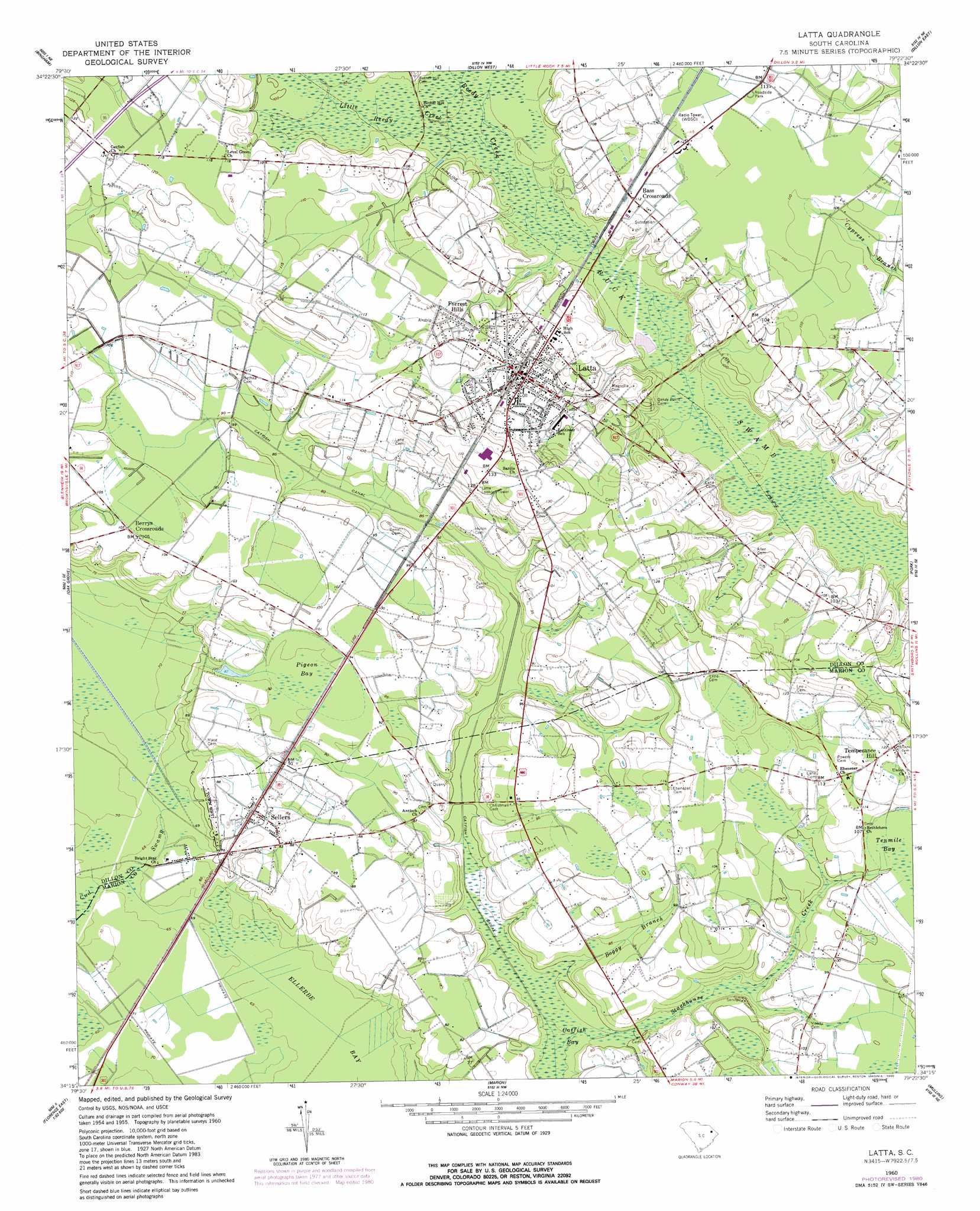
Latta Topo Map South Carolina
To zoom in, hover over the map of Latta
USGS Topo Quad 34079c4 - 1:24,000 scale
| Topo Map Name: | Latta |
| USGS Topo Quad ID: | 34079c4 |
| Print Size: | ca. 21 1/4" wide x 27" high |
| Southeast Coordinates: | 34.25° N latitude / 79.375° W longitude |
| Map Center Coordinates: | 34.3125° N latitude / 79.4375° W longitude |
| U.S. State: | SC |
| Filename: | o34079c4.jpg |
| Download Map JPG Image: | Latta topo map 1:24,000 scale |
| Map Type: | Topographic |
| Topo Series: | 7.5´ |
| Map Scale: | 1:24,000 |
| Source of Map Images: | United States Geological Survey (USGS) |
| Alternate Map Versions: |
Latta SC 1960, updated 1961 Download PDF Buy paper map Latta SC 1960, updated 1980 Download PDF Buy paper map Latta SC 2011 Download PDF Buy paper map Latta SC 2014 Download PDF Buy paper map |
1:24,000 Topo Quads surrounding Latta
Bennettsville South |
Clio |
Minturn |
Rowland |
Mcdonald |
Drake |
Bingham |
Dillon West |
Dillon East |
Gaddysville |
Witherspoon Island |
Oak Grove |
Latta |
Fork |
Lake View |
Florence East |
Pee Dee |
Marion |
Mullins |
Nichols |
Evergreen |
Pamplico North |
Friendship |
Centenary |
Galivants Ferry |
> Back to 34079a1 at 1:100,000 scale
> Back to 34078a1 at 1:250,000 scale
> Back to U.S. Topo Maps home
Latta topo map: Gazetteer
Latta: Dams
Latta Logan Pond Dam D-3604 elevation 25m 82′Latta: Parks
Latta Historic District Number 1 elevation 32m 104′Latta Historic District Number 2 elevation 31m 101′
Latta: Populated Places
Bass Crossroads elevation 33m 108′Berrys Crossroads elevation 32m 104′
Dalcho elevation 36m 118′
Forrest Hills elevation 33m 108′
Latta elevation 32m 104′
Sellers elevation 26m 85′
Temperance Hill elevation 36m 118′
Latta: Post Offices
Latta Post Office elevation 32m 104′Latta: Streams
Boggy Branch elevation 19m 62′Little Reedy Creek elevation 27m 88′
Reedy Creek elevation 26m 85′
Stackhouse Creek elevation 19m 62′
Latta: Swamps
Pigeon Bay elevation 27m 88′Latta digital topo map on disk
Buy this Latta topo map showing relief, roads, GPS coordinates and other geographical features, as a high-resolution digital map file on DVD:
South Carolina, Western North Carolina & Northeastern Georgia
Buy digital topo maps: South Carolina, Western North Carolina & Northeastern Georgia