Rennert Topo Map North Carolina
To zoom in, hover over the map of Rennert
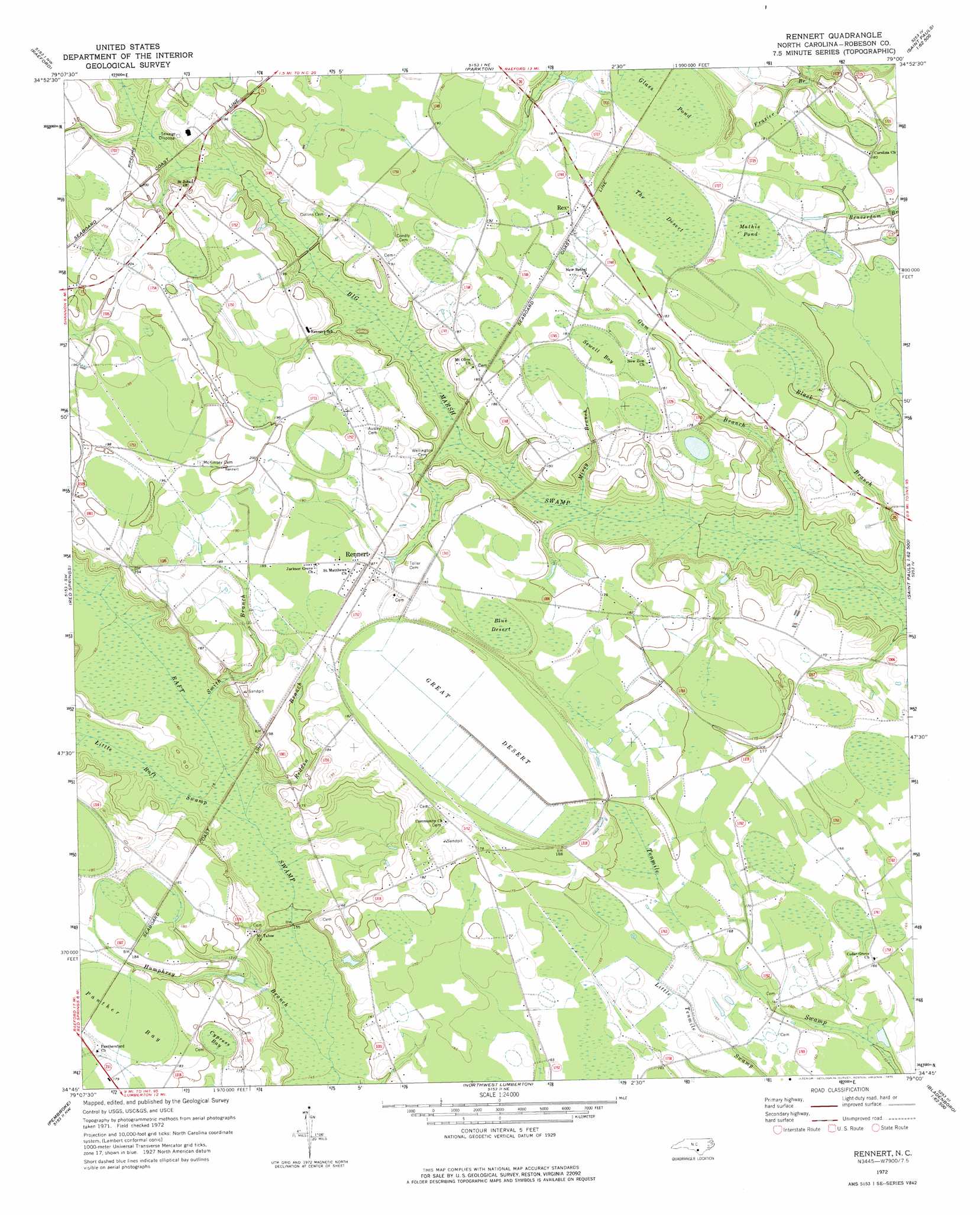
USGS Topo Quad 34079g1 - 1:24,000 scale
| Topo Map Name: | Rennert |
| USGS Topo Quad ID: | 34079g1 |
| Print Size: | ca. 21 1/4" wide x 27" high |
| Southeast Coordinates: | 34.75° N latitude / 79° W longitude |
| Map Center Coordinates: | 34.8125° N latitude / 79.0625° W longitude |
| U.S. State: | NC |
| Filename: | o34079g1.jpg |
| Download Map JPG Image: | Rennert topo map 1:24,000 scale |
| Map Type: | Topographic |
| Topo Series: | 7.5´ |
| Map Scale: | 1:24,000 |
| Source of Map Images: | United States Geological Survey (USGS) |
| Alternate Map Versions: |
Rennert NC 1972, updated 1975 Download PDF Buy paper map Rennert NC 1976, updated 1978 Download PDF Buy paper map Rennert NC 2010 Download PDF Buy paper map Rennert NC 2013 Download PDF Buy paper map Rennert NC 2016 Download PDF Buy paper map |
1:24,000 Topo Quads surrounding Rennert
Mccain |
Nicholson Creek |
Clifdale |
Fayetteville |
Vander |
Wagram |
Raeford |
Parkton |
Hope Mills |
Cedar Creek |
Wakulla |
Red Springs |
Rennert |
Saint Pauls |
Duart |
Maxton |
Pembroke |
Northwest Lumberton |
Northeast Lumberton |
Tar Heel |
Rowland |
Mcdonald |
Southwest Lumberton |
Southeast Lumberton |
Bladenboro |
> Back to 34079e1 at 1:100,000 scale
> Back to 34078a1 at 1:250,000 scale
> Back to U.S. Topo Maps home
Rennert topo map: Gazetteer
Rennert: Flats
Great Desert elevation 55m 180′Rennert: Populated Places
Rennert elevation 56m 183′Rex elevation 58m 190′
Rennert: Streams
Black Branch elevation 44m 144′Gum Branch elevation 45m 147′
Humphrey Branch elevation 44m 144′
Little Raft Swamp elevation 46m 150′
Mirey Branch elevation 48m 157′
Redden Branch elevation 46m 150′
Smith Branch elevation 51m 167′
Rennert: Swamps
Blue Desert elevation 57m 187′Cypress Bay elevation 52m 170′
Glass Pond elevation 55m 180′
Mathis Pond elevation 55m 180′
Panther Bay elevation 54m 177′
Sewell Bay elevation 55m 180′
The Desert elevation 55m 180′
Rennert digital topo map on disk
Buy this Rennert topo map showing relief, roads, GPS coordinates and other geographical features, as a high-resolution digital map file on DVD:
South Carolina, Western North Carolina & Northeastern Georgia
Buy digital topo maps: South Carolina, Western North Carolina & Northeastern Georgia