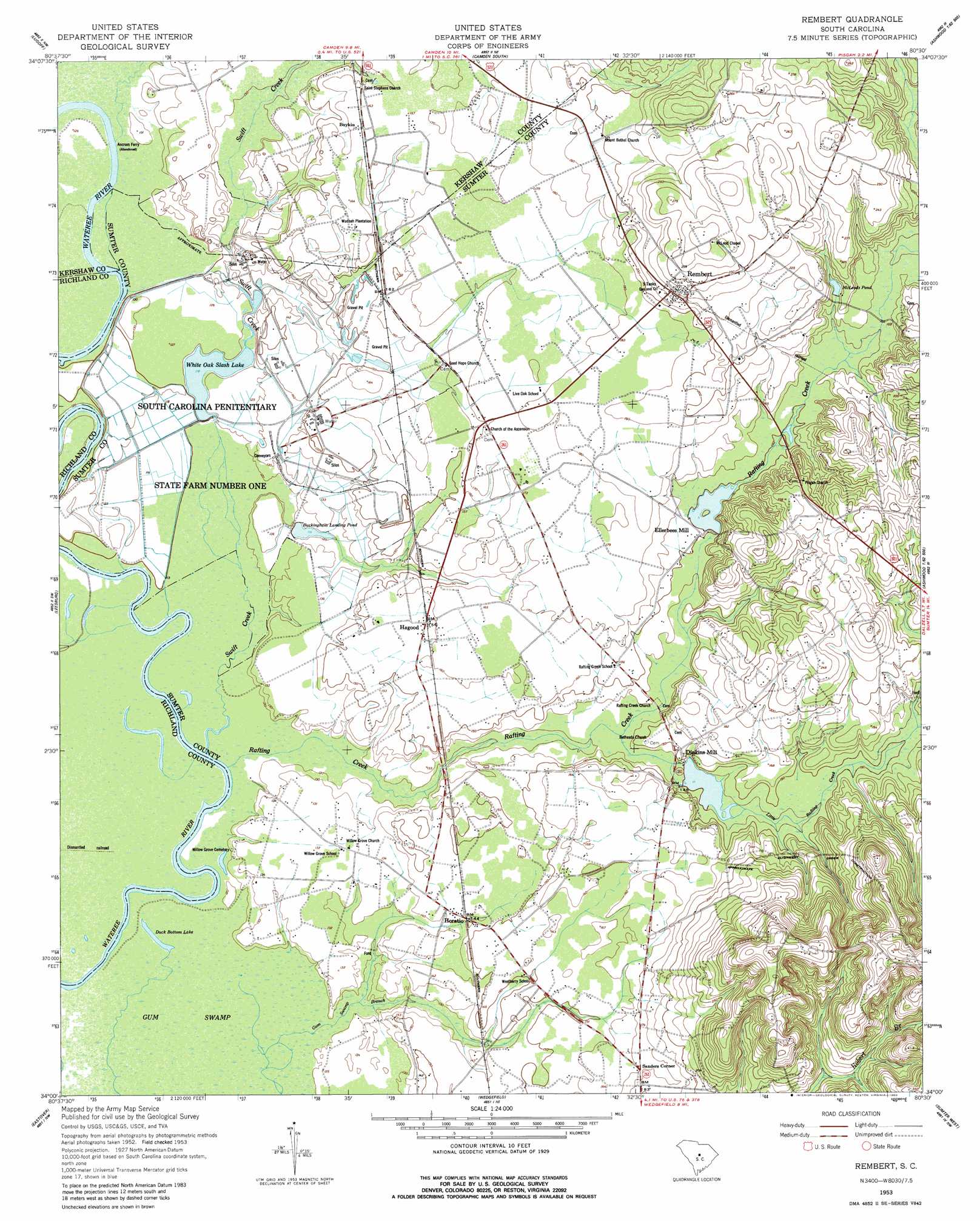
Rembert Topo Map South Carolina
To zoom in, hover over the map of Rembert
USGS Topo Quad 34080a5 - 1:24,000 scale
| Topo Map Name: | Rembert |
| USGS Topo Quad ID: | 34080a5 |
| Print Size: | ca. 21 1/4" wide x 27" high |
| Southeast Coordinates: | 34° N latitude / 80.5° W longitude |
| Map Center Coordinates: | 34.0625° N latitude / 80.5625° W longitude |
| U.S. State: | SC |
| Filename: | o34080a5.jpg |
| Download Map JPG Image: | Rembert topo map 1:24,000 scale |
| Map Type: | Topographic |
| Topo Series: | 7.5´ |
| Map Scale: | 1:24,000 |
| Source of Map Images: | United States Geological Survey (USGS) |
| Alternate Map Versions: |
Rembert SC 1953, updated 1957 Download PDF Buy paper map Rembert SC 1953, updated 1980 Download PDF Buy paper map Rembert SC 2011 Download PDF Buy paper map Rembert SC 2014 Download PDF Buy paper map |
1:24,000 Topo Quads surrounding Rembert
Longtown |
Rabon Crossroads |
Camden North |
Cassatt |
Lucknow |
Elgin |
Lugoff |
Camden South |
Spring Hill |
Bishopville West |
Messers Pond |
Leesburg |
Rembert |
Dalzell |
Oswego |
Congaree |
Eastover |
Wedgefield |
Sumter West |
Sumter East |
Gadsden |
Wateree |
Poinsett State Park |
Privateer |
Brogdon |
> Back to 34080a1 at 1:100,000 scale
> Back to 34080a1 at 1:250,000 scale
> Back to U.S. Topo Maps home
Rembert topo map: Gazetteer
Rembert: Dams
Dinkins Millpond Dam D-1461 elevation 41m 134′Ellerbees Millpond Dam D-1460 elevation 45m 147′
Harvins Pond Dam D-1973 elevation 49m 160′
McDuffie Pond Dam D-1974 elevation 53m 173′
White Oak Slash Lake Dam D-1972 elevation 36m 118′
Rembert: Lakes
Duck Bottom Lake elevation 35m 114′Rembert: Populated Places
Boykin elevation 49m 160′Dinkins Mill elevation 46m 150′
Ellerbee (historical) elevation 58m 190′
Ellerbees Mill elevation 46m 150′
Godgold Subdivision elevation 77m 252′
Hagood elevation 48m 157′
Happy Home Subdivision elevation 58m 190′
Horatio elevation 42m 137′
McCrearys Quarter (historical) elevation 36m 118′
Rembert elevation 66m 216′
Sanders Corner elevation 54m 177′
State Farm (historical) elevation 49m 160′
Rembert: Reservoirs
Buckingham Landing Pond elevation 36m 118′Dinkins Millpond elevation 41m 134′
Ellerbees Millpond elevation 45m 147′
Harvins Pond elevation 49m 160′
McDuffie Pond elevation 53m 173′
McLeods Pond elevation 54m 177′
White Oak Slash Lake elevation 36m 118′
Rembert: Streams
Little Rafting Creek elevation 41m 134′Rafting Creek elevation 36m 118′
Swift Creek elevation 36m 118′
Rembert digital topo map on disk
Buy this Rembert topo map showing relief, roads, GPS coordinates and other geographical features, as a high-resolution digital map file on DVD:
South Carolina, Western North Carolina & Northeastern Georgia
Buy digital topo maps: South Carolina, Western North Carolina & Northeastern Georgia