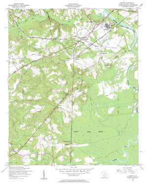
Lugoff Topo Map South Carolina
To zoom in, hover over the map of Lugoff
USGS Topo Quad 34080b6 - 1:24,000 scale
| Topo Map Name: | Lugoff |
| USGS Topo Quad ID: | 34080b6 |
| Print Size: | ca. 21 1/4" wide x 27" high |
| Southeast Coordinates: | 34.125° N latitude / 80.625° W longitude |
| Map Center Coordinates: | 34.1875° N latitude / 80.6875° W longitude |
| U.S. State: | SC |
| Filename: | o34080b6.jpg |
| Download Map JPG Image: | Lugoff topo map 1:24,000 scale |
| Map Type: | Topographic |
| Topo Series: | 7.5´ |
| Map Scale: | 1:24,000 |
| Source of Map Images: | United States Geological Survey (USGS) |
| Alternate Map Versions: |
Lugoff SC 1953, updated 1957 Download PDF Buy paper map Lugoff SC 2011 Download PDF Buy paper map Lugoff SC 2014 Download PDF Buy paper map |
1:24,000 Topo Quads surrounding Lugoff
> Back to 34080a1 at 1:100,000 scale
> Back to 34080a1 at 1:250,000 scale
> Back to U.S. Topo Maps home
Lugoff topo map: Gazetteer
Lugoff: Canals
Gilles Ditch elevation 39m 127′Jumping Gully elevation 39m 127′
Lugoff: Crossings
Interchange 92 elevation 64m 209′Lugoff: Dams
Ralph Smith Pond Dam D-2544 elevation 70m 229′South Carolina Noname 28015 D-2540 Dam elevation 42m 137′
South Carolina Noname 28024 D-2538 Dam elevation 69m 226′
South Carolina Noname 28031 D-2541 Dam elevation 47m 154′
South Carolina Noname 28033 D-2542 Dam elevation 39m 127′
South Carolina Noname 28043 D-2530 Dam elevation 64m 209′
South Carolina Noname 28050 Dam elevation 51m 167′
Stokes Pond Dam D-2543 elevation 62m 203′
Lugoff: Populated Places
Four Seasons elevation 82m 269′Gettysburg elevation 92m 301′
Green Valley elevation 47m 154′
Kellytown elevation 82m 269′
Lugoff elevation 80m 262′
Mayfield Acres elevation 76m 249′
Pecan Grove elevation 68m 223′
Pecan Orchard elevation 73m 239′
Pepper Ridge elevation 106m 347′
Pine Land elevation 71m 232′
Pine Mark elevation 98m 321′
Sandwood Hills elevation 90m 295′
Spring Village elevation 72m 236′
The Groves elevation 67m 219′
Thunderwoods elevation 85m 278′
Woodland Forest elevation 75m 246′
Lugoff: Reservoirs
Carnes Pond elevation 64m 209′Duck Pond elevation 39m 127′
Fredricksburg Pond elevation 51m 167′
Ralph Pond elevation 70m 229′
Stokes Pond elevation 62m 203′
Wateree Farm Pond Number One elevation 47m 154′
Wateree Farm Pond Number Three elevation 42m 137′
Whitehead Brothers Pond elevation 69m 226′
Lugoff: Streams
Beaverdam Creek elevation 49m 160′Bolton Branch elevation 39m 127′
Buck Creek elevation 39m 127′
Camp Creek elevation 39m 127′
Cook Run elevation 50m 164′
Flat Branch elevation 51m 167′
Gillies Creek elevation 42m 137′
Gum Swamp elevation 39m 127′
Haig Creek elevation 43m 141′
Twentyfive Mile Creek elevation 39m 127′
Lugoff: Swamps
Betty Neck Swamp elevation 41m 134′Lugoff digital topo map on disk
Buy this Lugoff topo map showing relief, roads, GPS coordinates and other geographical features, as a high-resolution digital map file on DVD:
South Carolina, Western North Carolina & Northeastern Georgia
Buy digital topo maps: South Carolina, Western North Carolina & Northeastern Georgia


