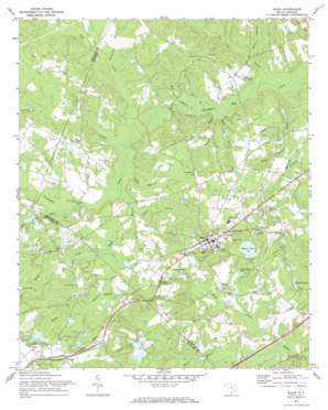
Elgin Topo Map South Carolina
To zoom in, hover over the map of Elgin
USGS Topo Quad 34080b7 - 1:24,000 scale
| Topo Map Name: | Elgin |
| USGS Topo Quad ID: | 34080b7 |
| Print Size: | ca. 21 1/4" wide x 27" high |
| Southeast Coordinates: | 34.125° N latitude / 80.75° W longitude |
| Map Center Coordinates: | 34.1875° N latitude / 80.8125° W longitude |
| U.S. State: | SC |
| Filename: | o34080b7.jpg |
| Download Map JPG Image: | Elgin topo map 1:24,000 scale |
| Map Type: | Topographic |
| Topo Series: | 7.5´ |
| Map Scale: | 1:24,000 |
| Source of Map Images: | United States Geological Survey (USGS) |
| Alternate Map Versions: |
Blaney SC 1953, updated 1957 Download PDF Buy paper map Elgin SC 1971, updated 1973 Download PDF Buy paper map Elgin SC 1971, updated 1984 Download PDF Buy paper map Elgin SC 2011 Download PDF Buy paper map Elgin SC 2014 Download PDF Buy paper map |
1:24,000 Topo Quads surrounding Elgin
> Back to 34080a1 at 1:100,000 scale
> Back to 34080a1 at 1:250,000 scale
> Back to U.S. Topo Maps home
Elgin topo map: Gazetteer
Elgin: Crossings
Interchange 87 elevation 68m 223′Elgin: Dams
Bowen Pond Dam Number One D-1138 elevation 82m 269′Bowen Pond Dam Number Two D-2519 elevation 77m 252′
Cook Pond Dam D-1068 elevation 72m 236′
Cranshaw Pond Dam D-2518 elevation 78m 255′
Lotts Mill Pond D-0552 Dam elevation 75m 246′
R W Cokers Pond Dam D-2516 elevation 79m 259′
South Carolina Noname 28044 D-2520 Dam elevation 70m 229′
South Carolina Noname 28048 D-1071 Dam elevation 75m 246′
South Carolina Noname 40068 D-0553 Dam elevation 109m 357′
Tucker Lake D-0554 Dam elevation 83m 272′
Wiedemann Pond Dam D-2517 elevation 86m 282′
Elgin: Lakes
Heath Pond elevation 66m 216′White Pond elevation 89m 291′
Elgin: Populated Places
Blaney Hills elevation 97m 318′Blaney West elevation 117m 383′
Cedar Springs elevation 114m 374′
Elgin elevation 122m 400′
Elgin Acres elevation 103m 337′
Elgin Farms elevation 95m 311′
Highland Farms elevation 109m 357′
Jeffers Place elevation 86m 282′
Pine Valley elevation 97m 318′
Pinewood Heights elevation 102m 334′
Pontiac elevation 122m 400′
Rock Branch North elevation 99m 324′
Sumei Circle elevation 89m 291′
Tupelo Creek elevation 105m 344′
Tupelo Hills elevation 88m 288′
White Hills elevation 114m 374′
Elgin: Reservoirs
Bowen Lower Pond elevation 77m 252′Bowen Upper Pond elevation 82m 269′
Company Pond elevation 81m 265′
Cooks Pond elevation 72m 236′
Cranshaw Pond elevation 78m 255′
Curetons Pond elevation 70m 229′
Hoods Pond elevation 70m 229′
Kirkland Pond elevation 67m 219′
Little White Pond elevation 77m 252′
Lotts Mill Pond elevation 75m 246′
Miles Pond elevation 82m 269′
R W Cokers Pond elevation 79m 259′
Taylor Pond elevation 75m 246′
Tucker Lake elevation 83m 272′
Wiedemann Pond elevation 86m 282′
Elgin: Streams
Bear Creek elevation 63m 206′Bell Branch elevation 53m 173′
Big Branch elevation 60m 196′
Briar Branch elevation 56m 183′
Bridge Creek elevation 75m 246′
Dodge Branch elevation 55m 180′
Donnington Branch elevation 72m 236′
Flat Branch elevation 65m 213′
Horsepen Creek elevation 54m 177′
Jim Branch elevation 56m 183′
Kelly Creek elevation 55m 180′
Reedy Branch elevation 72m 236′
Rice Creek elevation 75m 246′
Rock Branch elevation 57m 187′
Rocky Branch elevation 65m 213′
Sandy Branch elevation 68m 223′
Spring Branch elevation 56m 183′
Tenmile Branch elevation 60m 196′
Tuppler Branch elevation 71m 232′
Wolfpin Branch elevation 72m 236′
Yankee Branch elevation 56m 183′
Elgin digital topo map on disk
Buy this Elgin topo map showing relief, roads, GPS coordinates and other geographical features, as a high-resolution digital map file on DVD:
South Carolina, Western North Carolina & Northeastern Georgia
Buy digital topo maps: South Carolina, Western North Carolina & Northeastern Georgia


