Patrick Topo Map South Carolina
To zoom in, hover over the map of Patrick
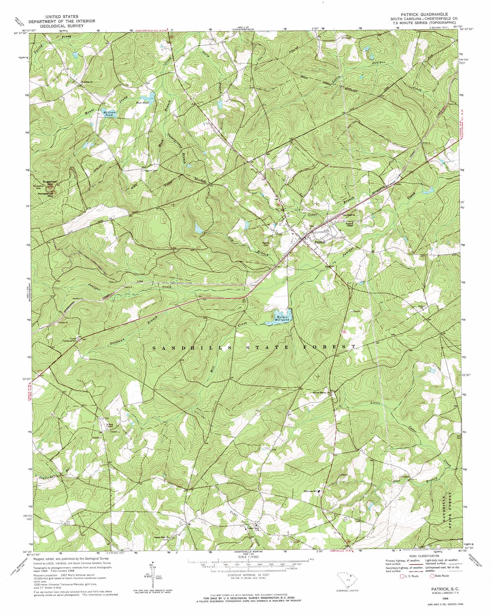
USGS Topo Quad 34080e1 - 1:24,000 scale
| Topo Map Name: | Patrick |
| USGS Topo Quad ID: | 34080e1 |
| Print Size: | ca. 21 1/4" wide x 27" high |
| Southeast Coordinates: | 34.5° N latitude / 80° W longitude |
| Map Center Coordinates: | 34.5625° N latitude / 80.0625° W longitude |
| U.S. State: | SC |
| Filename: | o34080e1.jpg |
| Download Map JPG Image: | Patrick topo map 1:24,000 scale |
| Map Type: | Topographic |
| Topo Series: | 7.5´ |
| Map Scale: | 1:24,000 |
| Source of Map Images: | United States Geological Survey (USGS) |
| Alternate Map Versions: |
Patrick SC 1968, updated 1970 Download PDF Buy paper map Patrick SC 2011 Download PDF Buy paper map Patrick SC 2014 Download PDF Buy paper map |
1:24,000 Topo Quads surrounding Patrick
Hornsboro |
Mount Croghan |
Morven West |
Morven East |
Diggs |
Jefferson Ne |
Ruby |
Chesterfield |
Cheraw |
Wallace |
Angelus |
Middendorf |
Patrick |
Cash |
Society Hill |
Bethune |
Lake Robinson |
Hartsville North |
Dovesville |
Mont Clare |
Lucknow |
Kellytown |
Hartsville South |
Darlington West |
Darlington East |
> Back to 34080e1 at 1:100,000 scale
> Back to 34080a1 at 1:250,000 scale
> Back to U.S. Topo Maps home
Patrick topo map: Gazetteer
Patrick: Dams
Brown Springs Pond Dam D-3212 elevation 63m 206′Hunter Pond Dam D-3210 elevation 82m 269′
Lee Pond Dam D-3209 elevation 72m 236′
McLean Pond Dam D-3208 elevation 58m 190′
Scott Pond Dam D-3213 elevation 91m 298′
South Carolina Noname 13059 D-3228 Dam elevation 72m 236′
Wilkes Millpond Dam D-3211 elevation 55m 180′
Patrick: Forests
Sand Hills State Forest elevation 84m 275′Patrick: Populated Places
Patrick elevation 67m 219′Patrick: Reservoirs
Flory Pond elevation 72m 236′McLean Pond elevation 55m 180′
Pate Pond elevation 53m 173′
Wilkes Millpond elevation 55m 180′
Patrick: Streams
Coker Branch elevation 42m 137′Cow Branch elevation 52m 170′
Deadman Branch elevation 56m 183′
Gully Branch elevation 48m 157′
Mash Branch elevation 51m 167′
Middle Prong Juniper Creek elevation 56m 183′
Mill Creek elevation 48m 157′
Pool Branch elevation 47m 154′
Underground Branch elevation 56m 183′
Patrick: Summits
Horseshoe Mountain elevation 123m 403′Sugarloaf Mountain elevation 133m 436′
Patrick digital topo map on disk
Buy this Patrick topo map showing relief, roads, GPS coordinates and other geographical features, as a high-resolution digital map file on DVD:
South Carolina, Western North Carolina & Northeastern Georgia
Buy digital topo maps: South Carolina, Western North Carolina & Northeastern Georgia