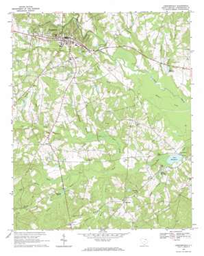
Chesterfield Topo Map South Carolina
To zoom in, hover over the map of Chesterfield
USGS Topo Quad 34080f1 - 1:24,000 scale
| Topo Map Name: | Chesterfield |
| USGS Topo Quad ID: | 34080f1 |
| Print Size: | ca. 21 1/4" wide x 27" high |
| Southeast Coordinates: | 34.625° N latitude / 80° W longitude |
| Map Center Coordinates: | 34.6875° N latitude / 80.0625° W longitude |
| U.S. State: | SC |
| Filename: | o34080f1.jpg |
| Download Map JPG Image: | Chesterfield topo map 1:24,000 scale |
| Map Type: | Topographic |
| Topo Series: | 7.5´ |
| Map Scale: | 1:24,000 |
| Source of Map Images: | United States Geological Survey (USGS) |
| Alternate Map Versions: |
Chesterfield SC 1968, updated 1970 Download PDF Buy paper map Chesterfield SC 2011 Download PDF Buy paper map Chesterfield SC 2014 Download PDF Buy paper map |
1:24,000 Topo Quads surrounding Chesterfield
> Back to 34080e1 at 1:100,000 scale
> Back to 34080a1 at 1:250,000 scale
> Back to U.S. Topo Maps home
Chesterfield topo map: Gazetteer
Chesterfield: Dams
Hurst Pond Dam D-3204 elevation 84m 275′Robeson Millpond Dam D-3207 elevation 40m 131′
South Carolina Noname 13001 D-3206 Dam elevation 36m 118′
Sowells Pond Dam D-3205 elevation 49m 160′
Chesterfield: Populated Places
Bethesda elevation 74m 242′Catoe (historical) elevation 103m 337′
Chesterfield elevation 89m 291′
Hunts Mill elevation 46m 150′
Hunts Spring (historical) elevation 42m 137′
Rivers (historical) elevation 55m 180′
Shiloh elevation 77m 252′
Chesterfield: Reservoirs
Hunts Millpond elevation 37m 121′Merriman Millpond elevation 46m 150′
Robeson Millpond elevation 40m 131′
Teal Millpond elevation 36m 118′
Teals Millpond elevation 50m 164′
Chesterfield: Streams
Abrams Creek elevation 39m 127′Bay Branch elevation 44m 144′
Big Bear Creek elevation 37m 121′
Cow Branch elevation 62m 203′
Cross Branch elevation 42m 137′
Indian Creek elevation 34m 111′
Jimmies Creek elevation 45m 147′
Little Bear Creek elevation 37m 121′
Mash Branch elevation 57m 187′
Mount Prong Creek elevation 39m 127′
Reedy Branch elevation 39m 127′
Robeson Branch elevation 36m 118′
Rocky Prong elevation 37m 121′
Spencer Mill Creek elevation 34m 111′
Strickland Branch elevation 44m 144′
Tavern Branch elevation 47m 154′
Twitty Prong elevation 42m 137′
Chesterfield digital topo map on disk
Buy this Chesterfield topo map showing relief, roads, GPS coordinates and other geographical features, as a high-resolution digital map file on DVD:
South Carolina, Western North Carolina & Northeastern Georgia
Buy digital topo maps: South Carolina, Western North Carolina & Northeastern Georgia


