Fort Lawn Topo Map South Carolina
To zoom in, hover over the map of Fort Lawn
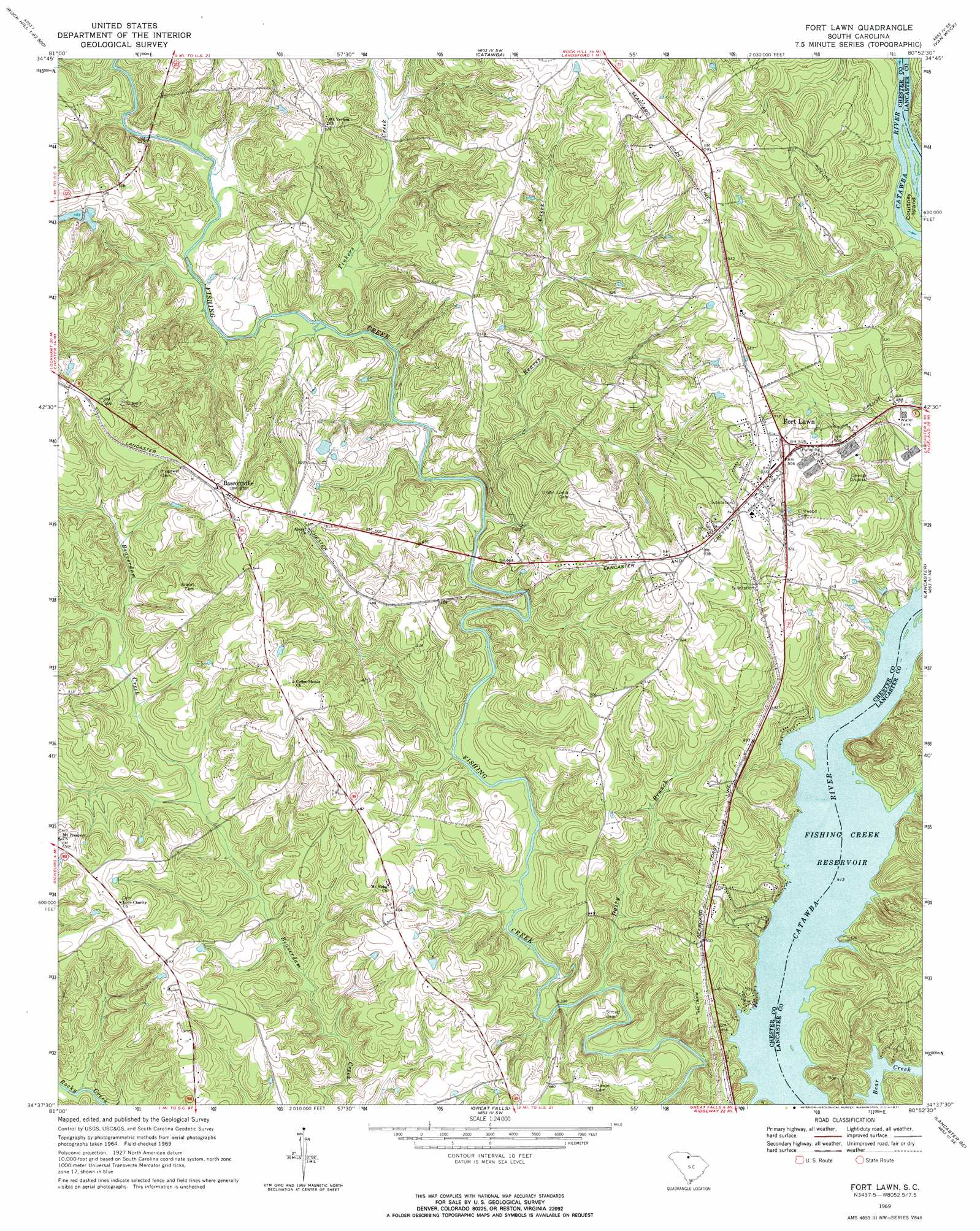
USGS Topo Quad 34080f8 - 1:24,000 scale
| Topo Map Name: | Fort Lawn |
| USGS Topo Quad ID: | 34080f8 |
| Print Size: | ca. 21 1/4" wide x 27" high |
| Southeast Coordinates: | 34.625° N latitude / 80.875° W longitude |
| Map Center Coordinates: | 34.6875° N latitude / 80.9375° W longitude |
| U.S. State: | SC |
| Filename: | o34080f8.jpg |
| Download Map JPG Image: | Fort Lawn topo map 1:24,000 scale |
| Map Type: | Topographic |
| Topo Series: | 7.5´ |
| Map Scale: | 1:24,000 |
| Source of Map Images: | United States Geological Survey (USGS) |
| Alternate Map Versions: |
Fort Lawn SC 1969, updated 1971 Download PDF Buy paper map Fort Lawn SC 2011 Download PDF Buy paper map Fort Lawn SC 2014 Download PDF Buy paper map |
1:24,000 Topo Quads surrounding Fort Lawn
Tirzah |
Rock Hill West |
Rock Hill East |
Catawba Ne |
Waxhaw |
Lowrys |
Edgemoor |
Catawba |
Van Wyck |
Unity |
Chester |
Richburg |
Fort Lawn |
Lancaster |
Antioch |
Blackstock |
Stover |
Great Falls |
Lancaster Se |
Heath Springs |
Lebanon |
Winnsboro |
Flint Hill |
Liberty Hill |
Whiteoak Creek |
> Back to 34080e1 at 1:100,000 scale
> Back to 34080a1 at 1:250,000 scale
> Back to U.S. Topo Maps home
Fort Lawn topo map: Gazetteer
Fort Lawn: Crossings
McDonalds Ferry (historical) elevation 126m 413′McDonalds Ford (historical) elevation 126m 413′
Fort Lawn: Dams
Rocky Creek WCD Dam Number One D-0212 elevation 127m 416′Shepherds Pond D-1437 Dam elevation 148m 485′
Fort Lawn: Islands
Courtney Island elevation 128m 419′Taylors Island (historical) elevation 126m 413′
Fort Lawn: Populated Places
Bascomville elevation 168m 551′Fort Lawn elevation 163m 534′
Fudges (historical) elevation 169m 554′
Lake View elevation 133m 436′
Fort Lawn: Post Offices
Fort Lawn Post Office elevation 162m 531′Fort Lawn: Streams
Dairy Branch elevation 111m 364′Reaves Creek elevation 118m 387′
Tinkers Creek elevation 122m 400′
Fort Lawn digital topo map on disk
Buy this Fort Lawn topo map showing relief, roads, GPS coordinates and other geographical features, as a high-resolution digital map file on DVD:
South Carolina, Western North Carolina & Northeastern Georgia
Buy digital topo maps: South Carolina, Western North Carolina & Northeastern Georgia