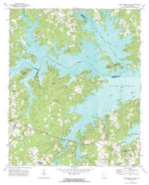
Lake Murray West Topo Map South Carolina
To zoom in, hover over the map of Lake Murray West
USGS Topo Quad 34081a4 - 1:24,000 scale
| Topo Map Name: | Lake Murray West |
| USGS Topo Quad ID: | 34081a4 |
| Print Size: | ca. 21 1/4" wide x 27" high |
| Southeast Coordinates: | 34° N latitude / 81.375° W longitude |
| Map Center Coordinates: | 34.0625° N latitude / 81.4375° W longitude |
| U.S. State: | SC |
| Filename: | o34081a4.jpg |
| Download Map JPG Image: | Lake Murray West topo map 1:24,000 scale |
| Map Type: | Topographic |
| Topo Series: | 7.5´ |
| Map Scale: | 1:24,000 |
| Source of Map Images: | United States Geological Survey (USGS) |
| Alternate Map Versions: |
Lake Murray West SC 1971, updated 1974 Download PDF Buy paper map Lake Murray West SC 2011 Download PDF Buy paper map Lake Murray West SC 2014 Download PDF Buy paper map |
1:24,000 Topo Quads surrounding Lake Murray West
> Back to 34081a1 at 1:100,000 scale
> Back to 34080a1 at 1:250,000 scale
> Back to U.S. Topo Maps home
Lake Murray West topo map: Gazetteer
Lake Murray West: Airports
Shealy Airport elevation 110m 360′Lake Murray West: Capes
Lominick Point elevation 111m 364′Lake Murray West: Crossings
Amicks Ferry (historical) elevation 110m 360′Hollys Ferry (historical) elevation 110m 360′
Lake Murray West: Islands
Dreher Island elevation 120m 393′Lake Murray West: Parks
Billy Dreher Island State Park elevation 112m 367′Lake Murray West: Populated Places
Acapulco elevation 126m 413′Climax elevation 130m 426′
Ella elevation 131m 429′
Hollow Creek elevation 140m 459′
Jug Hole elevation 121m 396′
Lake Murray Shores elevation 114m 374′
Lake Village elevation 122m 400′
Lazy Day Acres elevation 128m 419′
Living Inn elevation 127m 416′
Longview Plant elevation 116m 380′
Lowmans Crossroads (historical) elevation 127m 416′
Macedonia elevation 122m 400′
Mallard Bay elevation 129m 423′
Milmont Shores elevation 116m 380′
Oswald Park elevation 122m 400′
Red Star elevation 135m 442′
Ridge Road Crossroads elevation 153m 501′
Snug Harbor elevation 121m 396′
Lake Murray West: Streams
Buffalo Creek elevation 110m 360′Camping Creek elevation 110m 360′
Hollow Creek elevation 110m 360′
Horse Creek elevation 110m 360′
Little Hollow Creek elevation 112m 367′
Little Horse Creek elevation 112m 367′
Rocky Creek elevation 111m 364′
Whetstone Creek elevation 112m 367′
Lake Murray West digital topo map on disk
Buy this Lake Murray West topo map showing relief, roads, GPS coordinates and other geographical features, as a high-resolution digital map file on DVD:
South Carolina, Western North Carolina & Northeastern Georgia
Buy digital topo maps: South Carolina, Western North Carolina & Northeastern Georgia


