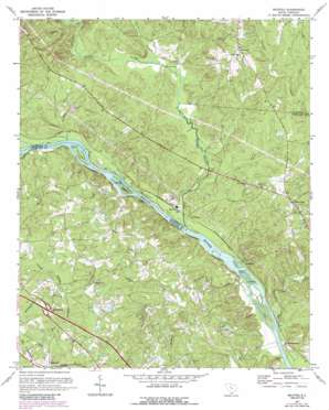
Richtex Topo Map South Carolina
To zoom in, hover over the map of Richtex
USGS Topo Quad 34081b2 - 1:24,000 scale
| Topo Map Name: | Richtex |
| USGS Topo Quad ID: | 34081b2 |
| Print Size: | ca. 21 1/4" wide x 27" high |
| Southeast Coordinates: | 34.125° N latitude / 81.125° W longitude |
| Map Center Coordinates: | 34.1875° N latitude / 81.1875° W longitude |
| U.S. State: | SC |
| Filename: | o34081b2.jpg |
| Download Map JPG Image: | Richtex topo map 1:24,000 scale |
| Map Type: | Topographic |
| Topo Series: | 7.5´ |
| Map Scale: | 1:24,000 |
| Source of Map Images: | United States Geological Survey (USGS) |
| Alternate Map Versions: |
Richtex SC 1947, updated 1969 Download PDF Buy paper map Richtex SC 1949 Download PDF Buy paper map Richtex SC 1971, updated 1973 Download PDF Buy paper map Richtex SC 1971, updated 1986 Download PDF Buy paper map Richtex SC 1971, updated 1990 Download PDF Buy paper map Richtex SC 2011 Download PDF Buy paper map Richtex SC 2014 Download PDF Buy paper map |
1:24,000 Topo Quads surrounding Richtex
> Back to 34081a1 at 1:100,000 scale
> Back to 34080a1 at 1:250,000 scale
> Back to U.S. Topo Maps home
Richtex topo map: Gazetteer
Richtex: Bars
Bookman Shoals elevation 55m 180′Chapel Shoals elevation 61m 200′
Freshley Shoals elevation 63m 206′
Richtex: Bridges
Ashley Bridge elevation 57m 187′Browns Bridge elevation 64m 209′
Richtex: Crossings
Interchange 97 elevation 110m 360′Richtex: Dams
Hawkins Pond D-1569 Dam elevation 75m 246′South Carolina Noname 24007 D-1263 Dam elevation 81m 265′
Wetze Pond D-0540 Dam elevation 107m 351′
Richtex: Islands
Bookman Island elevation 56m 183′Haltiwanger Island elevation 65m 213′
Hickory Island elevation 55m 180′
Huffman Island elevation 61m 200′
Richtex: Populated Places
Bookman elevation 58m 190′Calla (historical) elevation 109m 357′
Cedar Creek elevation 109m 357′
Jennings elevation 135m 442′
Littleton elevation 65m 213′
Montgomery elevation 57m 187′
Richtex elevation 67m 219′
Richtex: Reservoirs
Meetze Pond elevation 107m 351′Richtex: Streams
Big Cedar Creek elevation 51m 167′Bookman Creek elevation 69m 226′
Boone Creek elevation 64m 209′
Boyd Branch elevation 88m 288′
Freshley Branch elevation 64m 209′
Gibson Branch elevation 64m 209′
Hollinshead Creek elevation 54m 177′
Home Branch elevation 57m 187′
Hope Creek elevation 69m 226′
Little River elevation 57m 187′
Manns Branch elevation 66m 216′
Metz Branch elevation 88m 288′
Mussel Creek elevation 58m 190′
Shavers Creek elevation 59m 193′
Wateree Creek elevation 66m 216′
Wildhorse Branch elevation 91m 298′
Richtex digital topo map on disk
Buy this Richtex topo map showing relief, roads, GPS coordinates and other geographical features, as a high-resolution digital map file on DVD:
South Carolina, Western North Carolina & Northeastern Georgia
Buy digital topo maps: South Carolina, Western North Carolina & Northeastern Georgia


