Dyson Topo Map South Carolina
To zoom in, hover over the map of Dyson
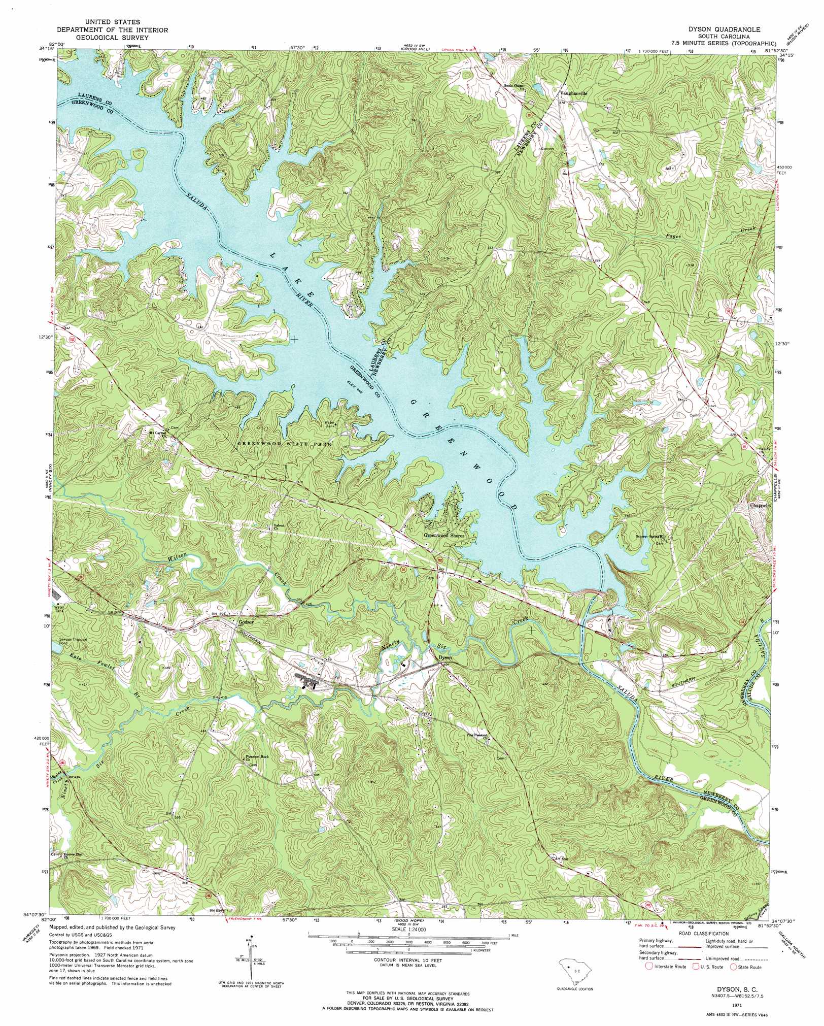
USGS Topo Quad 34081b8 - 1:24,000 scale
| Topo Map Name: | Dyson |
| USGS Topo Quad ID: | 34081b8 |
| Print Size: | ca. 21 1/4" wide x 27" high |
| Southeast Coordinates: | 34.125° N latitude / 81.875° W longitude |
| Map Center Coordinates: | 34.1875° N latitude / 81.9375° W longitude |
| U.S. State: | SC |
| Filename: | o34081b8.jpg |
| Download Map JPG Image: | Dyson topo map 1:24,000 scale |
| Map Type: | Topographic |
| Topo Series: | 7.5´ |
| Map Scale: | 1:24,000 |
| Source of Map Images: | United States Geological Survey (USGS) |
| Alternate Map Versions: |
Dyson SC 1971, updated 1973 Download PDF Buy paper map Dyson SC 2011 Download PDF Buy paper map Dyson SC 2014 Download PDF Buy paper map |
1:24,000 Topo Quads surrounding Dyson
Ware Shoals East |
Laurens South |
Clinton |
Joanna |
Newberry Nw |
Cokesbury |
Waterloo |
Cross Hill |
Bush River |
Newberry West |
Greenwood |
Ninety Six |
Dyson |
Chappells |
Silverstreet |
Bradley |
Kirksey |
Good Hope |
Saluda North |
Denny |
Winterseat |
Limestone |
Owdoms |
Saluda South |
Emory |
> Back to 34081a1 at 1:100,000 scale
> Back to 34080a1 at 1:250,000 scale
> Back to U.S. Topo Maps home
Dyson topo map: Gazetteer
Dyson: Bridges
Dysons Bridge elevation 118m 387′Dyson: Crossings
Anderson Ferry (historical) elevation 118m 387′Chiles Ferry (historical) elevation 134m 439′
Dyson: Dams
Lake Greenwood Buzzard Roost Dam elevation 133m 436′Dyson: Parks
Greenwood State Park elevation 147m 482′Dyson: Populated Places
Anglers Haven elevation 150m 492′Dyson elevation 122m 400′
Godsey elevation 147m 482′
Greenwood Shores elevation 136m 446′
Scurry elevation 165m 541′
Vaughanville elevation 173m 567′
Dyson: Reservoirs
Buzzard Roost elevation 134m 439′Lake Greenwood elevation 133m 436′
Dyson: Streams
Henley Creek elevation 128m 419′Kate Fowler Branch elevation 125m 410′
Maysons Creek elevation 134m 439′
Ninety Six Creek elevation 119m 390′
Wilson Creek elevation 119m 390′
Dyson digital topo map on disk
Buy this Dyson topo map showing relief, roads, GPS coordinates and other geographical features, as a high-resolution digital map file on DVD:
South Carolina, Western North Carolina & Northeastern Georgia
Buy digital topo maps: South Carolina, Western North Carolina & Northeastern Georgia