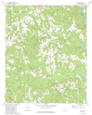
Pomaria Topo Map South Carolina
To zoom in, hover over the map of Pomaria
USGS Topo Quad 34081c4 - 1:24,000 scale
| Topo Map Name: | Pomaria |
| USGS Topo Quad ID: | 34081c4 |
| Print Size: | ca. 21 1/4" wide x 27" high |
| Southeast Coordinates: | 34.25° N latitude / 81.375° W longitude |
| Map Center Coordinates: | 34.3125° N latitude / 81.4375° W longitude |
| U.S. State: | SC |
| Filename: | o34081c4.jpg |
| Download Map JPG Image: | Pomaria topo map 1:24,000 scale |
| Map Type: | Topographic |
| Topo Series: | 7.5´ |
| Map Scale: | 1:24,000 |
| Source of Map Images: | United States Geological Survey (USGS) |
| Alternate Map Versions: |
Pomaria SC 1969, updated 1972 Download PDF Buy paper map Pomaria SC 2011 Download PDF Buy paper map Pomaria SC 2014 Download PDF Buy paper map |
| FStopo: | US Forest Service topo Pomaria is available: Download FStopo PDF Download FStopo TIF |
1:24,000 Topo Quads surrounding Pomaria
> Back to 34081a1 at 1:100,000 scale
> Back to 34080a1 at 1:250,000 scale
> Back to U.S. Topo Maps home
Pomaria topo map: Gazetteer
Pomaria: Populated Places
Cravenhill (historical) elevation 116m 380′Hayne (historical) elevation 136m 446′
Pomaria elevation 122m 400′
Reuben (historical) elevation 142m 465′
Sondleys (historical) elevation 151m 495′
Taylors Crossroads elevation 115m 377′
Walton (historical) elevation 110m 360′
Pomaria: Rapids
Buck Shoals elevation 77m 252′Griffins Shoal elevation 77m 252′
Pomaria: Streams
Buck Branch elevation 91m 298′Kerr Creek elevation 95m 311′
Mud Creek elevation 81m 265′
Second Creek elevation 84m 275′
Terrible Creek elevation 77m 252′
Pomaria digital topo map on disk
Buy this Pomaria topo map showing relief, roads, GPS coordinates and other geographical features, as a high-resolution digital map file on DVD:
South Carolina, Western North Carolina & Northeastern Georgia
Buy digital topo maps: South Carolina, Western North Carolina & Northeastern Georgia


