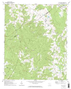
Bush River Topo Map South Carolina
To zoom in, hover over the map of Bush River
USGS Topo Quad 34081c7 - 1:24,000 scale
| Topo Map Name: | Bush River |
| USGS Topo Quad ID: | 34081c7 |
| Print Size: | ca. 21 1/4" wide x 27" high |
| Southeast Coordinates: | 34.25° N latitude / 81.75° W longitude |
| Map Center Coordinates: | 34.3125° N latitude / 81.8125° W longitude |
| U.S. State: | SC |
| Filename: | o34081c7.jpg |
| Download Map JPG Image: | Bush River topo map 1:24,000 scale |
| Map Type: | Topographic |
| Topo Series: | 7.5´ |
| Map Scale: | 1:24,000 |
| Source of Map Images: | United States Geological Survey (USGS) |
| Alternate Map Versions: |
Bush River SC 1970, updated 1973 Download PDF Buy paper map Bush River SC 1970, updated 1973 Download PDF Buy paper map Bush River SC 2011 Download PDF Buy paper map Bush River SC 2014 Download PDF Buy paper map |
| FStopo: | US Forest Service topo Bush River is available: Download FStopo PDF Download FStopo TIF |
1:24,000 Topo Quads surrounding Bush River
> Back to 34081a1 at 1:100,000 scale
> Back to 34080a1 at 1:250,000 scale
> Back to U.S. Topo Maps home
Bush River topo map: Gazetteer
Bush River: Airports
Connelly Field elevation 164m 538′Sexton Airport elevation 167m 547′
Bush River: Dams
Adams Pond D-1467 Dam elevation 156m 511′Bedenbaugh Pond Dam Number One D-3003 elevation 169m 554′
Bedenbaugh Pond Dam Number Two D-3002 elevation 172m 564′
Boyd Pond Dam D-3004 elevation 176m 577′
Longshore Number One D-1468 Dam elevation 157m 515′
Longshore Number Two D-1469 Dam elevation 156m 511′
Smiths Pond D-1668 Dam elevation 167m 547′
South Carolina Noname 36012 Dam elevation 160m 524′
Bush River: Populated Places
Bush River elevation 161m 528′Mudlick elevation 158m 518′
Bush River: Reservoirs
Bedenbaugh Pond Number One elevation 169m 554′Bedenbaughs Pond Number Two elevation 172m 564′
Boyds Pond elevation 176m 577′
Sandhill Farms Pond elevation 160m 524′
Smiths Pond elevation 167m 547′
Bush River: Streams
Garrison Creek elevation 123m 403′Mills Creek elevation 124m 406′
Quaker Creek elevation 131m 429′
Reeder Branch elevation 122m 400′
Bush River digital topo map on disk
Buy this Bush River topo map showing relief, roads, GPS coordinates and other geographical features, as a high-resolution digital map file on DVD:
South Carolina, Western North Carolina & Northeastern Georgia
Buy digital topo maps: South Carolina, Western North Carolina & Northeastern Georgia


