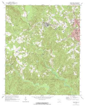
Union West Topo Map South Carolina
To zoom in, hover over the map of Union West
USGS Topo Quad 34081f6 - 1:24,000 scale
| Topo Map Name: | Union West |
| USGS Topo Quad ID: | 34081f6 |
| Print Size: | ca. 21 1/4" wide x 27" high |
| Southeast Coordinates: | 34.625° N latitude / 81.625° W longitude |
| Map Center Coordinates: | 34.6875° N latitude / 81.6875° W longitude |
| U.S. State: | SC |
| Filename: | o34081f6.jpg |
| Download Map JPG Image: | Union West topo map 1:24,000 scale |
| Map Type: | Topographic |
| Topo Series: | 7.5´ |
| Map Scale: | 1:24,000 |
| Source of Map Images: | United States Geological Survey (USGS) |
| Alternate Map Versions: |
Union West SC 1969, updated 1973 Download PDF Buy paper map Union West SC 2011 Download PDF Buy paper map Union West SC 2014 Download PDF Buy paper map |
| FStopo: | US Forest Service topo Union West is available: Download FStopo PDF Download FStopo TIF |
1:24,000 Topo Quads surrounding Union West
> Back to 34081e1 at 1:100,000 scale
> Back to 34080a1 at 1:250,000 scale
> Back to U.S. Topo Maps home
Union West topo map: Gazetteer
Union West: Airports
E M M D Plant Heliport elevation 174m 570′Union County Airport-Troy Shelton Field elevation 179m 587′
Union West: Bridges
Cedar Bluff Bridge elevation 114m 374′Harris Bridge elevation 110m 360′
Minter Bridge (historical) elevation 111m 364′
Mud Bridge elevation 127m 416′
Murphy Bridge elevation 120m 393′
Upper Rice Bridge elevation 126m 413′
Union West: Crossings
Bobos Ford elevation 114m 374′Union West: Parks
Buffalo Mill Historic District elevation 152m 498′Calhoun Experimental Forest elevation 137m 449′
Calhoun Experimental Forest elevation 124m 406′
South Street-South Church Street Historic District elevation 182m 597′
Union West: Populated Places
Bishop Town (historical) elevation 158m 518′Buffalo elevation 180m 590′
Goat Alley elevation 151m 495′
Sardis elevation 189m 620′
Tempie Hill elevation 183m 600′
Union West: Post Offices
Buffalo Post Office elevation 154m 505′Union West: Rapids
Fairforest Shoal elevation 119m 390′Union West: Streams
Buffalo Creek elevation 120m 393′Dining Creek elevation 114m 374′
Holcombe Branch elevation 114m 374′
Isaacs Creek elevation 111m 364′
Mitchell Creek elevation 126m 413′
Morris Branch elevation 105m 344′
Sand Creek elevation 111m 364′
Shoal Creek elevation 112m 367′
Sparks Creek elevation 110m 360′
Sugar Creek elevation 122m 400′
Union West digital topo map on disk
Buy this Union West topo map showing relief, roads, GPS coordinates and other geographical features, as a high-resolution digital map file on DVD:
South Carolina, Western North Carolina & Northeastern Georgia
Buy digital topo maps: South Carolina, Western North Carolina & Northeastern Georgia


